Oakland County, Michigan
| Oakland County, Michigan | ||
|---|---|---|
| ||
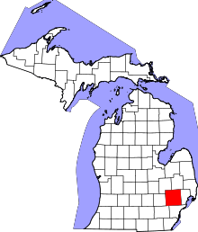 Location in the U.S. state of Michigan | ||
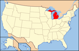 Michigan's location in the U.S. | ||
| Founded |
January 12, 1819 (created) 1820 (organized)[1][2] | |
| Seat | Pontiac | |
| Largest city | Troy | |
| Area | ||
| • Total | 907 sq mi (2,349 km2) | |
| • Land | 868 sq mi (2,248 km2) | |
| • Water | 40 sq mi (104 km2), 4.4% | |
| Population (est.) | ||
| • (2015) | 1,242,304 | |
| • Density | 1,386/sq mi (535/km²) | |
| Congressional districts | 8th, 9th, 11th, 14th | |
| Time zone | Eastern: UTC-5/-4 | |
| Website |
www | |

Oakland County is a county located in the U.S. state of Michigan, located in the northwest of the Detroit metropolitan area. As of the 2010 census, its population was 1,202,362,[3] making it the second-most populous county in Michigan, behind neighboring Wayne County. The county seat is Pontiac.[4] The county was founded in 1819 and organized in 1820.[1][5]
Oakland County is composed of 61 cities, townships and villages, and is part of the Detroit-Warren-Dearborn, MI Metropolitan Statistical Area. The city of Detroit is located in neighboring Wayne County, south of 8 Mile Road. Oakland County is among the ten highest income counties in the United States with populations over one million people.[6] It is also home to Oakland University, a large public institution that straddles the Auburn Hills and Rochester Hills border.
Geography
According to the U.S. Census Bureau, the county has a total area of 907 square miles (2,350 km2), of which 868 square miles (2,250 km2) is land and 40 square miles (100 km2) (4.4%) is water.[7]
Oakland County was originally divided into 25 separate townships, which are listed below. Each township is roughly equal in size at six miles (10 km) by six miles, for a total township area of 36 square miles (93 km2). The roots of this design were born out of the Land Ordinance of 1785 and the subsequent Northwest Ordinance of 1787. Oakland County itself is a prime example of the land policy that was established, as all townships are equal in size (save for slight variations due to waterways). Section 16 in each township was reserved for financing and maintaining public education, and even today many schools in Oakland County townships are located within that section.
Wayne County, where the city of Detroit is located, borders Oakland County to the south. 8 Mile Road, also known as "Baseline Road" in some areas, is the boundary between these counties. The baseline was used during the original surveying for Michigan, and it serves as the northern/southern boundaries for counties from Lake St. Clair to Lake Michigan. As more working and middle-class populations moved to the suburbs from the 1950s on, this divide (8 Mile Road) became historically known as an unofficial racial dividing line between what became the predominantly black city and almost exclusively white suburbs.
Since the late 20th century, however, the patterns of de facto segregation have faded as the suburbs have become more diverse. Middle-class African Americans have left the city, settling in inner-ring suburbs, notably Southfield (75.08%), west of Woodward Avenue. Based on the 2010 Census, the following cities also have significant minority ethnic populations: Farmington (25.3%), Farmington Hills (31.7%), Novi (30.12%), Oak Park (62.61%), Lathrup Village (72.97%), Orchard Lake Village (16.08%), Rochester Hills (20.94%), Troy (29.4%), Wixom (26.28%), West Bloomfield (24.0%), Bloomfield (18.28%), Bloomfield Hills (14.2%), Ferndale (17.2%), and Madison Heights (17.7%). Ferndale has a concentration of Arab Americans, who also live in nearby areas, and numerous Asian Americans, particularly Indians, have also settled in these areas.
Adjacent counties
- Lapeer County (northeast)
- Genesee County (northwest)
- Macomb County (east)
- Wayne County (southeast)
- Washtenaw County (southwest)
- Livingston County (west)
Demographics
| Historical population | |||
|---|---|---|---|
| Census | Pop. | %± | |
| 1820 | 330 | — | |
| 1830 | 4,911 | 1,388.2% | |
| 1840 | 23,646 | 381.5% | |
| 1850 | 31,270 | 32.2% | |
| 1860 | 38,261 | 22.4% | |
| 1870 | 40,867 | 6.8% | |
| 1880 | 41,537 | 1.6% | |
| 1890 | 41,245 | −0.7% | |
| 1900 | 44,792 | 8.6% | |
| 1910 | 49,576 | 10.7% | |
| 1920 | 90,050 | 81.6% | |
| 1930 | 211,251 | 134.6% | |
| 1940 | 254,068 | 20.3% | |
| 1950 | 396,001 | 55.9% | |
| 1960 | 690,259 | 74.3% | |
| 1970 | 907,871 | 31.5% | |
| 1980 | 1,011,793 | 11.4% | |
| 1990 | 1,083,592 | 7.1% | |
| 2000 | 1,194,156 | 10.2% | |
| 2010 | 1,202,362 | 0.7% | |
| Est. 2015 | 1,242,304 | [8] | 3.3% |
| U.S. Decennial Census[9] 1790-1960[10] 1900-1990[11] 1990-2000[12] 2010-2013[3] | |||
As of the 2010 Census, there were 1,202,362 people and 315,175 families residing in the county. 77.3% were White, 13.6% Black or African American, 5.6% Asian, 0.3% Native American, 1.0% of some other race and 2.2% of two or more races. 3.5% were Hispanic or Latino (of any race). There were 527,255 housing units at an average density of 564 per square mile (218/km²).[13]
Regarding ancestry, in 2000 14.4% of the population were ethnically German, 9.0% Irish, 8.5% English, 8.5% Polish, 5.7% Italian and 5.5% American, according to Census 2000. 87.4% spoke only English at home; 2.0% spoke Spanish, 1.3% Syriac (Neo Aramaic) and 1.0% Arabic. The population density as of the 2000 census was 1,369 people per square mile (528/km²). There were 492,006 housing units at an average density of 564 per square mile (218/km²).
The 2000 census showed two Native American tribes with more than 1,000 members in Oakland County. There were 2,095 Cherokee and 1,458 Chippewa.
The Jewish community of metropolitan Detroit, with a population of 72,000, is the 21st largest Jewish community in the nation. This community is concentrated in Oakland County, especially in West Bloomfield, Bloomfield Hills, Farmington Hills, Troy and Huntington Woods.[14]
There were 471,115 households, of which 32.40% had children under the age of 18 living with them. 54.20% were married couples living together, 9.50% had a female householder with no husband present, and 33.10% were non-families. 27.30% of all households were made up of individuals and 8.50% had someone living alone who was 65 years of age or older. The average household size was 2.51 and the average family size was 3.09.
Among Asian Americans, eight ethnic groups had more than 1,000 members in the county in 2000. The most numerous were those of Asian Indian descent, with 20,705. Next were those of Chinese heritage, numbering 10,018. Next were those of Japanese (5,589), Filipino (5,450) Korean (5,351), Vietnamese (1,687), Pakistani (1,458) and Hmong (1,210) ancestry.[15]
In 2001, Oakland County had the 36th largest Asian population of any county in the country.[16] In 2002, of the Oakland-Wayne-Macomb tricounty area, Oakland County had 49% of the tricounty area's Asian population.[17]
The county's population was spread out in terms of age, with 25.20% of people under the age of 18, 7.20% from 18 to 24, 32.40% from 25 to 44, 23.90% from 45 to 64, and 11.30% who were 65 years of age or older. The median age was 37 years. For every 100 females there were 95.90 males. For every 100 females age 18 and over, there were 92.70 males.
The median income for a household in the county was $61,907, and the median income for a family was $75,540 (these figures had risen to $62,308 and $79,589 respectively as of a 2009 estimate[18]). Males had a median income of $55,833 versus $35,890 for females. The per capita income for the county was $32,534. About 3.80% of families and 5.50% of the population were below the poverty line, including 6.50% of those under age 18 and 6.50% of those age 65 or over.
Government
The county government operates the jail, operates the major local courts, keeps files of deeds and mortgages, maintains vital records, administers public health regulations, and participates with the state in the provision of welfare and other social services. The county board of commissioners controls the budget but has limited authority to make laws or ordinances. In Michigan, most local government functions—police and fire, building and zoning, tax assessment, street maintenance, etc. — are the responsibility of individual cities and townships. Oakland County has an elected sheriff, and his or her law-enforcement services are used throughout the county. Fourteen cities/townships do not have municipal police forces, but rather contract with the sheriff for police services specific to the municipalities. For instance, the city of Rochester Hills does not have a "Rochester Hills Police Department," but instead has an established sheriff substation in the city with deputies who are dedicated to that city only. That branch operates as the Oakland County Sheriff's Department, Rochester Hills substation. The sheriff operates in the same manner with other municipalities who opt not to have their own police agencies. This typically is a cost-effective way for municipalities to provide police services to its citizens. The county sheriff also maintains a civil division, marine division, alcohol and traffic enforcement units, and an aviation division.
Elected officials
- County Executive: L. Brooks Patterson (Republican)
- Prosecuting Attorney: Jessica R. Cooper (Democrat)[19]
- Sheriff: Mike Bouchard (Republican)
- County Clerk/Register of Deeds: Lisa Brown (Democrat)
- County Treasurer: Andy Meisner (Democrat)
- Water Resources Commissioner: Jim Nash (Democrat)
- Board of Commissioners: 21 members, elected from districts (13 Republicans, 8 Democrats)
(information as of November 8, 2016)
Road Commission
Roads that are not maintained by a local community (city/village) are maintained by the independent Road Commission for Oakland County, which is governed by three board members appointed by the Oakland County Board of Commissioners. Road Commissioners: Eric. S. Wilson, Chairman; Gregory C. Jamian Vice Chairman; Ron Fowkes Dennis G. Kolar, Managing Director
Oakland County Service Center
The East Campus of the Oakland County Service Center is located in Pontiac. It includes the county courthouse and jail for adults.[20]
The West Campus of the Oakland County Service Center is located in Waterford Township.[20][21] This includes the Oakland County Executive Building and Conference Center,[22] and the Oakland County Children's Village,[20] the county's juvenile detention center for children.[23] The Children's Village acts as one of the support sites for the Waterford School District.[24]
Politics
| Year | Democratic | Republican |
|---|---|---|
| 2016 | 51.7% 342,976 | 43.6% 289,127 |
| 2012 | 53.4% 349,055 | 45.4% 296,531 |
| 2008 | 56.4% 373,270 | 41.9% 277,480 |
| 2004 | 49.8% 319,387 | 49.3% 316,633 |
| 2000 | 49.3% 281,201 | 48.1% 274,319 |
| 1996 | 47.8% 241,884 | 43.5% 219,855 |
| 1992 | 38.6% 214,733 | 43.6% 242,160 |
| 1988 | 37.8% 174,745 | 61.3% 283,359 |
| 1984 | 32.8% 150,286 | 66.7% 306,050 |
| 1980 | 35.6% 164,869 | 54.7% 253,211 |
| 1976 | 39.5% 164,266 | 58.7% 244,271 |
| 1972 | 34.2% 129,400 | 63.8% 241,613 |
| 1968 | 44.8% 154,630 | 45.3% 156,538 |
| 1964 | 61.4% 182,797 | 38.3% 114,025 |
| 1960 | 45.4% 135,531 | 54.3% 162,026 |
Oakland County historically was a stronghold of the Republican Party, a classic bastion of suburban conservatism and still does based on the fact that many independents are conservatives. However, since the 1990s it has become more of a swing county and has voted for the Democratic candidate for President in the last five elections. Democrats also hold four of the six county-wide elective offices.
In 1996, Bill Clinton became the first Democrat to secure the plurality of Oakland County presidential votes since Lyndon Johnson in 1964. Al Gore and John Kerry also carried the county, by narrow margins, against George W. Bush in 2000 and 2004, respectively. In 2008, Barack Obama became the first Democrat to win a majority in the county since Lyndon Johnson in 1964. (See table at right.) He again carried the county in 2012, though by a smaller margin.
While the Democratic Party has found increasing success in Presidential elections in Oakland County, the state Republican Party has remained strong in recent gubernatorial and state elections. The county favored Governor Rick Snyder (R) by a 22-percent margin in the 2010 statewide elections and again by a 12-point margin in 2014. Republicans also hold a 14-7 majority on the county commission.
In the 112th Congress, Oakland County is represented by two Democrats, Brenda Lawrence (14th) and Sander Levin (9th), and two Republicans, David Trott (11th) and Mike Bishop (8th). Bishop, Lawrence and Trott were first elected to Congress in 2014.
Transportation
Air
- Oakland County International Airport (PTK) (Waterford Township) - Charter passenger facility.
The following airports are located in neighboring counties:
- Detroit Metropolitan Wayne County Airport (DTW) (Romulus) - Major commercial airport and hub for Delta Air Lines and Spirit Airlines located in Wayne County.
- Bishop International Airport (FNT) (Flint) - Commercial airport located in Genesee County.
- Coleman A. Young International Airport (DET) (Detroit) - General aviation only. This airport is in Wayne County in the city of Detroit.
Major highways
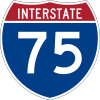 I-75 (Walter P. Chrysler Freeway) is the main north–south highway in the region, serving Flint, Pontiac, Troy, and Detroit, before continuing south (as the Fisher and Detroit-Toledo Freeways) to serve many of the communities along the shore of Lake Erie.
 I‑96 runs northwest-southeast through Oakland County and (as the Jeffries Freeway) has its eastern terminus in downtown Detroit.
 I-275 runs north–south from I-75 in the south to the junction of I-96 and I-696 in the north, providing a bypass through the western suburbs of Detroit.
 I‑696 (Walter P. Reuther Freeway) runs east–west from the junction of I-96 and I-275, providing a route through the northern suburbs of Detroit. Taken together, I-275 and I-696 form a semicircle around Detroit.
 US 24 ends north of Pontiac at I-75. To the south, US 24 serves suburban Detroit and Monroe before entering Ohio. Much of US 24 in Oakland County is named Telegraph Road, and it is a major north–south road extending from Toledo, Ohio, through Monroe, Wayne, and Oakland Counties to Pontiac. It gained notoriety in a song (Telegraph Road) by the group Dire Straits.
 M-1 (Woodward Avenue) has a northern terminus in Pontiac. The route continues southerly from Oakland County into the City of Detroit, ending downtown. The Detroit Zoo is located along M-1 in Oakland County. M-1 is also home to the Woodward Dream Cruise, a classic-car cruise from Pontiac to Ferndale that is held in August. It is the largest single-day classic-car cruise in America.
 M-5
M-5 M-10 (John C. Lodge Freeway) runs largely parallel to I-75 from Southfield to downtown Detroit. The service drives are named Northwestern Highway.
 M-15 (Ortonville Road, Main Street in Clarkston)
 M-24 (Lapeer Road) has a southern terminus at I-75 north of Pontiac. To the north, the route continues to Lapeer and beyond. Note: M-24 and US 24 do not intersect at present, although this was the case until the 1950s.
 M-39 (Southfield Freeway) runs north–south from Southfield to Allen Park from I-94. North of 10 Mile Road, the freeway ends and continues as Southfield Road into Birmingham.
 M-59 (Highland Road [from Pontiac westerly], Huron Street [within Pontiac] and Veterans Memorial Freeway [Pontiac to Utica]), continues east in Macomb County as Hall Road to Clinton Township and west to I-96 near Howell
 M-102 Perhaps better known as 8 Mile Road, M-102 follows the Oakland–Wayne county line for most of its length. 8 Mile Road, known by many due to the film 8 Mile, forms the dividing line between Detroit on the south and the suburbs of Macomb and Oakland counties on the north. It is also known as Baseline Road outside of Detroit, because it coincides with the baseline used in surveying Michigan; that baseline is also the boundary for a number of Michigan counties. It is designated M-102 for much of its length in Wayne County.
 M-150 (Rochester Road) serves as a spur highway from M-59 into the city of Rochester.
- Grand River Avenue connects the suburbs of Brighton, Novi, and Farmington to downtown Detroit. The avenue follows the route of old US 16, before I-96 replaced it in 1962. It is one of the five roads planned by Judge August Woodward to radiate out from Detroit and connect the city to other parts of the state.
Mile roads
- Surface-street navigation in metro Detroit is commonly anchored by "mile roads," major east-west surface streets that are spaced at one-mile (1.6 km) intervals and increment as one travels north and away from the city center. Mile roads sometimes have two names, the numeric name (e.g., 15 Mile Road), used in Macomb County, and a local name (e.g., Maple Road), used in Oakland County (for the most part).
Bicycling
The conditions on most non-residential roads in Oakland County are not favorable to bicycling. Exceptions to this are primarily in the inner-ring suburbs within the southeast corner of the county. This is due to their street grid.
A primary reason for these unfavorable cycling conditions is the Road Commission for Oakland County has a policy of not accommodating bicycles on the road. As a result, some communities have designated sidepaths (locally called "safety paths") as bike routes which do not meet the American Association of State Highway and Transportation Officials (AASHTO) guidelines for bicycling facilities and have been found to be less safe than on-road bike facilities.[25]
As a result, there are no designated Bicycle Friendly Communities within Oakland County.
Only the city of Ferndale has a built comprehensive bicycle network of bike lanes and signed shared roadways.
Education
The County of Oakland counterpart in public education (K-12) is the Oakland Schools, an Intermediate school district.
Higher education
Oakland County is home to several institutions of higher education.
- Baker College, Auburn Hills campus
- Oakland University, Rochester
- The Western Michigan University Thomas M. Cooley Law School, Auburn Hills campus
- Lawrence Technological University, Southfield
- Rochester College, Rochester
- South University, Novi campus
- Walsh College of Accountancy and Business, Troy and Novi campuses
- Oakland Community College, five campuses: Orchard Ridge, Auburn Hills, Southfield, Highland Lakes, and Royal Oak.
- Saint Mary's College of Madonna University, Orchard Lake
Sports
| Club | League | Venue | Established | Championships |
|---|---|---|---|---|
| Detroit Pistons | National Basketball Association | The Palace of Auburn Hills | 1958 (moved to the Palace in 1988) | 3 |
| Detroit Shock | Women's National Basketball Association | Moved to Oklahoma, October 2009 | 1998 | 3 |
| Oakland County FC | Premier League of America, Soccer | Stoney Creek High School Athletic Field | 2015 |
The NFL's Detroit Lions played their home games at the Pontiac Silverdome from 1975 through 2001, when they moved to Ford Field in Downtown Detroit. The Silverdome was also the site of Super Bowl XVI, where the San Francisco 49ers defeated the Cincinnati Bengals, the first of 5 Super Bowl titles for the 49ers.
From 1978 through 1988 prior to their move to the Palace of Auburn Hills, the Pistons also played their home games at the Silverdome.
The Silverdome has also hosted various other sporting events since it opened.
Communities
Cities
- Auburn Hills
- Berkley
- Birmingham
- Bloomfield Hills
- Clarkston
- Clawson
- Farmington
- Farmington Hills
- Ferndale
- Hazel Park
- Huntington Woods
- Keego Harbor
- Lake Angelus
- Lathrup Village
- Madison Heights
- Northville
- Novi
- Oak Park
- Orchard Lake Village
- Pleasant Ridge
- Pontiac (county seat)
- Rochester
- Rochester Hills
- Royal Oak
- South Lyon
- Southfield
- Sylvan Lake
- Troy
- Walled Lake
- Wixom
Villages
Townships
- Addison Township
- Bloomfield Charter Township
- Brandon Charter Township
- Commerce Charter Township
- Groveland Township
- Highland Charter Township
- Holly Township
- Independence Charter Township
- Lyon Charter Township
- Milford Charter Township
- Novi Township
- Oakland Charter Township
- Orion Charter Township
- Oxford Charter Township
- Rose Township
- Royal Oak Charter Township
- Southfield Township
- Springfield Charter Township
- Waterford Charter Township
- West Bloomfield Charter Township
- White Lake Charter Township
Unincorporated Communities
- Andersonville
- Austin Corners
- Brandon Gardens
- Campbells Corner
- Charing Cross
- Clintonville
- Clyde
- Commerce
- Davisburg
- Drayton Plains
- East Highland
- Elizabeth Lake
- Five Points
- Four Towns
- Gingellville
- Glengary
- Goodison
- Groveland Corners
- Hickory Ridge
- Highland
- Huron Heights
- Jossman Acres
- Kensington
- Lake Orion Heights
- Lakeville
- New Hudson
- Newark
- Oak Grove
- Oakley Park
- Oakwood
- Oxbow
- Perry Lake Heights
- Rose Center
- Rose Corners
- Rudds Mill
- Seven Harbors
- Springfield
- Thomas
- Union Lake
- Walters
- Waterford Village
- Waterstone
- West Highland
- Westacres
- White Lake
Lakes
_boats_Wednesdays_(514873849).jpg)
Twelve Oakland County all-sports lakes have public boat launches;[26] Big Lake (Springfield Twp.), Cass Lake (Waterford Twp.), Cedar Island Lake (White Lake Twp.), Crescent Lake (Waterford Twp.), Lake Oakland (Waterford Twp.), Lake Orion (Orion Twp.), Long Lake (Commerce Twp.), Maceday Lake (Waterford Twp.), Pontiac Lake (Waterford Twp.), Tipsico Lake (Rose Twp.), Union Lake (Commerce Twp.), and White Lake (White Lake Twp.)
In addition, no-wake lakes in Oakland County with public boat launches include Crooked Lake (Independence Twp.), Heron Lake (Holly Twp.), Kent Lake (Milford Twp.) and Wildwood Lake (Groveland Twp.).
There are 387 lakes in Oakland County. Of those lakes, 317 are named while 70 are unnamed lakes.[27][28][29][30][31][32][33]
Named Oakland County lakes include:
A
Adams Lake (Orion Twp.)
Alderman Lake (Highland Twp.)
Algoe Lake (Springfield Twp.)
Allen Lake (Springfield Twp.)
B
Bailey Lake (Independence Twp.)
Baker Lake (Rose Twp.)
Bald Eagle Lake (Brandon Twp.)
Bass Lake (Milford Twp.)
Beaty Lake (Highland Twp.)
Bevins Lake (Holly Twp.)
Bloat Lake (Springfield Twp.)
Big Lake (Springfield Twp.)
Big School Lot Lake (Rose Twp.)
Big Seven Lake (Holly Twp.)
Bogie Lake (Commerce Twp.)
Brendel Lake (Highland Twp.)
Bridge Lake (Brandon Twp.)
Buckell Lake (Springfield Twp.)
Buckhorn Lake (Orion Twp.)
Buckhorn Lake (Rose Twp.)
Buhl Lake (Orion Twp.)
Bunny Run Lake (Orion Twp.)
Bush Lake (Holly Twp.)
C
Carpenter Lake (Orion Twp.)
Carroll Lake (Commerce Twp.)
Carus Lake (Commerce Twp.)
Cass Lake (West Bloomfield Twp.)
Cedar Lake (Brandon Twp.)
Cedar Lake (Oxford Twp.)
Cedar Island Lake (White Lake Twp.)
Charlick Lake (Highland Twp.)
Chase Lake (Highland Twp.)
Chestnut Lake (Rochester Hills)
Childs Lake (Milford Twp.)
Clam Lake (Waterford Twp.)
Clam Lake (Orion Twp.)
Clark Lake (Commerce Twp.)
Clear Lake (Oxford Twp.)
Cogger Lake (Highland Twp.)
Colley Lake (Commerce Twp.)
Clear Lake (Oxford Twp.)
Commerce Lake (Commerce Twp.)
Cooley Lake (White Lake Twp.)
Cranberry Lake (Independence Twp.)
Cranberry Lake (Orion Twp.)
Cranberry Lake (Milford Twp.)
Cranberry Lake (Brandon Twp.)
Crescent Lake (Waterford Twp.)
Cogger Lake (Rose Twp.)
Crooked Lake (Independence Twp.)
Crotched Lake (Springfield Twp.)
Crystal Lake (Pontiac)
Crystal Lake (Rochester Hills)
D
Darby Lake (Commerce Twp.)
Dark Lake (Independence Twp.) - two lakes with this name in this location
Dark Lake (Oxford Twp.)
Davis Lake (Oxford Twp.)
Deer Lake (Independence Twp.)
Dixie Lake (Springfield Twp.)
Dollar Lake (Independence Twp.)
Downey Lake (Highland Twp.)
Drake Lake (Springfield Twp.)
Duck Lake (Highland Twp.)
Duck Lake (Oxford Twp.)
Dunham Lake (Highland Twp.)
E
Eagle Lake (Waterford Twp.)
Ekelund Lake (Brandon Twp.)
Eliza Lake (Springfield Twp.)
Elizabeth Lake (Waterford Twp.)
Elkhorn Lake (Orion Twp.)
Elliott Lake (Rose Twp.)
Emerald Lake (Rochester Hills)
Erwin Lake (Orion Twp.)
Esler Lake (Highland Twp.)
F
Fagan Lake (Springfield Twp.)
Fair Lake (White Lake Twp.)
Fiddle Lake (Waterford Twp.)
Fish Lake (Highland Twp.)
Fish Lake (Oxford Twp.)
Fish Lake (Rose Twp.)
Flanders Lake (Commerce Twp.)
Flemings Lake (Independence Twp.)
Foster Lake (Independence Twp.)
Fox Lake (Commerce Twp.)
G
Gallagher Lake (Milford Twp.)
Galloway Lake (Auburn Hills)
Geneva Lake (Waterford Twp.)
Gilbert Lake (Bloomfield Twp.)
Gourd Lake (Highland Twp.)
Graham Lake (Orion Twp.)
Grampian Lake (Orion Twp.)
Grass Lake (Highland Twp.)
Grass Lake (Brandon Twp.)
Green Lake (Brandon Twp.)
Green Lake (Commerce Twp.)
Green Lake (Rose Twp.)
Greens Lake (Independence Twp.)
Greens Lake (Oxford Twp.)
Gulick Lake (Independence Twp.)
H
Halstead Lake (Springfield Twp.)
Hammond Lake (West Bloomfield Twp.)
Handsome Lake (Orion Twp.)
Hartwig Lake (Springfield Twp.)
Harvey Lake (Highland Twp.)
Haven Hill Lake (Highland Twp.)
Hawk Lake (Commerce Twp.)
Heart Lake (Orion Twp.)
Heather Lake (Orion Twp.)
Hidden Lake (Lyon Twp.)
Highland Lake (Highland Twp.)
Hogback Lake (Rose Twp.)
Honeywell Lake (Milford Twp.)
Horseshoe Lake (Oxford Twp.)
Horton Lake (Springfield Twp.)
Heron Lake (Holly Twp.)
Holdridge Lake (Springfield Twp.)
Honeywell Lake (Milford Twp.)
Horseshoe Lake (Oxford Twp.)
Horton Lake (Springfield Twp.)
Howell Lake (Oxford Twp.)
Huckleberry Lake (Springfield Twp.)
Huff Lake (Brandon Twp.)
Hummer Lake (Oxford Twp.)
Huntoon Lake (Waterford Twp.)
I
Indian Lake (Orion Twp.)
Indianwood Lake (Oxford Twp.)
J
Judah Lake (Orion Twp.)
K
Kelly Lake (Rose Twp.)
Kennedy Lake (Holly Twp.)
Kent Lake (Milford Twp.)
Kenyon Lake (Rose Twp.)
Kirby Lake (Springfield Twp.)
Knox Lake (Independence Twp.)
L
Lacy Lake (Springfield Twp.)
Lakeville Lake (Addison Twp.)
Lake Anadale (Rochester Hills)
Lake Angelus (Auburn Hills)
Lake Braemar (Rose Twp.)
Lake Charnwood (Rochester Hills)
Lake Erin (Orion Twp.)
Lake George (Orion Twp.)
Lake Goodrich (Waterford Twp.)
Lake Hope (Springfield Twp.)
Lake Lahring (Springfield Twp.)
Lake Louise (Brandon Twp.)
Lake Mauna Loa (Springfield Twp.)
Lake Neva (Highland Twp.)
Lake Nicholas (Brandon Twp.)
Lake Oahu (Springfield Twp.)
Lake Oakland (Waterford Twp.)
Lake O'Brien (Highland Twp.)
Lake Ona (Milford Twp.)
Lake Orion (Orion Twp.)
Lake Sherwood (Milford Twp.)
Lake Sixteen (Oxford Twp.)
Lakeville Lake (Orion Twp.)
Lantern Lake (Auburn Hills)
Leggets Lake (Waterford Twp.)
Leonard Lake (Highland Twp.)
Lester Lake (Waterford Twp.)
Little Lake (Springfield Twp.)
Little Carroll Lake (Commerce Twp.)
Little Crotched Lake (Springfield Twp.)
Little School Lot Lake (Rose Twp.)
Little Walters Lake (Independence Twp.)
Long Lake (Springfield Twp.)
Long Lake (Orion Twp.)
Long Lake (Brandon Twp.)
Long Lake (Oxford Twp.)
Long Lake (Commerce Twp.)
Loon Lake (Milford Twp)
Loon Lake (Waterford Twp.)
Lotus Lake (Waterford Twp.)
Lower Long Lake (Bloomfield Twp.)
Lower Pettibone Lake (Milford Twp.)
Lower Proud Lake (Commerce Twp.)
Lower Straits Lake (Commerce Twp.)
M
Maceday Lake (Waterford Twp.)
Mandon Lake (White Lake Twp.)
Manito Lake (Oxford Twp.)
Mari Lake (Springfield Twp.)
Martin Lake (Springfield Twp.)
McGinnis Lake (Springfield Twp.)
McWithy Lake (Highland Twp.)
Mead Lake (Independence Twp.)
Meadow Lake (White Lake Twp )
Mercedes Lake (Commerce Twp.)
Meyers Lake (Highland Twp.)
Middle Lake (Independence Twp.)
Middle Straits Lake (Commerce Twp.)
Miller Lake (Rochester Hills)
Miller Lake (Orion Twp.)
Minnie Lake (Springfield Twp.)
Mirror Lake (Commerce Twp.)
Mohawk Lake (Waterford Twp.)
Moore Lake (Milford Twp.)
Morgan Lake (Independence Twp.)
Morgan Lake (Waterford Twp.)
Morris Lake (Commerce Twp.)
Moss Lake (Milford Twp.)
Mud Lake (Commerce Twp.)
N
Narrin Lake (Brandon Twp.)
O
Orange Lake (Bloomfield Twp.)
Orchard Lake (West Bloomfield Twp.)
Otter Lake (Waterford Twp.)
Oxbow Lake (White Lake Twp.)
Oxford Lake (Orion Twp.)
P
Parke Lake (Independence Twp.)
Pebble Lake (Rochester Hills)
Peninsula Lake (Highland Twp.)
Perch Lake (Highland Twp.)
Phillip Lake (Milford Twp.)
Phipps Lake (Springfield Twp.)
Pickerel Lake (Highland Twp.)
Pickett Lake (Milford Twp.)
Pier Lake (Springfield Twp.)
Pine Lake (West Bloomfield Twp.)
Pine Lake (Oxford Twp.)
Pitch Haven Lake (Commerce Twp.)
Pleasant Lake (Commerce Twp.)
Pleasant Lake (Waterford Twp.)
Ploss Lake (Orion Twp.)
Pontiac Lake (White Lake Twp.)
Powell Lake (Oxford Twp.)
Prince Lake (Orion Twp.)
Proud Lake (Commerce Twp.)
Pungs Lake (Oxford Twp.)
Q
Quicksand Lake (Commerce Twp.)
R
Rainbow Lake (Waterford Twp.)
Rattalee Lake (Springfield Twp.)
Reed Lake (Commerce Twp.)
Rice Lake (Holly Twp.)
Richardson Lake (Rose Twp.)
Round Lake (Addison Twp.)
Round Lake (Commerce Twp.)
Round Lake (Independence Twp.)
Round Lake (Oxford Twp.)
Round Lake (Commerce Twp.)
S
Sans Souci Lake (Springfield Twp.)
Schmitt Lake (Highland Twp.)
Schoolhouse Lake (Waterford Twp.)
Scotch Lake (Commerce Twp.)
Scott Lake (Waterford Twp.)
Sears Lake (Milford Twp.)
Seymour Lake (Oxford Twp.)
Shadow Lake (Addison Twp.)
Shiawassee Lake (Highland Twp.)
Shoe Lake (Orion Twp.)
Silver Lake (Waterford Twp.)
Simonson Lake (Rose Twp.)
Simpson Lake (Springfield Twp.)
Slack Lake (Springfield Twp.)
Sodon Lake (Bloomfield Twp.)
Softwater Lake (Springfield Twp.)
Spring Lake (Independence Twp.)
Spring Lake (Springfield Twp.)
Spring Lake (Oxford Twp.)
Square Lake (Bloomfield Twp.)
Square Lake (Oxford Twp.)
Squaw Lake (Oxford Twp.)
Stewart Lake (Springfield Twp.)
Stiffs Mill Pond (Rose Twp.)
Stison Lake (Highland Twp.)
Stony Lake (Oxford Twp.)
Strawberry Lake (Springfield Twp.)
Stuart Lake (Commerce Twp.)
Sugden Lake (Commerce Twp.)
Sullivan Lake (Rose Twp.)
Susin Lake (Springfield Twp.)
Sylvan Lake (Waterford Twp.)
Sylvan Glen Lake (Rochester Hills)
T
Tamarack Lake (Springfield Twp.)
Tamarack Lake (Orion Twp.)
Tan Lake (Oxford Twp.)
Taylor Lake (Rose Twp.)
Teeple Lake (Highland Twp.)
Tipsico Lake (Rose Twp.)
Tomahawk Lake (Highland Twp.)
Tooley Lake (Springfield Twp.)
Tommys Lake (Orion Twp.)
Townsend Lake (Independence Twp.)
Tray Lake (Milford Twp.)
Tremper Lake (Rose Twp.)
Truax Lake (Brandon Twp.)
Tull Lake (White Lake Twp.)
Tully Lake (Brandon Twp.)
Twin Sun Lake (Milford Twp.)
U
Union Lake (Commerce Twp.)
Upper Bushman Lake (Independence Twp.)
Upper Lakeville Lake (Addison Twp.)
Upper Long Lake (Bloomfield Twp.)
Upper Pettibone Lake (Highland Twp.)
Upper Silver Lake (Waterford Twp.)
Upper Straits (Bloomfield Twp.)
V
Valley Lake (Springfield Twp.)
Van Norman Lake (Independence Twp.)
Voorhies Lake (Orion Twp.)
W
Wabeek Lake (Bloomfield Twp.)
Walled Lake (Commerce Twp.)
Walker Lake (Rochester Hills)
Walnut Lake (West Bloomfield Twp.)
Walters Lake (Independence Twp.)
Waterbury Lake (Highland Twp.)
Waterstone Lake (Oxford Twp.)
Watkins Lake (Waterford Twp.)
Waumegah Lake (Springfield Twp.)
West Wind Lake (Rose Twp.)
Whipple Lake (Independence Twp.)
Whisper Lake (Oxford Twp.)
White Lake (White Lake Twp.)
White Horse Lake (Waterford Twp.)
Wilson Lake (Brandon Twp.)
Wilson Lake (Rose Twp.)
Wing Lake (Bloomfield Twp.)
Wildwood Lake (Groveland Twp.)
Williams Lake (Waterford Twp.)
Wolverine Lake (Commerce Twp.)
Woodbridge Lake (Commerce Twp.)
Woodhull Lake (Waterford Twp.)
Woodpecker Lake (Commerce Twp.)
Woodruff Lake (Highland Twp.)
Wormer Lake (Waterford Twp.)
There are no lakes in Oakland County beginning with the letter X, Y or Z.
The ten largest lakes in Oakland County are:
1. Cass Lake 1,280 acres
2. Kent Lake 1,200 acres
3. Orchard Lake 795 acres
4. Walled Lake 670 acres
5. Pontiac Lake 640 acres
6. White Lake 540 acres
7. Sylvan Lake 532 acres
8. Lake Orion 506 acres
9. Lake Angelus 477 acres
10. Union Lake 465 acres
The ten deepest lakes in Oakland County are:[34]
1. Cass Lake 123 feet
2. Maceday Lake 117 feet
3t. Orchard Lake 110 feet
3t. Union Lake 110 feet
5. Walnut Lake 101 feet
6t. Van Norman Lake 90 feet
6t. Pine Lake 90 feet
8. Lake Angelus 88 feet
9t. Loon Lake 73 feet
9t. Silver Lake 73 feet
Rivers
There are five rivers in Oakland County:[35]
The headwaters of each of these rivers lie in Oakland County.
See also
- Woodward Corridor
- National Register of Historic Places listings in Oakland County, Michigan
- List of Michigan State Historic Sites in Oakland County, Michigan
- Oakland County Child Killer
- Saginaw Trail
References
- 1 2 "Bibliography on Oakland County". Clarke Historical Library, Central Michigan University. Retrieved January 29, 2013.
- ↑ "History of Oakland County," OaklandWeb.com. Retrieved February 7, 2007.
- 1 2 "State & County QuickFacts". United States Census Bureau. Retrieved August 29, 2013.
- ↑ "Find a County". National Association of Counties. Archived from the original on May 31, 2011. Retrieved June 7, 2011.
- ↑ History of Oakland County, Michigan. Philadelphia: L. H. Everts and Co. 1877. p. 23. Retrieved October 4, 2014.
- ↑ Detroit Regional Chamber of Commerce - quick facts
- ↑ "2010 Census Gazetteer Files". United States Census Bureau. August 22, 2012. Retrieved September 27, 2014.
- ↑ "County Totals Dataset: Population, Population Change and Estimated Components of Population Change: April 1, 2010 to July 1, 2015". Retrieved July 2, 2016.
- ↑ "U.S. Decennial Census". United States Census Bureau. Archived from the original on May 11, 2015. Retrieved September 27, 2014.
- ↑ "Historical Census Browser". University of Virginia Library. Retrieved September 27, 2014.
- ↑ "Population of Counties by Decennial Census: 1900 to 1990". United States Census Bureau. Retrieved September 27, 2014.
- ↑ "Census 2000 PHC-T-4. Ranking Tables for Counties: 1990 and 2000" (PDF). United States Census Bureau. Retrieved September 27, 2014.
- ↑ "Oakland County QuickFacts from the US Census Bureau". Retrieved July 6, 2012.
- ↑ http://detroitjcrc.org/community_relations/detroit.php?page=10080
- ↑ See search results from United States Census Bureau. Retrieved July 2, 2007.
- ↑ Metzger, Kurt and Jason Booza. "Asians in the United States, Michigan and Metropolitan Detroit Archived November 9, 2013, at the Wayback Machine.." Wayne State University Center for Urban Studies-January 2001 Working Paper Series, No. 7, p. 5. Retrieved on September 8, 2013.
- ↑ Metzger, Kurt and Jason Booza. "Asians in the United States, Michigan and Metropolitan Detroit Archived November 9, 2013, at the Wayback Machine.." Center for Urban Studies, Wayne State University. January 2002 Working Paper Series, No. 7. p. 7. Retrieved on November 6, 2013.
- ↑ http://factfinder.census.gov/servlet/ADPTable?_bm=y&-qr_name=ACS_2009_1YR_G00_DP3&-geo_id=05000US26125&-context=adp&-ds_name=&-tree_id=309&-_lang=en&-redoLog=false&-format=
- ↑ Martindale, Mike (January 15, 2009). "New Oakland prosecutor 'going pretty hard'". The Detroit News. Retrieved March 1, 2009.
- 1 2 3 "Complex Map" (Archived 2015-07-09 at WebCite). Oakland County Government. Retrieved on July 9, 2015.
- ↑ "Generic Base Map 2014" (Archived 2015-07-09 at WebCite). Waterford Township. Retrieved on July 10, 2015.
- ↑ "Oakland County Executive Office Building Conference Center Locator Map & Directions" (Archived 2015-07-09 at WebCite). Oakland County Government. Retrieved on July 10, 2015.
- ↑ "Oakland County Children's Village" (Archived 2015-07-08 at WebCite). Government of Oakland County. Retrieved on July 9, 2015. "Oakland County Children’s Village 1200 North Telegraph Road Pontiac, MI 48341"
- ↑ "District Map" (Archived 2015-07-09 at WebCite). Waterford School District. Retrieved on July 9, 2015.
- ↑ "Risk of Sidewalk and Wrong-way Riding". Bicyclist Injuries: Learning from the Statistics. Archived from the original on May 20, 2007. Retrieved March 17, 2007.
- ↑ markup, Lindy Rymill, substance and. "Small Boat Launch Ramps & Lakes: Southeast Michigan". avonsailboats.com. Retrieved June 28, 2016.
- ↑ "DNR - Oakland County". michigan.gov. Retrieved June 28, 2016.
- ↑ "Oakland County MI Lakes - LakePlace.com". lakeplace.com. Retrieved June 28, 2016.
- ↑ "Oakland County Michigan Lakes". hometownlocator.com. Retrieved June 28, 2016.
- ↑ http://www.sportfishjunkies.com/search/lakes--near--rochester-hills-michigan-united-states-of-america
- ↑ "Google Maps". google.com. Retrieved June 28, 2016.
- ↑ https://waterfordmi.gov/DocumentCenter/View/460
- ↑ http://www.historicmapworks.com/Map/US/22335/Waterford+Township/Oakland+County+1908/Michigan/
- ↑ "Search Results - Lakelubbers". lakelubbers.com. Retrieved June 28, 2016.
- ↑ "Oakland County, Michigan". oakgov.com. Retrieved June 28, 2016.
Further reading
- Durant, Samuel W. (1877). History of Oakland County, Michigan: With Illustrations Descriptive of Its Scenery, Palatial Residences, Public Buildings, Fine Blocks, and Important Manufactories, From Original Sketches by Artists of the Highest Ability. Philadelphia: L.H. Everts and Co.
- Romig, Walter (1986) [1973]. Michigan Place Names: The History of the Founding and the Naming of More than Five Thousand Past and Present Michigan Communities. Great Lakes Books. Detroit: Wayne State University Press. ISBN 978-0814318386.
- Seeley, Thaddeus DeWitt (1912). History of Oakland County Michigan: A Narrative Account of Its Historic Progress, Its People, and Its Principal Interests. Chicago: Lewis Publishing Co. Volume 1. Volume 2
External links
- Oakland County Government official website
- Map of Oakland County
- The Road Commission for Oakland County
- An Account of Oakland County edited by Lillian Drake Avery. Dayton, Ohio: National Historical Association, Inc., [1925?]
- "Bibliography on Oakland County". Clarke Historical Library, Central Michigan University. Retrieved January 29, 2013.
- Automation Alley
 |
Genesee County | Genesee County Lapeer County |
Lapeer County | |
| Livingston County | |
Macomb County | ||
| ||||
| | ||||
| Washtenaw County | Wayne County | Wayne County (Detroit) |
| Topics |  | |
|---|---|---|
| Detroit | ||
| Municipalities over 80,000 | ||
| Municipalities 40,000 to 80,000 | ||
| Cultural enclaves | ||
| Satellite cities | ||
| Counties in MSA | ||
| Counties in CSA | ||
Coordinates: 42°40′N 83°23′W / 42.66°N 83.38°W