Graissessac
| Graissessac | ||
|---|---|---|
|
Graissessac seen from the Col du Layrac | ||
| ||
 Graissessac | ||
|
Location within Occitanie region  Graissessac | ||
| Coordinates: 43°40′54″N 3°05′36″E / 43.6817°N 3.0933°ECoordinates: 43°40′54″N 3°05′36″E / 43.6817°N 3.0933°E | ||
| Country | France | |
| Region | Occitanie | |
| Department | Hérault | |
| Arrondissement | Béziers | |
| Canton | Bédarieux | |
| Government | ||
| • Mayor (2008–2014) | Francine Saisi | |
| Area1 | 10.03 km2 (3.87 sq mi) | |
| Population (2008)2 | 690 | |
| • Density | 69/km2 (180/sq mi) | |
| Time zone | CET (UTC+1) | |
| • Summer (DST) | CEST (UTC+2) | |
| INSEE/Postal code | 34117 / 34260 | |
| Elevation |
270–1,001 m (886–3,284 ft) (avg. 1,000 m or 3,300 ft) | |
|
1 French Land Register data, which excludes lakes, ponds, glaciers > 1 km² (0.386 sq mi or 247 acres) and river estuaries. 2 Population without double counting: residents of multiple communes (e.g., students and military personnel) only counted once. | ||

.svg.png)
Graissessac is a commune in the Hérault département in the Occitanie region in southern France.
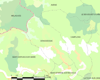
Map
Population
| Historical population | ||
|---|---|---|
| Year | Pop. | ±% |
| 1881 | 3,089 | — |
| 1891 | 2,936 | −5.0% |
| 1901 | 2,093 | −28.7% |
| 1911 | 2,042 | −2.4% |
| 1921 | 2,200 | +7.7% |
| 1931 | 2,548 | +15.8% |
| 1936 | 2,416 | −5.2% |
| 1954 | 2,404 | −0.5% |
| 1962 | 1,962 | −18.4% |
| 1968 | 1,510 | −23.0% |
| 1975 | 1,134 | −24.9% |
| 1982 | 924 | −18.5% |
| 1990 | 687 | −25.6% |
| 1999 | 632 | −8.0% |
| 2008 | 690 | +9.2% |
See also
References
| Wikimedia Commons has media related to Graissessac. |
This article is issued from Wikipedia - version of the 11/12/2016. The text is available under the Creative Commons Attribution/Share Alike but additional terms may apply for the media files.