Rieussec
This article is about the commune in France. For the inventor of the chronograph, see Nicolas Mathieu Rieussec.
| Rieussec | ||
|---|---|---|
|
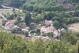
Rieussec seen from the hillside | ||
| ||
 Rieussec | ||
|
Location within Occitanie region  Rieussec | ||
| Coordinates: 43°25′05″N 2°44′24″E / 43.4181°N 2.74°ECoordinates: 43°25′05″N 2°44′24″E / 43.4181°N 2.74°E | ||
| Country | France | |
| Region | Occitanie | |
| Department | Hérault | |
| Arrondissement | Béziers | |
| Canton | Saint-Pons-de-Thomières | |
| Intercommunality | Pays Saint-Ponais | |
| Government | ||
| • Mayor (2001–2008) | André Barreau | |
| Area1 | 22.2 km2 (8.6 sq mi) | |
| Population (2008)2 | 94 | |
| • Density | 4.2/km2 (11/sq mi) | |
| Time zone | CET (UTC+1) | |
| • Summer (DST) | CEST (UTC+2) | |
| INSEE/Postal code | 34228 / 34220 | |
| Elevation |
314–860 m (1,030–2,822 ft) (avg. 490 m or 1,610 ft) | |
|
1 French Land Register data, which excludes lakes, ponds, glaciers > 1 km² (0.386 sq mi or 247 acres) and river estuaries. 2 Population without double counting: residents of multiple communes (e.g., students and military personnel) only counted once. | ||

Rieussec (Occitan: Riu Sec, meaning dry river) is a commune in the Hérault department in the Occitanie region in southern France.
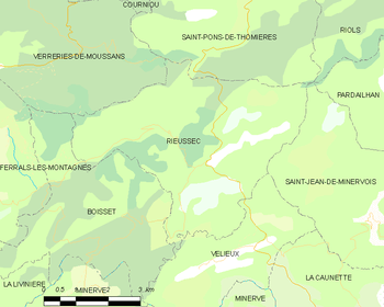
Map
Population
| Historical population | ||
|---|---|---|
| Year | Pop. | ±% |
| 1962 | 61 | — |
| 1968 | 70 | +14.8% |
| 1975 | 62 | −11.4% |
| 1982 | 71 | +14.5% |
| 1990 | 54 | −23.9% |
| 1999 | 76 | +40.7% |
| 2008 | 94 | +23.7% |
Geography
The Thoré has its source in the northern part of the commune.
See also
References
| Wikimedia Commons has media related to Rieussec. |
This article is issued from Wikipedia - version of the 11/12/2016. The text is available under the Creative Commons Attribution/Share Alike but additional terms may apply for the media files.