Le Triadou
| Le Triadou | ||
|---|---|---|
|
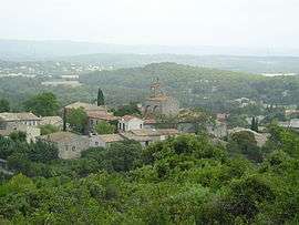
A general view of Le Triadou | ||
| ||
 Le Triadou | ||
|
Location within Occitanie region  Le Triadou | ||
| Coordinates: 43°44′27″N 3°51′09″E / 43.7408°N 3.8525°ECoordinates: 43°44′27″N 3°51′09″E / 43.7408°N 3.8525°E | ||
| Country | France | |
| Region | Occitanie | |
| Department | Hérault | |
| Arrondissement | Montpellier | |
| Canton | Les Matelles | |
| Intercommunality | Pic-Saint-Loup | |
| Government | ||
| • Mayor (2008–2014) | Renée Bosoni | |
| Area1 | 6.3 km2 (2.4 sq mi) | |
| Population (2008)2 | 378 | |
| • Density | 60/km2 (160/sq mi) | |
| Time zone | CET (UTC+1) | |
| • Summer (DST) | CEST (UTC+2) | |
| INSEE/Postal code | 34314 / 34270 | |
| Elevation |
63–142 m (207–466 ft) (avg. 100 m or 330 ft) | |
|
1 French Land Register data, which excludes lakes, ponds, glaciers > 1 km² (0.386 sq mi or 247 acres) and river estuaries. 2 Population without double counting: residents of multiple communes (e.g., students and military personnel) only counted once. | ||
.svg.png)
Le Triadou is a commune in the Hérault department in the Occitanie region in southern France.
Population
| Historical population | ||
|---|---|---|
| Year | Pop. | ±% |
| 1962 | 85 | — |
| 1968 | 93 | +9.4% |
| 1975 | 125 | +34.4% |
| 1982 | 143 | +14.4% |
| 1990 | 262 | +83.2% |
| 1999 | 328 | +25.2% |
| 2008 | 378 | +15.2% |
See also
References
| Wikimedia Commons has media related to Le Triadou. |
This article is issued from Wikipedia - version of the 11/12/2016. The text is available under the Creative Commons Attribution/Share Alike but additional terms may apply for the media files.