Lamalou-les-Bains
| Lamalou-les-Bains | ||
|---|---|---|
|
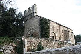
Saint-Pierre-de-Rhèdes church | ||
| ||
 Lamalou-les-Bains | ||
|
Location within Occitanie region  Lamalou-les-Bains | ||
| Coordinates: 43°35′55″N 3°04′50″E / 43.5986°N 3.0806°ECoordinates: 43°35′55″N 3°04′50″E / 43.5986°N 3.0806°E | ||
| Country | France | |
| Region | Occitanie | |
| Department | Hérault | |
| Arrondissement | Béziers | |
| Canton | Saint-Gervais-sur-Mare | |
| Intercommunality | Les Sources | |
| Government | ||
| • Mayor (2008–2014) | Marcel Roques (NC) | |
| Area1 | 6.18 km2 (2.39 sq mi) | |
| Population (2008)2 | 2,280 | |
| • Density | 370/km2 (960/sq mi) | |
| Time zone | CET (UTC+1) | |
| • Summer (DST) | CEST (UTC+2) | |
| INSEE/Postal code | 34126 / 34240 | |
| Elevation |
175–458 m (574–1,503 ft) (avg. 600 m or 2,000 ft) | |
|
1 French Land Register data, which excludes lakes, ponds, glaciers > 1 km² (0.386 sq mi or 247 acres) and river estuaries. 2 Population without double counting: residents of multiple communes (e.g., students and military personnel) only counted once. | ||
.svg.png)
Lamalou-les-Bains is a commune in the Hérault département in the Occitanie region in southern France.
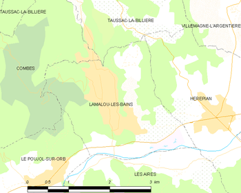
Map
Geography
Lamalou-les-Bains is located 53½ miles west of Montpellier in the Orb valley of the southern Cévennes. The village lies at an altitude of 200 metres and offers commanding views of the rivers, lakes and mountains situated in Haut Languedoc.
Population
| Historical population | ||
|---|---|---|
| Year | Pop. | ±% |
| 1962 | 1,987 | — |
| 1968 | 2,029 | +2.1% |
| 1975 | 2,067 | +1.9% |
| 1982 | 2,202 | +6.5% |
| 1990 | 2,194 | −0.4% |
| 1999 | 2,156 | −1.7% |
| 2008 | 2,280 | +5.8% |
Its inhabitants are called Lamalousiens.
Spa
The waters, which are both hot and cold, are used in cases of rheumatism, sciatica, locomotor ataxia and nervous maladies.
International relations
Lamalou-les-Bains is twinned with:
Festival
Lamalou-les-Bains hosts an annual Operetta Festival in the months of July and August.
See also
References
-
 This article incorporates text from a publication now in the public domain: Chisholm, Hugh, ed. (1911). "Lamalou-les-Bains". Encyclopædia Britannica (11th ed.). Cambridge University Press.
External links
| Wikimedia Commons has media related to Lamalou-les-Bains. |
- Town website (French)
- Tourim office website (French)
- Spa webpage (French)
- Description of Saint-Pierre-de-Rhèdes church (French)
- casino de lamalou les bains (French)
This article is issued from Wikipedia - version of the 11/12/2016. The text is available under the Creative Commons Attribution/Share Alike but additional terms may apply for the media files.