Saint-Gély-du-Fesc
| Saint-Gély-du-Fesc | ||
|---|---|---|
|
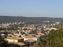
A general view of Saint-Gély-du-Fesc | ||
| ||
 Saint-Gély-du-Fesc | ||
|
Location within Occitanie region  Saint-Gély-du-Fesc | ||
| Coordinates: 43°41′35″N 3°48′24″E / 43.6931°N 3.8067°ECoordinates: 43°41′35″N 3°48′24″E / 43.6931°N 3.8067°E | ||
| Country | France | |
| Region | Occitanie | |
| Department | Hérault | |
| Arrondissement | Montpellier | |
| Canton | st Gely | |
| Intercommunality | Pic-Saint-Loup | |
| Government | ||
| • Mayor (2008–2014) | Mm.Leynou | |
| Area1 | 16.51 km2 (6.37 sq mi) | |
| Population (2008)2 | 8,495 | |
| • Density | 510/km2 (1,300/sq mi) | |
| Time zone | CET (UTC+1) | |
| • Summer (DST) | CEST (UTC+2) | |
| INSEE/Postal code | 34255 / 34980 | |
| Elevation |
71–264 m (233–866 ft) (avg. 116 m or 381 ft) | |
|
1 French Land Register data, which excludes lakes, ponds, glaciers > 1 km² (0.386 sq mi or 247 acres) and river estuaries. 2 Population without double counting: residents of multiple communes (e.g., students and military personnel) only counted once. | ||
.svg.png)
Saint-Gély-du-Fesc is a commune in the Hérault department in the Occitanie region in southern France.
The origin of this city is from Saint Gilles, a Christian of the 8th century, and Fesc means « control post » in Occitan language.
In 2004, the city has decided to leave the Agglomeration community of Montpellier Agglomération.
Population
| Historical population | ||
|---|---|---|
| Year | Pop. | ±% |
| 1962 | 528 | — |
| 1968 | 907 | +71.8% |
| 1975 | 2,055 | +126.6% |
| 1982 | 3,714 | +80.7% |
| 1990 | 5,936 | +59.8% |
| 1999 | 7,625 | +28.5% |
| 2008 | 8,495 | +11.4% |

Saint-Gély-Du-Fesc demographic historgram
Personalities
George Brassens died in this city, in 1981.
Places and monuments
- Archeological site of the "Vautes", of "Rouergas", and of the "Colline de l'Homme Mort" (dead men hill), who left traces from the neolithic. (4000 years B-C).
- Church of Saint-Gilles; on top of the steeple, the iron bell tower contains a bell cassified "MH", dating from 1759.
- Coulondres-Philippe-Eldridge parc, an 18 hectares site where one can observe several mediterranean species, as well as a botanical path.
See also
References
| Wikimedia Commons has media related to Saint-Gély-du-Fesc. |
This article is issued from Wikipedia - version of the 11/12/2016. The text is available under the Creative Commons Attribution/Share Alike but additional terms may apply for the media files.