Mons, Hérault
| Mons | ||
|---|---|---|
|
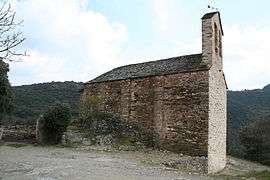
Chapel Saint-Roch | ||
| ||
 Mons | ||
|
Location within Occitanie region  Mons | ||
| Coordinates: 43°34′20″N 2°57′22″E / 43.5722°N 2.9561°ECoordinates: 43°34′20″N 2°57′22″E / 43.5722°N 2.9561°E | ||
| Country | France | |
| Region | Occitanie | |
| Department | Hérault | |
| Arrondissement | Béziers | |
| Canton | Olargues | |
| Intercommunality | Orb et Jaur | |
| Government | ||
| • Mayor (2008–2014) | Alain Ringal | |
| Area1 | 22.32 km2 (8.62 sq mi) | |
| Population (2008)2 | 567 | |
| • Density | 25/km2 (66/sq mi) | |
| Time zone | CET (UTC+1) | |
| • Summer (DST) | CEST (UTC+2) | |
| INSEE/Postal code | 34160 / 34390 | |
| Elevation |
117–1,054 m (384–3,458 ft) (avg. 248 m or 814 ft) | |
|
1 French Land Register data, which excludes lakes, ponds, glaciers > 1 km² (0.386 sq mi or 247 acres) and river estuaries. 2 Population without double counting: residents of multiple communes (e.g., students and military personnel) only counted once. | ||
.svg.png)
Mons is a commune in the Hérault department in Occitanie in southern France.
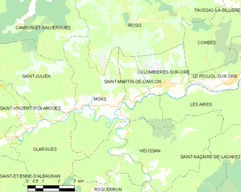
Map
Population
| Historical population | ||
|---|---|---|
| Year | Pop. | ±% |
| 1962 | 251 | — |
| 1968 | 440 | +75.3% |
| 1975 | 455 | +3.4% |
| 1982 | 514 | +13.0% |
| 1990 | 519 | +1.0% |
| 1999 | 507 | −2.3% |
| 2008 | 567 | +11.8% |

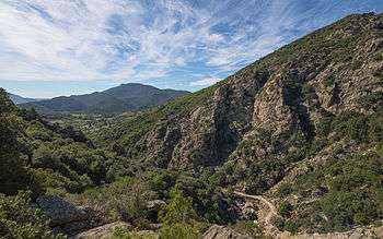
Southern end of the Gorges d'Héric.
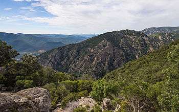
The Roc de Peyris (595m) witch overhang the Southern end of the Gorges d'Héric.
See also
References
| Wikimedia Commons has media related to Mons (Hérault). |
This article is issued from Wikipedia - version of the 11/12/2016. The text is available under the Creative Commons Attribution/Share Alike but additional terms may apply for the media files.