Prades-sur-Vernazobre
| Prades-sur-Vernazobre | |
|---|---|
|
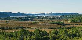
A general view of Prades-sur-Vernazobre | |
 Prades-sur-Vernazobre | |
|
Location within Occitanie region  Prades-sur-Vernazobre | |
| Coordinates: 43°26′54″N 2°59′13″E / 43.4483°N 2.9869°ECoordinates: 43°26′54″N 2°59′13″E / 43.4483°N 2.9869°E | |
| Country | France |
| Region | Occitanie |
| Department | Hérault |
| Arrondissement | Béziers |
| Canton | Saint-Chinian |
| Intercommunality | Saint-Chinianais |
| Government | |
| • Mayor (2008–2014) | Serge Fernandez |
| Area1 | 19.98 km2 (7.71 sq mi) |
| Population (2008)2 | 269 |
| • Density | 13/km2 (35/sq mi) |
| Time zone | CET (UTC+1) |
| • Summer (DST) | CEST (UTC+2) |
| INSEE/Postal code | 34218 / 34360 |
| Elevation |
64–663 m (210–2,175 ft) (avg. 70 m or 230 ft) |
|
1 French Land Register data, which excludes lakes, ponds, glaciers > 1 km² (0.386 sq mi or 247 acres) and river estuaries. 2 Population without double counting: residents of multiple communes (e.g., students and military personnel) only counted once. | |
Prades-sur-Vernazobre is a commune in the Hérault department in the Occitanie region in southern France.
Population
| Historical population | ||
|---|---|---|
| Year | Pop. | ±% |
| 1901 | 396 | — |
| 1906 | 380 | −4.0% |
| 1911 | 349 | −8.2% |
| 1921 | 365 | +4.6% |
| 1926 | 350 | −4.1% |
| 1931 | 350 | +0.0% |
| 1936 | 291 | −16.9% |
| 1946 | 258 | −11.3% |
| 1954 | 245 | −5.0% |
| 1962 | 221 | −9.8% |
| 1968 | 246 | +11.3% |
| 1975 | 228 | −7.3% |
| 1982 | 203 | −11.0% |
| 1990 | 211 | +3.9% |
| 1999 | 236 | +11.8% |
| 2008 | 269 | +14.0% |
See also
References
External links
| Wikimedia Commons has media related to Prades-sur-Vernazobre. |
This article is issued from Wikipedia - version of the 11/12/2016. The text is available under the Creative Commons Attribution/Share Alike but additional terms may apply for the media files.