Prades-le-Lez
| Prades-le-Lez | ||
|---|---|---|
|
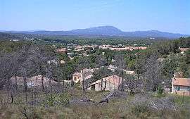
A general view of Prades-le-Lez | ||
| ||
 Prades-le-Lez | ||
|
Location within Occitanie region  Prades-le-Lez | ||
| Coordinates: 43°42′00″N 3°51′56″E / 43.7°N 3.8656°ECoordinates: 43°42′00″N 3°51′56″E / 43.7°N 3.8656°E | ||
| Country | France | |
| Region | Occitanie | |
| Department | Hérault | |
| Arrondissement | Montpellier | |
| Canton | Les Matelles | |
| Intercommunality | Montpellier | |
| Government | ||
| • Mayor (2008–2014) | Jean-Marc Lussert | |
| Area1 | 8.88 km2 (3.43 sq mi) | |
| Population (2008)2 | 4,525 | |
| • Density | 510/km2 (1,300/sq mi) | |
| Time zone | CET (UTC+1) | |
| • Summer (DST) | CEST (UTC+2) | |
| INSEE/Postal code | 34217 / 34730 | |
| Elevation |
53–134 m (174–440 ft) (avg. 65 m or 213 ft) | |
|
1 French Land Register data, which excludes lakes, ponds, glaciers > 1 km² (0.386 sq mi or 247 acres) and river estuaries. 2 Population without double counting: residents of multiple communes (e.g., students and military personnel) only counted once. | ||
.svg.png)
Prades-le-Lez is a commune in the Hérault department in the Occitanie region in southern France.
Population
| Historical population | ||
|---|---|---|
| Year | Pop. | ±% |
| 1888 | 628 | — |
| 1890 | 415 | −33.9% |
| 1891 | 442 | +6.5% |
| 1911 | 511 | +15.6% |
| 1825 | 483 | −5.5% |
| 1935 | 509 | +5.4% |
| 1950 | 419 | −17.7% |
| 1968 | 704 | +68.0% |
| 1975 | 917 | +30.3% |
| 1982 | 1,538 | +67.7% |
| 1990 | 3,604 | +134.3% |
| 1999 | 4,361 | +21.0% |
| 2008 | 4,525 | +3.8% |
See also
References
| Wikimedia Commons has media related to Prades-le-Lez. |
This article is issued from Wikipedia - version of the 11/12/2016. The text is available under the Creative Commons Attribution/Share Alike but additional terms may apply for the media files.