Cers, Hérault
| Cers | ||
|---|---|---|
|
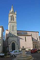
Church St-Genies | ||
| ||
 Cers | ||
|
Location within Occitanie region  Cers | ||
| Coordinates: 43°19′27″N 3°18′19″E / 43.3242°N 3.3053°ECoordinates: 43°19′27″N 3°18′19″E / 43.3242°N 3.3053°E | ||
| Country | France | |
| Region | Occitanie | |
| Department | Hérault | |
| Arrondissement | Béziers | |
| Canton | Béziers-2 | |
| Intercommunality | Béziers Méditerranée | |
| Government | ||
| • Mayor (2008–2014) | Gérard Gautier | |
| Area1 | 7.85 km2 (3.03 sq mi) | |
| Population (2008)2 | 2,215 | |
| • Density | 280/km2 (730/sq mi) | |
| Time zone | CET (UTC+1) | |
| • Summer (DST) | CEST (UTC+2) | |
| INSEE/Postal code | 34073 / 34420 | |
| Elevation |
3–48 m (9.8–157.5 ft) (avg. 15 m or 49 ft) | |
|
1 French Land Register data, which excludes lakes, ponds, glaciers > 1 km² (0.386 sq mi or 247 acres) and river estuaries. 2 Population without double counting: residents of multiple communes (e.g., students and military personnel) only counted once. | ||
.svg.png)
Cers is a commune in the Hérault department in southern France.

Map
Population
| Historical population | ||
|---|---|---|
| Year | Pop. | ±% |
| 1962 | 595 | — |
| 1968 | 666 | +11.9% |
| 1975 | 840 | +26.1% |
| 1982 | 1,350 | +60.7% |
| 1990 | 1,798 | +33.2% |
| 1999 | 1,802 | +0.2% |
| 2008 | 2,215 | +22.9% |
See also
References
| Wikimedia Commons has media related to Cers. |
This article is issued from Wikipedia - version of the 5/1/2014. The text is available under the Creative Commons Attribution/Share Alike but additional terms may apply for the media files.