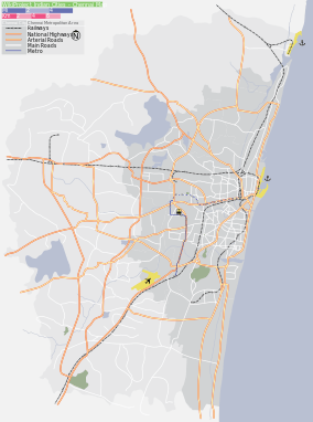
Keelkattalai
| Keelkattalai Keelkattalai | |
|---|---|
| suburb | |
 Keelkattalai  Keelkattalai  Keelkattalai | |
| Coordinates: 12°57′54″N 80°11′46″E / 12.96487°N 80.19611°ECoordinates: 12°57′54″N 80°11′46″E / 12.96487°N 80.19611°E | |
| Country | India |
| State | Tamil Nadu |
| District | Kancheepuram |
| Metro | Chennai |
| Government | |
| • Body | CMDA |
| Population (2011) | |
| • Total | 34,591 |
| Languages | |
| • Official | Tamil |
| Time zone | IST (UTC+5:30) |
| PIN | 600117 |
| Planning agency | CMDA |
Keelkattalai is a suburb in South of Chennai.
Demographics
As of 2001 India census,[1] Keelkattalai had a population of 17,440. Males constitute 53% of the population and females 47%.Keelkattalai has an average literacy rate of 91%, higher than the national average of 59.5%: male literacy is 91%, and female literacy is 87%. In Keelkattalai, 14% of the population are under 6 years of age.
Name
The name Keelkattalai is derived from the word கீழ் from கிழக்கு (meaning east) and கட்டளை (meaning village) and translates to "The village in the east" i.e.', it is in the east with respect to Pallavaram,a pallava era settlement.
Connectivity
'Keelkattalai' POSTAL PIN CODE CHENNAI- 600117 State Highways Connect's to Tambaram,lot of buses that connect people to the nearest suburban railway stations like St. Thomas Mount& Velachery. Velachery station has enough parking area for two as well as 4-wheelers for the convenience of commuters. Autorickshaws are very commonly used but are considered a little expensive. A few horse carriages still come from St. Thomas Mount station but are seldom seen these days. The Velachery MRTS Station is nearer than the St. Thomas Mount Station, about 5 km in North, and takes a major load of commuters from Keelkattalai towards the main city.Keelkattalai has Golbal connectivity like 6 km distance from Chennai Anna International Airport. While Saint Thomas Mount Railways Station which is 3 km from Keelkattalai covers the city and Suburban from Chengalpattu to Marina Beach station's, Velachery is a terminal and covers areas like Tiruvanmiyur, Adyar, marina beach etc. Both the lines terminate at the beach station. The Inner Ring road project work is complete and connects to GST road and then towards airport or Ashok nagar. The junction where Medavakkam High/Main Road [N-S] & Madipakkam Main Road[E-W] connects is referred to as Koot Road. High rise apartments are fast replacing individual houses in this area. The area has undergone rapid development since the Railway Station at Velachery, abt 3 km in East, started operation from 2008 with the ease of connectivity to city and to the famous IT corridor.Keelkattalai is 3 km distance to reach Chennai Metro Railways. Keelkattalai also connected to Indian National Highways NH45 is 4.5 km.It also near to Tambaram where bus and train facilities to all within state and national connectivity can be enjoyed.Keelkattalai also connected to State Highways SH109 is 0.5 km.It also near to Chrompet , * Pallavaram and Tambaram where bus and train facilities to all within state and national connectivity can be enjoyed.
Facilities and attractions
Leading food outlets like KFC, Dominos, Papa Johns,Aasife Biryani,,Subway, Alreef, Raintree, Adyar ananda bhavan, and Sri Krishna Sweets have set up their outlets here. There are many shopping outlets like Reliance Digital world, Sathya's,poorvika mobiles,The mobile store,Reliance trends, Girias and Megamart.
Schools and colleges
Schools in this locality include
- Holy family convent matriculation Higher Secondary School
- Sri Sankara Vidyalaya Matriculation School
- KIDDIES CHOICE Montessori & Kindergarten School
- Ravindra Bharathi Global School
- Vel's Higher Secondary School
- Velankanni Matriculation Higher Secondary School
- BAALYAA School
Hospitals
- Grace Multispeciality Hospital,
- Vijayam Hospital, Keelkattalai,
- Anjakha Hospital,
- Divya Hospital,
There is no good government Hospital in Keelkattalai for the people living in this area.
Location in context
 |
Pallikaranai | Medavakkam | Pallavaram |  |
| Velachery | |
Moovarasanpattu / Nanganallur | ||
| ||||
| | ||||
| Adambakkam | St Thomas Mount | Pazhavanthangal |
References
- ↑ "Census of India 2001: Data from the 2001 Census, including cities, villages and towns (Provisional)". Census Commission of India. Archived from the original on 2004-06-16. Retrieved 2008-11-01.