Prince George's County, Maryland
| Prince George's County, Maryland | |||||
|---|---|---|---|---|---|
| County | |||||
| Prince George's County | |||||
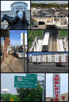 The Prince George's County courthouse in 2008, the Boulevard at the Capital Centre in 2005, downtown Upper Marlboro in 2006, the Prince George's Plaza in 2004, Laurel's Patuxent Square in 2013, Andrews AFB in 2008, downtown Adelphi in 2008. | |||||
| |||||
| Nickname(s): "P.G. County",[1] "P.G.",[1] "Ward 9"[2] | |||||
|
Motto: "Semper Eadem" (English: "Ever the Same") | |||||
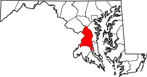 Location in the U.S. state of Maryland | |||||
 Maryland's location in the U.S. | |||||
| Founded | October 3, 1695 | ||||
| Named for | Prince George of Denmark | ||||
| Government • Executive |
Rushern L. Baker, III (D) | ||||
| Seat | Upper Marlboro | ||||
| Largest city | Bowie | ||||
| Area | |||||
| • Total | 499 sq mi (1,292 km2) | ||||
| • Land | 483 sq mi (1,251 km2) | ||||
| • Water | 16 sq mi (41 km2), 3.2% | ||||
| Population (est.) | |||||
| • (2015) | 909,535 | ||||
| • Density | 1,823/sq mi (704/km²) | ||||
| Demonym(s) | Prince Georgian, P.G. Countyan | ||||
| ZIP code(s) | 20607–20774 | ||||
| Area code(s) | 240, 301 | ||||
| Congressional districts | 4th, 5th | ||||
| Time zone | Eastern: UTC-5/-4 | ||||
| Website |
www | ||||

Prince George’s County, also known as P.G. County,[1] is a county in the U.S. state of Maryland, bordering the eastern portion of Washington, D.C. As of the 2010 U.S. Census, the population was 863,420,[3] making it the second-most populous county in Maryland, behind only Montgomery County. Its county seat is Upper Marlboro.[4]
Prince George’s County is included in the Washington-Arlington-Alexandria, DC-VA-MD-WV Metropolitan Statistical Area. Due to its proximity to Washington, D.C. the county also hosts many U.S. governmental facilities, such as Joint Base Andrews, a U.S. military airbase, as well as the headquarters of the United States Census Bureau.
Etymology
The official name of the county, as specified in the county's charter, is "Prince George’s County, Maryland".[5] The county is named after Prince George of Denmark (1653–1708), the husband of Anne, Queen of Great Britain, and the brother of King Christian V of Denmark and Norway. The county's demonym is Prince Georgian and its motto is Semper Eadem (English: "Ever the Same"), a phrase used by Queen Anne. Prince George's County is frequently referred to as "P.G." or "P.G. County", an abbreviation viewed as pejorative by some residents.[1]
History
.svg.png)
.svg.png)
.svg.png)
The Cretaceous Era brought dinosaurs to the area which left a number of fossils, now preserved in a 7.5-acre (3.0 ha) park in Laurel.[6] The site, which among other finds has yielded fossilized teeth from Astrodon and Priconodon species, has been called the most prolific in the eastern United States.[7]
In the mid to late Holocene era, the area was occupied by Paleo-Native Americans and then later, Native Americans. When the first European settlers arrived, what is now Prince George's County was inhabited by people of the Piscataway Indian Nation. Three branches of the tribe are still living today, two of which are headquartered in Prince George's County.
17th century
Prince George's County was created by the English Council of Maryland in the Province of Maryland in 1696[8] from portions of Charles and Calvert counties. The county was divided into six districts referred to as "Hundreds": Mattapany, Petuxant, Collington, Mount Calvert, Piscattoway and New Scotland.[9]
18th century
A portion was detached in 1748 to form Frederick County. Because Frederick County was subsequently divided to form the present Allegany, Garrett, Montgomery, and Washington counties, all of these counties in addition were derived from what had up to 1748 been Prince George's County.
In 1791, portions of Prince George's County were ceded to form the new District of Columbia, along with portions of Montgomery County, Maryland, as well as the parts of Northern Virginia; that were later returned to Virginia.
19th century
During the War of 1812, the British marched through the county by way of Bladensburg to burn the White House. On their return, they kidnapped a prominent doctor, William Beanes. Lawyer Francis Scott Key was asked to negotiate for his release, which resulted in his writing "The Star-Spangled Banner".
Since much of the southern part of the county was tobacco farms that were worked by enslaved Africans,[10] there was a high population of African Americans in the region. After the Civil War, many African Americans attempted to become part of Maryland politics, but were met with violent repression after the fall of Reconstruction.[11]
In April 1865, John Wilkes Booth made his escape through Prince George's County after shooting President Abraham Lincoln. He was on his way to Virginia.
20th century
The population of African Americans declined during the first half of the 20th century, but was renewed to over 50% in the early 1990s when the county again became majority African American.[12] The first African American County Executive was Wayne K. Curry, elected in 1994.
On July 1, 1997, the Prince George's County section of the city of Takoma Park, Maryland, which straddled the boundary between Prince George's and Montgomery counties, was transferred to Montgomery County.[13] This was done after city residents voted to be under the sole jurisdiction of Montgomery County, and subsequent approval by both counties and the Maryland General Assembly. This was the first change in Prince George's County's boundaries since 1968, when the City of Laurel was unified in Prince George's County.
21st century
The county has a number of properties on the National Register of Historic Places.[14]
Geography
According to the U.S. Census Bureau, the county has a total area of 499 square miles (1,290 km2), of which 483 square miles (1,250 km2) is land and 16 square miles (41 km2) (3.2%) is water.[15]
Prince George's County lies in the Atlantic coastal plain, and its landscape is characterized by gently rolling hills and valleys. Along its western border with Montgomery County, Adelphi, Calverton and West Laurel rise into the piedmont, exceeding 300 feet (91 m) in elevation.
The Patuxent River forms the county's eastern border with Howard, Anne Arundel, and Calvert counties.
Regions
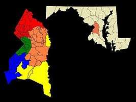
= North County
= Central County
= Rural Tier
= Inner Beltway
= South County
County terrain, culture and demographics differ significantly by location within the county. There are five key regions to Prince George's County: North County, Central County, the Rural Tier, the Inner Beltway, and South County.
North County
Northern Prince George's County includes Laurel, Beltsville, Adelphi, College Park and Greenbelt. This area of the county is anchored by the Capital Beltway and the Baltimore–Washington Parkway. Laurel is experiencing a population boom with the construction of the Inter-County Connector. The key employers in this region are the University of Maryland, Beltsville Agricultural Research Center, and NASA-Goddard Space Flight Center. Areas of geographic distinction include Greenbelt Park, a wooded reserve adjacent to the planned environmental community of Greenbelt, and University Park, a collection of historic homes adjacent to the University of Maryland. Riversdale Mansion, along with the historic homes of Berwyn Heights, Mt. Rainier and Hyattsville, along with Langley Park are also located in this area. The hidden Lake Artemesia, a park constructed during the completion of the Washington Metro Green Line, incorporates a stocked fishing lake and serves as the trail-head for an extensive Anacostia Tributary Trails system that runs along the Anacostia River and its tributaries. The south and central tracts of the Patuxent Wildlife Research Center also lie in this part of the county; the north tract lies north of the Patuxent River in Anne Arundel County.
Central County
Central County, located on the eastern outskirts of the Capital Beltway, consists of Mitchellville, Woodmore, Greater Upper Marlboro, Springdale, and Bowie. According to the 2010 census, it has generally been the fastest growing region of the county.[16] Mitchellville is named for a wealthy African American family, the Mitchells, who owned a large portion of land in this area of the county.[17] Central Avenue, a major exit off the I-95 beltway, running east to west, is one of two main roads in this portion of the county. The other major roadway is Old Crain Highway, which runs north to south along the eastern portion of the county. The Newton White Mansion on the grounds is a popular site for weddings and political events.
Bowie is best known as a planned Levittown.[18] William Levitt built traditional homes, as well as California contemporaries along U.S. Route 50, the key highway to the eastern shore and the state capital of Annapolis. Bowie has currently grown to be the largest city in Prince George's County, with more than 50,000 people. It also has a large Caucasian population, compared to much of the county (48% of the population).[19] Housing styles vary from the most contemporary to century old homes in Bowie's antique district (formerly known as Huntingtown), where the town of Bowie began as a haven for thoroughbred horse racing. Areas of geographic distinction include the Ogden Bowie Mansion, Allen Pond, key segments of the Washington, Baltimore and Annapolis Trail, as well as planned parks, lakes and walking trails.
Rural Tier
Prince George's rural tier was designated "in the 2002 General Plan as an area where residential growth would be minimal";[20] it may be found in the area well beyond the Beltway to the east and south of central county, bounded on the north by U.S. Route 50, the west by the communities Accokeek and Fort Washington, and the east by the Patuxent River. Prince George's origins are in this part of the county. Most of this area contains the unincorporated parishes, villages and lost towns of Prince George's County. Largely under postal designations of "Upper Marlboro" or "Brandywine", in truth the town of Upper Marlboro is more central county in character, though it is the post office location for various rural settlements. (The names of these unincorporated areas are listed below in the towns section of this article). Since 1721 Upper Marlboro has been the county seat of government, with families that trace their lineage back to Prince George's initial land grants and earliest governing officials. Names like Clagett, Sasscer, King James and Queen Anne pepper the streets.
The rural tier has been the focus of orchestrated efforts by residents and county government to preserve its rural character and environmental integrity.[21] Under the Maryland-National Capital Park and Planning Commission (M-NCPPC), Patuxent River Park is the largest natural preserve and provides public access for birdwatching and viewing the rural tier's natural waterfront vistas. In season, the park's Jug Bay Natural Area and the Patuxent Riverkeeper in Queen Anne both offer canoeing and kayaking rentals on the Patuxent. The county's largest collection of tobacco planter mansions and preserved homes are in the rural tier, some managed by the M-NCPPC. Many rural tier roads have scenic highway preservation status; a fall drive yields exceptional beauty along the Patuxent valley's Leeland Road, Croom Road, Clagett's Landing Rd., Mill Branch Rd., Queen Anne Rd., and Brandywine Rd. Walking access along roads in this area is very limited, because most property along the roads remains in private ownership. However, walking is much more accessible in the widespread M-NCPPC lands and trails and state holdings in the Patuxent valley, such as Merkle Wildlife Sanctuary and Rosaryville State Park, both popular among hikers and mountain bikers.
Inner Beltway
The inner beltway communities of Capitol Heights, District Heights, Forestville, Suitland and Seat Pleasant border the neighboring District of Columbia's northeastern and southeastern quadrants. This region is the most densely populated area of the county, although many communities here saw a decrease in population from 2000 to 2010. A high percentage of its residents are African American.[22]
South County
South county is a blend of the greenery of the rural tier and the new development of central county. The communities of Clinton, Oxon Hill, Temple Hills and Fort Washington are the largest areas of south county. It is the only portion of Prince George's County to enjoy the Potomac River waterfront, and that geographic distinction has yielded the rise of the National Harbor project: a town center and riverside shopping and living development on the Potomac. The National Harbor has become a major tourist and convention attraction, with significant hotel accommodations, eateries and shopping. Ferry rides allow trips across the Potomac into Alexandria.[23] Several historic sites, including Mt. Vernon, can be viewed from the harbor front. River Road in Fort Washington also yields great views of the Potomac. Fort Washington Park was a major battery and gives access to the public for tours of the fort, scenic access to the river and other picnic grounds. Oxon Hill Manor offers a working farm and plantation mansion for touring; His Lordship's Kindness is another major historic home. Also, Fort Foote is an old American Civil War fort and tourist destination.
Adjacent counties and independent cities
- Anne Arundel County (east)
- Calvert County (southeast)
- Charles County (south)
- Howard County (north)
- Montgomery County (northwest)
- Fairfax County, Virginia (southwest)
- Alexandria, Virginia (southwest)
- Washington, D.C. (west)
Prince George's and Montgomery Counties share a bi-county planning and parks agency in the M-NCPPC and a public bi-county water and sewer utility in the Washington Suburban Sanitary Commission
National protected areas
Government
| Year | Republican | Democratic |
|---|---|---|
| 2012 | 9.2% 35,734 | 90.0% 347,938 |
| 2008 | 10.4% 38,833 | 89.0% 332,396 |
| 2004 | 17.4% 55,532 | 81.8% 260,532 |
| 2000 | 18.4% 49,987 | 79.5% 216,119 |
| 1996 | 21.9% 52,697 | 73.5% 176,612 |
| 1992 | 24.5% 62,955 | 65.7% 168,691 |
| 1988 | 38.8% 86,545 | 60.0% 133,816 |
| 1984 | 41.0% 95,121 | 58.6% 136,063 |
| 1980 | 40.7% 78,977 | 50.9% 98,757 |
| 1976 | 42.0% 81,027 | 58.0% 111,743 |
| 1972 | 58.5% 116,166 | 40.3% 79,914 |
| 1968 | 41.2% 73,269 | 40.3% 71,524 |
| 1964 | 36.2% 46,413 | 63.8% 81,806 |
| 1960 | 42.0% 44,817 | 58.0% 62,013 |
Since 1792, the county seat has been Upper Marlboro. Prior to 1792, the county seat was located at Mount Calvert, a 76-acre (308,000 m²) estate along the Patuxent River on the edge of what is now in the unincorporated community of Croom.
Prince George's County was granted a charter form of government in 1970 with the county executive elected as the head of the executive branch and the county council members as the leadership of the legislative branch. Prince George's County is part of the Seventh Judicial Circuit of the state of Maryland and holds 23 of the 32 total circuit court judges in the circuit (which includes Calvert, Charles, Prince George's, and St. Mary's counties).[24]
Fitch Ratings assigned a 'AAA' bond rating to Prince George's County on August 25, 2011, re-affirming the county's stable financial outlook. Earlier in 2011, the County received 'AAA' status from Standard & Poor's and Moody's. 'AAA' bond ratings are the highest possible bond ratings a jurisdiction can receive.[25]
County executive
| Name | Party | Term |
|---|---|---|
| William W. Gullett | Republican | 1970–1974 |
| Win Kelly | Democratic | 1974–1978 |
| Lawrence Hogan | Republican | 1978–1982 |
| Parris N. Glendening | Democratic | 1982–1994 |
| Wayne K. Curry | Democratic | 1994–2002 |
| Jack B. Johnson | Democratic | 2002–2010 |
| Rushern L. Baker III | Democratic | 2010– |
Other officials
- County Council Chair: Mel Franklin
- State's Attorney: Angela Alsobrooks
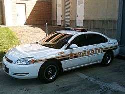
- County Sheriff: Melvin C. High (D)
- County Fire Chief: Marc S. Bashoor
- Chief of the County Police: Hank Stawinski
- PGCPS Chief Executive Officer: Kevin Maxwell
Emergency services
Law enforcement
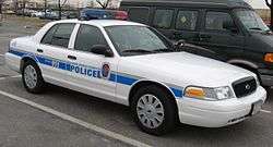
Prince George's County is serviced by multiple law enforcement agencies. The Prince George's County Police Department is the primary police service for county residents residing in unincorporated areas of the county. In addition, the Prince George's County Sheriff's Office acts as the enforcement arm of the county court, and also shares some patrol responsibility with the county police. County parks are serviced by the Prince George's County Division of the Maryland-National Capital Park Police. Besides the county-level services, all but one of the 27 local municipalities maintain police departments that share jurisdiction with the county police services. Furthermore, the Maryland State Police enforces the law on state highways which pass through the county and the Maryland Department of Natural Resources Police patrol the state parks and navigable waterways located within the county.
Along with the state and local law enforcement agencies, the federal government also maintains several departments that service citizens of the county such as the US Park Police, US Postal Police, Andrews Air Force Base Security Police, and other federal police located on various federal property located within the county.
In addition, nearly all of the incorporated cities and towns in the county have their own municipal police force. Notable exceptions include the city of College Park.
Emergency services
Prince George's County hospitals include Bowie Health Center, Doctors Community Hospital in Lanham, Gladys Spellman Specialty Hospital & Nursing Center in Cheverly, Hospice of the Chesapeake in Landover, Laurel Regional Hospital in Laurel, Prince George's Hospital Center in Cheverly, Southern Maryland Hospital Center in Clinton, and Fort Washington Medical Center.
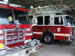
The Prince George's County Volunteer Firemen's Association was formed in 1922 with several of the first companies organized in the county. The first members of the association were Hyattsville, Cottage City, Mount Rainier, and Brentwood.
In March 1966, the Prince George's County Government employed the firefighters who had been hired by individual volunteer stations and an organized career department was begun. The career firefighters and paramedics are represented by IAFF 1619.
Prince George's County became the first jurisdiction in Maryland to implement the 9-1-1 Emergency Reporting System in 1973. Advanced life support services began for citizens of the county in 1977. Firefighters were certified as Cardiac Rescue Technicians and deployed in what was called at the time Mobile Intensive Care Units to fire stations in Brentwood, Silver Hill, and Laurel.
As of 2007, the Prince George's County Fire/EMS Department operates a combination system staffed by over 800 career firefighters and paramedics, and nearly 1,100 active volunteers.
Demographics
| Historical population | |||
|---|---|---|---|
| Census | Pop. | %± | |
| 1790 | 21,344 | — | |
| 1800 | 21,175 | −0.8% | |
| 1810 | 20,589 | −2.8% | |
| 1820 | 20,216 | −1.8% | |
| 1830 | 20,474 | 1.3% | |
| 1840 | 19,539 | −4.6% | |
| 1850 | 21,549 | 10.3% | |
| 1860 | 23,327 | 8.3% | |
| 1870 | 21,138 | −9.4% | |
| 1880 | 26,451 | 25.1% | |
| 1890 | 26,080 | −1.4% | |
| 1900 | 29,898 | 14.6% | |
| 1910 | 36,147 | 20.9% | |
| 1920 | 43,347 | 19.9% | |
| 1930 | 60,095 | 38.6% | |
| 1940 | 89,490 | 48.9% | |
| 1950 | 194,182 | 117.0% | |
| 1960 | 357,395 | 84.1% | |
| 1970 | 660,567 | 84.8% | |
| 1980 | 665,071 | 0.7% | |
| 1990 | 729,268 | 9.7% | |
| 2000 | 801,515 | 9.9% | |
| 2010 | 863,420 | 7.7% | |
| Est. 2015 | 909,535 | [26] | 5.3% |
| U.S. Decennial Census[27] 1790-1960[28] 1900-1990[29] 1990-2000[30] 2010-2015[3] | |||
Prince George's County is the wealthiest African American-majority county in the United States.[31][32]
2000
The racial makeup of the county was as of 2000:
- 62.70% Black
- 27.04% White
- 0.35% Native American
- 7.12% Hispanic or Latino (of any race)
- 3.87% Asian
- 0.06% Native Hawaiian or Pacific Islander
- 3.38% Some other race
- 2.61% Two or more races
By the 2008 estimates there were 298,439 households out of which 65.1% are family households and 34.9% were non-family households. 36.4% of households had children under the age of 18 living with them, 44.00% were married couples living together, 19.60% had a female householder with no husband present. 24.10% of all households were made up of individuals and 4.90% had someone living alone who was 65 years of age or older. The average household size was 2.74 persons and the average family size was 3.25 persons.
In the county the population was spread out with 26.80% under the age of 18, 10.40% from 18 to 24, 33.00% from 25 to 44, 22.10% from 45 to 64, and 7.70% who were 65 years of age or older. The median age was 33 years. For every 100 females there were 91.50 males. For every 100 females age 18 and over, there were 87.20 males.
The median income for a household in the county in 2008 was $71,696,[33] and the median income for a family was $81,908. The 2008 mean income for a family in the county was $94,360. As of 2000, males had a median income of $38,904 versus $35,718 for females. The 2008 per capita income for the county was $23,360. About 4.70% of families and 7.40% of the population were below the poverty line, including 9.2% of those under age 18 and 7.1% of those age 65 or over. Prince George's County is the 70th most affluent county in the United States by median income for families and the most affluent county in the United States with an African-American majority. Almost 38.8% of all households in Prince George's County, earned over $100,000 in 2008.[34]
2010 census
As of the 2010 United States Census, there were 863,420 people, 304,042 households, and 203,520 families residing in the county.[35] The population density was 1,788.8 inhabitants per square mile (690.7/km2). There were 328,182 housing units at an average density of 679.9 per square mile (262.5/km2).[36] The racial makeup of the county was 64.5% black or African American, 19.2% white, 4.1% Asian, 0.5% American Indian, 0.1% Pacific islander, 8.5% from other races, and 3.2% from two or more races. Those of Hispanic or Latino origin made up 14.9% of the population.[35] In terms of ancestry, 6.5% were Subsaharan African, and 2.0% were American.[37]
Of the 304,042 households, 36.8% had children under the age of 18 living with them, 40.1% were married couples living together, 20.4% had a female householder with no husband present, 33.1% were non-families, and 26.1% of all households were made up of individuals. The average household size was 2.78 and the average family size was 3.31. The median age was 34.9 years.[35]
The median income for a household in the county was $71,260 and the median income for a family was $82,580. Males had a median income of $49,471 versus $49,478 for females. The per capita income for the county was $31,215. About 5.0% of families and 7.9% of the population were below the poverty line, including 9.6% of those under age 18 and 6.7% of those age 65 or over.[38]
Education
30.1% of all residents over the age of 25 had graduated from college and obtained a bachelor's degree (17.8%) or professional degree (12.2%). 86.2% of all residents over the age of 25 were high school graduates or higher.
Religion
Prince George's County is home to more than 800 churches, including 12 megachurches,[39] as well as a number of mosques, synagogues, and Hindu and Buddhist temples. Property belonging to religious entities makes up 3,450 acres (14.0 km2) of land in the county, or 1.8% of the total area of the county.[40]
Economy
Top employers
According to the county's comprehensive annual financial report, the top private-sector employers in the county are the following. "NA" indicates not in the top ten for the year given.
| Employer | Employees (2014)[41] |
Employees (2011)[42] |
Employees (2005)[42] |
|---|---|---|---|
| United Parcel Service (UPS) | 4,220 | 4,220 | 2,300 |
| Giant | 3,000 | 3,600 | 6,152 |
| Verizon | 2,738 | 2,738 | NA |
| Dimensions Healthcare System | 2,500 | 2,500 | 2,100 |
| Marriott International (Gaylord National Resort & Convention Center) |
2,430 | 2,000 | NA |
| Shoppers Food & Pharmacy | 1,975 | 1,975 | 1,975 |
| Safeway | 1,605 | 1,605 | 2,400 |
| Capital One Bank (formerly Chevy Chase Bank) | NA | 1,456 | NA |
| Target | 1,400 | 1,400 | NA |
| Doctor's Community Hospital | 1,300 | 1,300 | NA |
| MedStar Health (Southern Maryland Hospital Center) |
1,242 | 1,300 | 1,300 |
The top public-sector employers in the county are:
| Employer | Employees (2014)[41] |
Employees (2011)[42] |
|---|---|---|
| University System of Maryland | 17,905 | 16,014 |
| Joint Base Andrews Naval Air Facility Washington | 13,500 | 8,057 |
| Prince George's County | 7,003 | 7,052 |
| Internal Revenue Service | 5,539 | 5,539 |
| U.S. Census Bureau | 4,414 | 4,287 |
| NASA Goddard Space Flight Center | 3,397 | 3,171 |
| Prince George's Community College | 2,637 | 1,700 |
| U.S. Department of Agriculture (Henry A. Wallace Beltsville Agricultural Research Center) |
1,850 | 1,850 |
| National Maritime Intelligence-Integration Office | 1,724 | 1,724 |
| National Oceanic and Atmospheric Administration | 1,350 | 1,350 |
Crime
Prince George's County accounted for 20% of murders in the State of Maryland from 1985 to 2006.[43] A twenty-year crime index trends study, performed by Prince George's County Police Department Information Resource Management, showed the county had a 23.1% increase in total crime for the years of 2000 to 2004. Between the years of 1984 to 2004, Prince George's had a 62.8% increase in total crime.[44]
However, as of 2009, crime had generally declined in the county[45] and the number of homicides declined from 151 in 2005 to 99 in 2009.[46][47]
Although crime had been declining, residents became alarmed when there were thirteen homicides during the first twelve days of 2011. This put added pressure on the police department to come up with a way to stop the violence.[48] By the end of January, the county experienced 16 homicides.
Violence continued into 2013 initially. The Washington Post reported that, as of February 20, Prince George's County already had 15 homicides in 2013, up from 10 on the same date in 2012.[49] However, as of the end of 2013, the County had experienced a record drop in crime, especially record lows in violent crimes.[50]
Education
Colleges and universities
- Bowie State University, located in unincorporated area north of Bowie
- Brightwood College, located in unincorporated area (Beltsville)
- Capital Seminary & Graduate School, in Greenbelt
- Capitol Technology University, located in unincorporated area south of Laurel
- Prince George's Community College, located in unincorporated area (Largo)
- Strayer University, P.G. Campus, in unincorporated area (Suitland)
- University of Maryland, College Park, in College Park
- University of Maryland University College, in unincorporated area (Adelphi)
The University of Maryland System headquarters are in the unincorporated area of Adelphi.[51]
Public schools
The county's schools are managed by the Prince George's County Public Schools system.
Transportation
The County contains a large portion of the Capital Beltway. After a decades-long debate, construction began in late 2007 on an east-west toll freeway, the Intercounty Connector ("ICC"), which extends Interstate 370 in Montgomery County in order to connect I-270 with Interstate 95 and U.S. 1 in Laurel. The ICC was completed in 2012.
The Washington Metropolitan Area Transit Authority operates Metrobus fixed-route bus service and Metrorail heavy-rail passenger service in and out of the County as well as the regional MetroAccess paratransit system for the handicapped. The Prince George’s County Department of Public Works and Transportation also operates TheBus, a County-wide fixed-route bus system, and the Call-A-Bus service for passengers who do not have access to or have difficulty using fixed-route bus service. Call-A-Bus is a demand-response service which generally requires 14-days advance reservations. The county also offers a subsidized taxicab service for elderly and disabled residents called Call-A-Cab in which eligible customers who sign up for the service purchase coupons giving them a 50 percent discount with participating taxicab companies in Prince George’s and Montgomery Counties.
Fifteen stations of the Washington Metro subway system are located in Prince George’s County, with four of them as terminus stations: Greenbelt, New Carrollton, Largo, and Branch Avenue. There has been much debate on the construction of the Purple Line, which would link highly developed areas of both Montgomery and Prince George’s Counties. Also worth noting is the potential expansion of the Green Line northward to Laurel and beyond.
The MARC Train (Maryland Area Rail Commuter) train service has two lines that traverse Prince George's County. The Camden Line runs between Baltimore Camden Station and Washington Union Station and has six stops in the county in Riverdale Park, College Park, Greenbelt, Muirkirk, Laurel, and Laurel Racetrack. The Penn Line runs on the AMTRAK route between Baltimore Penn Station and Washington Union Station. It has three stops in the county: Bowie State, Seabrook, and New Carrollton.
The College Park Airport (est. 1909) is the world’s oldest continuously operated airport and is home to the adjacent College Park Aviation Museum.
Residents may use Ronald Reagan Washington National Airport in Arlington County, Virginia, Baltimore–Washington International Thurgood Marshall Airport near Baltimore, and Dulles International Airport in Dulles, Virginia.
Major highways
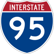 Interstate 95
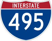 I-495 / Capital Beltway
 I-595 / US 50
 U.S. 1
 US 301 also called Crain Highway, is a major divided roadway, entering with MD 5 near Brandywine, and continuing north where it merges with eastbound US 50 heading toward Annapolis and the Maryland eastern shore.
 State Route 295 is the hidden designation for the portion of the Baltimore-Washington Parkway that runs north-south through the county. It runs from the intersection of Route 50 and MD 201 at the DC/MD line, and continues into Anne Arundel County to Baltimore.
 also called Pennsylvania Avenue, runs from the Maryland-DC border eastward into Anne Arundel County and south in Calvert County.
 also called Branch Avenue, runs from Maryland-DC border southeast through Charles County into St. Mary's County.
 also called Central Avenue, runs from Capitol Heights eastward through the center of the county, through Bowie, and into Anne Arundel County.
 also called Landover Road (north of 214) and Largo Road (south of 214), runs northward from the town of Upper Marlboro to Hyattsville.
 also called Kenilworth Avenue, runs north from the Maryland-DC border in Cheverly. After the intersection with Cherrywood Lane in Greenbelt, the name changes to Edmonston Road, which continues north until it ends in Laurel.
 also known as East-West Highway, stretches from the Prince George's County-Montgomery County border near Takoma Park to its end in Landover. In the town of Riverdale Park, it is called Riverdale Road.
 also called Annapolis Road, runs laterally from Hyattsville to Route 3 in Bowie.
 also called the Intercounty Connector (ICC) (Maryland Route 200), a long-planned toll road, was under construction as of late 2007,[52] and completed in 2014.[53] The toll road runs west from U.S. 1 just south of Laurel, crossing Konterra Drive, with a major new interchange at Interstate 95; then continuing west into Montgomery County and interchanging with U.S. 29, Maryland Route 97 (Georgia Avenue) and terminating at Interstate 370 near Shady Grove, Rockville and Gaithersburg, and providing a direct freeway connection to Interstate 270 via Interstate 370.
Enterprises and recreation
Prince George’s County is home to the United States Department of Agriculture's Henry A. Wallace Beltsville Agricultural Research Center, NASA’s Goddard Space Flight Center, the United States Census Bureau, Andrews Air Force Base, the National Archives and Records Administration's College Park facility, the University of Maryland’s flagship College Park campus, Six Flags America and Six Flags Hurricane Harbor, FedEx Field (home of the Washington Redskins), and the National Harbor, which its developers, Peterson Companies and Gaylord Entertainment Company, bill as the largest single mixed-use project and combined convention center–hotel complex on the East Coast.
Media
- WPGC-FM, Morningside, MD, take their P-G-C call letters from the name Prince George's County
- Prince George's Sentinel, Seabrook, MD, weekly newspaper covering the county with a circulation of 23,000 copies[54]
Recreation
Although Prince George’s County is not often credited for the Washington Redskins, the Redskins stadium is in Landover. No other major-league professional sports teams are in the county, though Bowie hosts the Bowie Baysox, a minor league baseball team. The county is known for its very successful youth. In basketball, ESPN published an article declaring Prince George's County the new "Hoops Hot Bed" and ranked it as the number one basketball talent pool in the country.[55] A number of basketball prospects, including Ty Lawson, Kevin Durant, Jeff Green, Roy Hibbert and Michael Beasley from AAU basketball teams such as the PG Jaguars, DC Assault, and DC Blue Devils. Besides AAU, basketball has skyrocketed from local high schools such as DeMatha Catholic High School and Bishop McNamara High School, both of which have found some great success locally and nationally.
Communities
This county contains the following incorporated municipalities:
Cities
Towns
Part of the city of Takoma Park was formerly in Prince George’s County, but since 1997 the city has been entirely in Montgomery County.[56] The part of Takoma Park that changed counties comprises two residential neighborhoods, Carole Highlands (an unincorporated portion of this neighborhood is still in Prince George’s County) and New Hampshire Gardens.
Census-designated places
Unincorporated areas are also considered as towns by many people and listed in many collections of towns, but they lack local government. Various organizations, such as the United States Census Bureau, the United States Postal Service, and local chambers of commerce, define the communities they wish to recognize differently, and since they are not incorporated, their boundaries have no official status outside the organizations in question. The Census Bureau recognizes the following census-designated places in the county:
- Accokeek
- Adelphi
- Joint Base Andrews
- Aquasco
- Baden
- Beltsville
- Brandywine
- Brock Hall
- Calverton
- Camp Springs
- Cedarville
- Chillum
- Clinton
- Coral Hills
- Croom
- East Riverdale
- Fairwood
- Forestville
- Fort Washington
- Friendly
- Glassmanor
- Glenn Dale
- Hillandale
- Hillcrest Heights
- Kettering
- Konterra
- Lake Arbor
- Landover
- Langley Park
- Lanham
- Largo
- Marlboro Meadows
- Marlboro Village
- Marlow Heights
- Marlton
- Melwood
- Mitchellville
- National Harbor
- Oxon Hill
- Peppermill Village
- Queen Anne
- Queenland
- Rosaryville
- Seabrook
- Silver Hill
- South Laurel
- Springdale
- Suitland
- Summerfield
- Temple Hills
- Walker Mill
- West Laurel
- Westphalia
- Woodlawn
- Woodmore
Unincorporated communities
- Ardmore
- Avondale
- Berwyn
- Carmody Hills
- Carole Highlands
- Cedar Heights
- Chapel Oaks
- Cheltenham
- Collington
- Danville
- Green Meadows
- Indian Creek Village
- Kentland
- Lewisdale
- Meadows
- Montpelier
- Muirkirk
- North College Park
- Palmer Park
- Piscataway
- Raljon
- Rogers Heights
- South Bowie
- Tantallon
- Tuxedo
- Vansville
- West Hyattsville
- White Hall
- Woodyard
Ghost town
Sister cities
Prince George's County has three sister cities, as designated by Sister Cities International:
 Royal Bafokeng Nation, Republic of South Africa
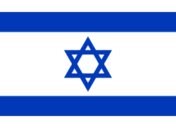 Rishon LeZion, State of Israel
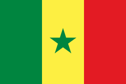 Ziguinchor, Republic of Senegal
Notable people
- Karen Allen, actor, (National Lampoon's Animal House, Raiders of the Lost Ark), director, grew up in New Carrollton and attended DuVal High School.
- Thurl Bailey, professional basketball player; grew up in Landover.[57]
- Ben Barnes, Member of the Maryland House of Delegates, from Greenbelt, Maryland.
- John Bayne, 19th-century founder of the University of Maryland, superintendent of county schools, Union Army physician, and one of the first Americans to grow and eat a tomato, proving they were not poisonous as had been thought, lived on Oxon Hill Road in Oxon Hill.
- Michael Beasley, professional basketball player for the Miami Heat
- Len Bias, All-American Basketball star at the University of Maryland in the 1980s, grew up in Landover Hills and attended Northwestern High School in Hyattsville.
- Riddick Bowe, former world heavyweight boxing champion, and family lived in Sero Estates, Fort Washington.
- Sergey Brin, founder of Google, grew up in Adelphi and attended Eleanor Roosevelt High School in Greenbelt.
- Steve Byrnes, Former NASCAR TV Analyst, grew up in New Carrollton, attended both Largo High School (Maryland) & University of Maryland
- John Carroll, S.J. (1735–1815), first Roman Catholic bishop and archbishop in the United States, and founder of Georgetown University, was born in Upper Marlboro.
- JC Chasez, singer/producer, grew up in Bowie.
- Frank Cho, award-winning cartoonist, grew up in Beltsville and attended community college and university in the county.
- Thomas John Claggett (1742–1816), first Episcopal bishop consecrated in the United States and third Chaplain of the United States Senate, was from Upper Marlboro.
- Leonard Covington (1768–1813), born in Aquasco, U.S. congressman from Maryland[58]
- Kevin Durant, professional basketball player for the Oklahoma City Thunder
- Roger Easton, Sr., naval scientist, the chief inventor of GPS and winner of the 2004 National Medal of Technology, lived on Oxon Hill Road in Oxon Hill.
- Francis B. Francois, lawyer and engineer, lived in Bowie for over 40 years. In 1999, he was elected to the National Academy of Engineering in recognition of his achievements in the field of engineering and policy leadership in surface transportation infrastructure and research. He served on the Prince George's County council as an elected official for 10 years.
- Steven F. Gaughan, Prince George's County police officer killed in the line of duty in 2005
- Kathie Lee Gifford, network television personality, grew up in Bowie.
- Ginuwine, R&B pop musician, lived in Fort Washington.
- Lyle Goodhue (1903–1981), USDA research scientist and inventor, lived in Prince George's County from 1935 to 1945.
- Jeff Green, NBA player for the Boston Celtics
- Goldie Hawn, actress, director, and producer, grew up in Takoma Park before it was transferred to Montgomery County.
- Jim Henson, creator of the Muppets later used on Sesame Street, grew up in University Park and attended Northwestern High School in Hyattsville.
- Taraji P. Henson, actress, attended Oxon Hill High School.
- Roy Hibbert, professional basketball player for the Indiana Pacers, and raised in Adelphi, Maryland
- Steny Hoyer, former Majority Leader of the United States House of Representatives till 2011, lived as a teenager in Suitland and Mitchellville, attended Suitland High School and Univ. Maryland – College Park, and later lived in Friendly before moving to St. Mary's County.
- Cathy Hughes, founder and manager of Radio One, the nation's largest African American broadcasting company
- Jarrett Jack, a professional basketball player for the Brooklyn Nets.
- Isis King, first transgender contestant in America's Next Top Model (Cycles 11 and 17)
- Martin Lawrence, actor and comedian, lived in Landover and attended Eleanor Roosevelt High School in Greenbelt
- Ty Lawson NBA player for the Houston Rockets.
- Sugar Ray Leonard, boxing champion, grew up in Palmer Park.
- G. Gordon Liddy, presidential aide convicted in the Watergate scandal, later an author and radio personality, lives in Fort Foote, Fort Washington.
- John P. McDonough, Maryland Secretary of State, from Bladensburg, Maryland.
- Mike Miller, state Senate President since 1987, grew up in Clinton and attended Surrattsville High School.
- Mýa, R&B pop musician, attended Eleanor Roosevelt High School in Greenbelt, Maryland as a violinist in the orchestra among the class of 1994.
- Sammy Nestico, band music arranger, lived in Oxon Hill in the 1960s.
- Stephanie Roper, noted victim of crime[59]
- Jan Scruggs, who conceived the National Vietnam Veterans Memorial, grew up in Bowie.
- Michael Sweetney, a former professional basketball player.
- Dominic Wade, professional boxer, from Largo.
- Wale, a hip-hop artist, who often notes in his songs how he is from "PG County," and the "DMV" region (D.C, Maryland, Virginia).
- Sumner Welles, U.S. Undersecretary of State to Franklin Roosevelt, built and lived in Oxon Hill Manor, which is now a public facility.
- Delonte West, a former NBA player and Graduate of Eleanor Roosevelt High School in Greenbelt,MD
- Morgan Wootten coached at DeMatha Catholic High School in Hyattsville from 1956 to 2002. The coach with the most wins in high school basketball history, he was elected to the Basketball Hall of Fame, the only high school basketball coach ever so honored. He currently resides in University Park.
- Robert M. Wright, born in Prince George's County in 1840; one of the founders of Dodge City, Kansas
Namesakes
- The USS Prince Georges (AK-224), was a United States Navy Crater-class cargo ship named after the county.
See also
References
- 1 2 3 4 Parker, Lonnae O'Neal; Wiggins, Ovetta (May 7, 2006). "'P.G.': Insult or Abbreviation?". The Washinghton Post. The Washington Post Company. p. C05. Retrieved 2008-05-01.
- ↑ Beckwith, Ryan Teague (May 27, 2012). "Local Lingo: Ward Nine". The Hyattsville Wire. Maryland. Archived from the original on December 10, 2013. Retrieved March 15, 2016.
Some people like to joke that Prince George's County is 'Ward Nine' — the fictitious extra ward for the Washington, D.C. City Council.
- 1 2 "State & County QuickFacts". United States Census Bureau. Retrieved August 24, 2013.
- ↑ "Find a County". National Association of Counties. Retrieved 2011-06-07.
- ↑ Prince George's County (April 3, 2000). "Subtitle 1: General Provisions". 103: Name and Boundaries. Title 17, the Public Local Laws of Prince George's County, Part II. Prince George's County, Maryland: Prince George's County. Retrieved March 30, 2015.
Section 103. Name and Boundaries. The corporate name shall be "Prince George's County, Maryland," and it shall thus be designated in all actions and proceedings touching its rights, powers, properties, liabilities, and duties. Its boundaries and County seat shall be and remain as they are at the time this Charter takes effect unless otherwise changed in accordance with law.
- ↑ "Dinosaur Park Officially Dedicated and Opened To the Public". pgparks.com. Prince George's County Department of Parks and Recreation. Retrieved October 28, 2009.
- ↑ Roylance, Frank D. (October 29, 2009). "Where dinosaurs once walked". baltimoresun.com. The Baltimore Sun. Retrieved October 28, 2009.
- ↑ "Proceedings of the Council of Maryland, 1696/7:1698, Volume 23, Page 23". Maryland State Archives. Retrieved 2007-05-04.
- ↑ "Proceedings of the Council of Maryland, 1696/7:1698, Volume 23, Page 23". Maryland State Archives. Retrieved May 4, 2007.
- ↑ "Fight to Freedom: Slavery and the Underground Railroad in Maryland from the Maryland State Archives".
- ↑ Records & Recollections – Early Black History in Prince George's County, Maryland by Bianca P. Floyd, M-NCPPC ©1989
- ↑ PRINCE GEORGE'S COUNTY HITTING 300 Washington Post – Friday, April 19, 1996 Author: Larry Fox
- ↑ "Substantial Changes to Counties and County Equivalent Entities: 1970–Present". Census Bureau. Retrieved 8 August 2009.
- ↑ National Park Service (2008-04-15). "National Register Information System". National Register of Historic Places. National Park Service.
- ↑ "2010 Census Gazetteer Files". United States Census Bureau. August 22, 2012. Retrieved September 12, 2014.
- ↑ Bloch, Matthew; Carter, Shan; McLean, Alan (2010-12-13). "Mapping the 2010 U.S. Census". New York Times. Retrieved 2 November 2011.
- ↑ Michael F., Dwyer (1974). "Maryland Historic Trust Inventory Form For State Historic Sites Survey PG:71B-8". Silver Spring, Maryland: Maryland National Capital Park and Planning Commission: 3.
- ↑ Baltz, Shirley Vlasak (1984). A Chronicle of Belair. Bowie, Maryland: Bowie Heritage Committee. pp. 84–88. LCCN 85165028.
- ↑ "Bowie city, Maryland – Fact Sheet – American FactFinder". Factfinder.census.gov. Retrieved 2011-12-10.
- ↑ "Submittal to the Maryland Department of Planning Regarding Conformance with SB 236" (PDF). Prince George's County, Maryland. January 22, 2013. p. 7. Retrieved September 13, 2013.
- ↑ "Prince George's County Planning". Coalition for Smart Growth. Archived from the original on April 15, 2012. Retrieved 3 November 2011.
- ↑ Downs, Kat; Keating, Dan; Vaughn Kelso, Nathaniel. "Segregation Receding". The Washington Post. Retrieved 2 November 2011.
- ↑ Tuss, Adam (2 April 2008). "Tourists Get Best of Both Worlds on New Ferry". WTOP. Retrieved 31 August 2011.
- ↑ "Maryland Circuit Courts – Origin & Functions". Msa.md.gov. Retrieved 2011-12-10.
- ↑ "Fitch Assigns 'AAA' Bond Rating to Prince George's County". Prince George's County, Maryland Homepage. August 26, 2011. Retrieved March 11, 2012.
- ↑ "County Totals Dataset: Population, Population Change and Estimated Components of Population Change: April 1, 2010 to July 1, 2015". Retrieved July 2, 2016.
- ↑ "U.S. Decennial Census". United States Census Bureau. Retrieved September 12, 2014.
- ↑ "Historical Census Browser". University of Virginia Library. Retrieved September 12, 2014.
- ↑ "Population of Counties by Decennial Census: 1900 to 1990". United States Census Bureau. Retrieved September 12, 2014.
- ↑ "Census 2000 PHC-T-4. Ranking Tables for Counties: 1990 and 2000" (PDF). United States Census Bureau. Retrieved September 12, 2014.
- ↑ Howell, Tom Jr. (2006-04-18). "Census 2000 Special Report. Maryland Newsline, Census: Md. Economy Supports Black-Owned Businesses". University of Maryland. Philip Merrill College of Journalism.
- ↑ Chappell, Kevin (November 2006). "America's Wealthiest Black County". Ebony. Retrieved 2007-02-14.
- ↑ "Prince George's County QuickFacts from US Census Bureau". Quickfacts.census.gov. Retrieved 2011-12-10.
- ↑ American FactFinder, United States Census Bureau. "Prince George's County, Maryland - Selected Economic Characteristics: 2006-2008". Factfinder.census.gov. Retrieved 2011-12-10.
- 1 2 3 "DP-1 Profile of General Population and Housing Characteristics: 2010 Demographic Profile Data". United States Census Bureau. Retrieved 2016-01-22.
- ↑ "Population, Housing Units, Area, and Density: 2010 - County". United States Census Bureau. Retrieved 2016-01-22.
- ↑ "DP02 SELECTED SOCIAL CHARACTERISTICS IN THE UNITED STATES – 2006-2010 American Community Survey 5-Year Estimates". United States Census Bureau. Retrieved 2016-01-22.
- ↑ "DP03 SELECTED ECONOMIC CHARACTERISTICS – 2006-2010 American Community Survey 5-Year Estimates". United States Census Bureau. Retrieved 2016-01-22.
- ↑ The Partnership for Prince George's. "The Partnership for Prince George's About Us". Archived from the original on September 30, 2011. Retrieved 2011-09-30.
- ↑ Harris, Sudarsan; Harris, Hamil R. (March 14, 2005). "Tax Exempt and Growing, Churches Worry Pr. George's". The Washington Post. Retrieved 2008-03-26.
- 1 2 Comprehensive Annual Financial Report For the Year Ending June 30, 2014, Prince George's County, Maryland.
- 1 2 3 "CAR 2011" (PDF). Prince George's County: Office of Finance of Prince George's County. June 2011. p. 22. Retrieved 19 July 2012.
- ↑ Virtually Everything, Inc. (2007-04-24). "Baltimore, Prince George's Reign as State's Murder Capitals – Southern Maryland Headline News". Somd.com. Retrieved 2011-12-10.
- ↑ Archived March 30, 2012, at the Wayback Machine.
- ↑ "Crime in Prince George's is at lowest level since 1975, police say". Gazette.net. 2010-01-14. Retrieved 2011-12-10.
- ↑ "december08ucr_county.xls" (PDF). Retrieved 2011-12-10.
- ↑ Archived February 25, 2012, at the Wayback Machine.
- ↑ Zapotosky, Matt (January 12, 2011). "More slayings in Pr. George's, and police feel the heat". Washington Post.
- ↑ Zapotosky, Matt (2013-02-22). "Spasm of violence leaves four people dead in Pr. George's; students among the victims". The Washington Post. Retrieved February 20, 2013.
- ↑ Bell, Brad (2014-01-02). "Prince George's County violent crime drops for 3rd straight year". WJLA-TV. Retrieved 2014-03-03.
- ↑ "Contact/Visit Us." University System of Maryland. Retrieved on September 18, 2012. "3300 Metzerott Road Adelphi, MD 20783" – See also Directions to USM Office
- ↑ Melissa J. Brachfeld (2007-12-19). "Preliminary work on ICC gets under way". The Gazette. Retrieved 2008-08-29.
- ↑ Kevin Rector (2014-11-05). "Final section of ICC to Laurel, new I-95 interchange to open this weekend". Baltimore Sun. Retrieved 2015-06-26.
- ↑ "Prince George's Sentinel". Mondo Times. Mondo Code LLC.
- ↑ Palmer, Chris (December 17, 2008). "What's the hoops hotbed of the US right now? Chicago? No. LA? Nope. NYC? Sorry. Welcome to Prince George's County, MD". ESPN. Retrieved 2008-12-17.
- ↑ Montgomery, David (November 8, 1995). "In a Montgomery State of Mind, Takoma Park Votes to Unify". Washington Post.
- ↑ Johnson, Page (February 17, 2005). "Thurl Bailey: A Man as Big as His Vision of Life". Meridian Magazine.
- ↑ Who Was Who in America, Historical Volume, 1607–1896. Chicago: Marquis Who's Who. 1963.
- ↑ http://www.mdcrimevictims.org/about-mdcvrc/
Further reading
- The Public Local Laws of Prince George's County.
- The Dilemma of the Black Middle Class, includes analysis of the county.
External links
| Wikimedia Commons has media related to Prince George's County, Maryland. |
| Wikivoyage has a travel guide for Prince George's County. |
Coordinates: 38°50′N 76°51′W / 38.83°N 76.85°W
 |
|
|
| |
| |
|
| ||
| ||||
| | ||||
| |
|
|
| Administration |  | |
|---|---|---|
| Landmarks | ||
| Transportation | ||
| Culture | ||
| Education | ||
| Principal cities |
| |||||||||||
|---|---|---|---|---|---|---|---|---|---|---|---|---|
| Counties and county equivalents* |
| |||||||||||
The District of Columbia itself, and Virginia's incorporated cities, are county equivalents. Virginia's incorporated cities are listed under their surrounding county. The incorporated cities bordering more than one county (Alexandria, Falls Church and Fredericksburg) are listed under the county they were part of before incorporation as a city. | ||||||||||||

