Toledo, Ohio
| Toledo, Ohio | |||
|---|---|---|---|
| City | |||
| City of Toledo | |||
|
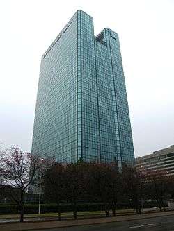
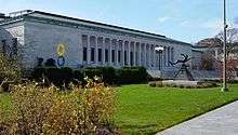
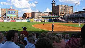
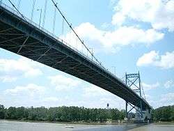
Images, from top left to right: Downtown Toledo, University Hall, Toledo Museum of Art, Lucas County Courthouse, Tony Packo's Cafe, Anthony Wayne Bridge, Fifth Third Field | |||
| |||
| Nickname(s): The Glass City; T-Town; Frogtown | |||
| Motto: "Laborare est Orare" | |||
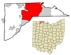 Location of Toledo within Lucas County, Ohio | |||
 Toledo, Ohio Location in the United States | |||
| Coordinates: 41°39′56″N 83°34′31″W / 41.66556°N 83.57528°WCoordinates: 41°39′56″N 83°34′31″W / 41.66556°N 83.57528°W | |||
| Country | United States | ||
| State | Ohio | ||
| County | Lucas | ||
| Founded | 1833 | ||
| Government | |||
| • Mayor | Paula Hicks-Hudson (D)[1] | ||
| Area[2] | |||
| • City | 84.12 sq mi (217.87 km2) | ||
| • Land | 80.69 sq mi (208.99 km2) | ||
| • Water | 3.43 sq mi (8.88 km2) | ||
| Elevation | 614 ft (187 m) | ||
| Population (2010)[3] | |||
| • City | 287,208 | ||
| • Estimate (2015)[4] | 279,789 | ||
| • Rank | US: 71st | ||
| • Density | 3,559/sq mi (1,374.3/km2) | ||
| • Urban | 507,643 (US: 80th) | ||
| • Metro | 608,145 (US: 89th) | ||
| • Demonym | Toledoan | ||
| Time zone | EST (UTC−5) | ||
| • Summer (DST) | EDT (UTC−4) | ||
| ZIP codes |
Zip codes[5]
| ||
| Area code(s) | 419, 567 | ||
| FIPS code | 39-77000 | ||
| GNIS feature ID | 1067015[6] | ||
| Website |
www | ||


Toledo (/təˈliːdoʊ/) is a city in and the county seat of Lucas County, Ohio, United States.[7] Toledo is in northwest Ohio, at the western end of Lake Erie bordering the state of Michigan. The city was founded by United States citizens in 1833 on the west bank of the Maumee River, and originally incorporated as part of Monroe County, Michigan Territory. It was re-founded in 1837, after conclusion of the Toledo War, when it was incorporated in Ohio.
After construction of the Miami and Erie Canal, Toledo grew quickly; it also benefited from its position on the railway line between New York City and Chicago. It has since become a city with an art community, auto assembly businesses, education, healthcare, and local sports teams. The city's glass industry has earned it the nickname, "The Glass City".
The population of Toledo as of the 2010 Census was 287,208, making it the 71st-largest city in the United States. It is the fourth most populous city in the U.S. state of Ohio after Columbus, Cleveland, and Cincinnati. The Toledo metropolitan area had a 2010 population of 651,429, and was the sixth-largest metropolitan area in the state of Ohio, behind Cleveland, Columbus, Cincinnati, Dayton, and Akron.[8]
History
Varying cultures of indigenous peoples lived along the rivers and lakefront of what is now northwestern Ohio for thousands of years. When the city of Toledo was preparing to pave its streets, it surveyed "two prehistoric semicircular earthworks, presumably for stockades." One was at the intersection of Clayton and Oliver streets on the south bank of Swan Creek; the other was at the intersection of Fassett and Fort streets on the right bank of the Maumee River.[9] Such earthworks were typical of mound-building peoples.
This region was part of a larger area controlled by the historic tribes of the Wyandot and the people of the Council of Three Fires (Ojibwe, Potawatomie and Odawa). The first European to visit the area was Étienne Brûlé, a French-Canadian guide and explorer, in 1615.[10] The French established trading posts in the area by 1680 to take advantage of the lucrative fur trade. The Odawa moved from Manitoulin Island and the Bruce Peninsula at the invitation of the French, who established a trading post at Fort Detroit, about 60 miles to the north. They settled an area extending into northwest Ohio. By the early 18th century, the Odawa occupied areas along most of the Maumee River to its mouth. They served as middlemen between the French and tribes further to the west and north. The Wyandot occupied central Ohio, and the Shawnee and Lenape occupied the southern areas.[11][12]
United States period
The area was not settled by European-Americans until 1795 and after. After the conclusion of the American Revolutionary War, the regional tribes allied in the Western Confederacy, fighting a series of battles in what became known as the Northwest Indian War in an effort to repulse American settlers from the country west of the Appalachians and north of the Ohio River. They were finally defeated in 1794 at the Battle of Fallen Timbers. This loose affiliation of tribes included the Wyandot and Council of Three Fires. By a treaty in 1795, they ceded large areas of territory in Ohio to the United States, opening lands for European-American settlement.
According to Charles E. Slocum, the American military built Fort Industry at the mouth of the Maumee about 1805, but as a temporary stockade. No official reports support the 19th-century tradition of its earlier history there.[9]
The United States continued to work to extinguish land claims of Native Americans. In the Treaty of Detroit (1807), the above four tribes ceded a large land area to the United States of what became southeastern Michigan and northwestern Ohio, to the mouth of the Maumee River (where Toledo later developed). Reserves for the Odawa were set aside in northwestern Ohio for a limited period of time. The Native Americans signed the treaty at Detroit, Michigan on November 17, 1807, with William Hull, governor of the Michigan Territory and superintendent of Indian affairs, as the sole representative of the U.S.[13]
More European-American settlers entered the area over the next few years, but many fled during the War of 1812, when British forces raided the area with their Indian allies. Resettlement began around 1818 after a Cincinnati syndicate purchased a 974-acre (3.9 km2) tract at the mouth of Swan Creek and named it Port Lawrence, developing it as the modern downtown area of Toledo. Immediately to the north of that, another syndicate founded the town of Vistula, the historic north end.[10] These two towns physically bordered each other with Cherry Street dividing them. This is why present-day streets on the northeast side of Cherry Street run at a slightly different angle from those to the southwest of it.
19th century
In 1824 the Ohio state legislature authorized the construction of the Miami and Erie Canal and later its Wabash and Erie Canal extension in 1833. The canal's purpose was to connect the city of Cincinnati to Lake Erie for water transportation to eastern markets, including to New York City via the Erie Canal and Hudson River. At that time no highways had been built in the state, and it was very difficult for goods produced locally to reach the larger markets east of the Appalachian Mountains. During the canal's planning phase, many small towns along the northern shores of Maumee River heavily competed to be the ending terminus of the canal, knowing it would give them a profitable status.[14] The towns of Port Lawrence and Vistula merged in 1833 to better compete against the upriver towns of Waterville, Maumee, and Manhattan.
The inhabitants of this joined settlement chose the name Toledo,
"but the reason for this choice is buried in a welter of legends. One recounts that Washington Irving, who was traveling in Spain at the time, suggested the name to his brother, a local resident; this explanation ignores the fact that Irving returned to the United States in 1832. Others award the honor to Two Stickney, son of the major who quaintly numbered his sons and named his daughters after States. The most popular version attributes the naming to Willard J. Daniels, a merchant, who reportedly suggested Toledo because it 'is easy to pronounce, is pleasant in sound, and there is no other city of that name on the American continent.'"[10]
Despite Toledo's efforts, the canal built the final terminus in Manhattan, one-half mile (800 m) to the north of Toledo, because it was closer to Lake Erie. As a compromise, the state placed two sidecuts before the terminus, one in Toledo at Swan Creek and another in Maumee, about 10 miles to the southwest.
Among the numerous treaties made between the Ottawa and the United States were two signed in this area: at Miami (Maumee) Bay in 1831 and Maumee, Ohio, upriver of Toledo, in 1833.[15] These actions were among US purchases or exchanges of land in order to accomplish Indian Removal of the Ottawa from areas wanted for European-American settlement. The last of the Odawa did not leave this area until 1839, when Ottokee, grandson of Pontiac, led his band from their village at the mouth of the Maumee River to Indian Territory in Kansas.[16][17]
An almost bloodless conflict between Ohio and the Michigan Territory, called the Toledo War (1835–1836), was "fought" over a narrow strip of land from the Indiana border to Lake Erie, now containing the city and the suburbs of Sylvania and Oregon, Ohio. The strip—which varied between five and eight miles (13 km) in width—was claimed by both the state of Ohio and the Michigan Territory due to conflicting legislation concerning the location of the Ohio-Michigan state line. Militias from both states were sent to the border but never engaged. The only casualty of the conflict was a Michigan deputy sheriff—stabbed in the leg with a pen knife by Two Stickney during the arrest of his elder brother, One Stickney—and the loss of two horses, two pigs and a few chickens stolen from an Ohio farm by lost members of the Michigan militia. In the end, the state of Ohio was awarded the land after the state of Michigan was given a larger portion of the Upper Peninsula in exchange. Stickney Avenue in Toledo is named for brothers One and Two Stickney.[18]
Toledo was very slow to expand during its first two decades of settlement. The first lot was sold in the Port Lawrence section of the city in 1833. It held 1,205 persons in 1835, and five years later it had gained just seven more persons. Settlers came and went quickly through Toledo and between 1833 and 1836, ownership of land had changed so many times that none of the original parties remained in the town. The canal and its Toledo sidecut entrance were completed in 1843. Soon after the canal was functional, the new canal boats had become too large to use the shallow waters at the terminus in Manhattan. More boats began using the Swan Creek sidecut than its official terminus, quickly putting the Manhattan warehouses out of business and triggering a rush to move business to Toledo. Most of Manhattan's residents moved out by 1844.
The 1850 census recorded Toledo as having 3,829 residents and Manhattan 541. The 1860 census shows Toledo with a population of 13,768 and Manhattan with 788. While the towns were only a mile apart, Toledo grew by 359% in ten years. Manhattan's growth was on a small base and never competed, given the drawbacks of its lesser canal outlet. By the 1880s, Toledo expanded over the vacant streets of Manhattan and Tremainsville, a small town to the west.[14][19]
In the last half of the 19th century, railroads slowly began to replace canals as the major form of transportation. They were faster and had greater capacity. Toledo soon became a hub for several railroad companies and a hotspot for industries such as furniture producers, carriage makers, breweries, glass manufacturers, and others. Large immigrant populations came to the area, attracted by the many factory jobs available and the city's easy accessibility. By 1880, Toledo was one of the largest cities in Ohio and it added significant infrastructure from its thriving economy.

20th century to present
Toledo continued to expand in population and industry into the early 20th century. Because of its dependence on manufacturing, the city was hit hard by the Great Depression. Many large-scale WPA projects were constructed to reemploy citizens in the 1930s. Some of these include the amphitheater and aquarium at the Toledo Zoo and a major expansion to the Toledo Museum of Art.
In 1940, the Census Bureau reported Toledo's population as 94.8% white and 5.2% black.[20] The city rebounded, but the slump of American manufacturing in the second half of the 20th century during industrial restructuring cost many jobs. In addition, suburbanization and highway development drew more established, middle-class people out of center cities for newer housing.
By the time of the 1980s, Toledo had a depressed economy. The destruction of many buildings downtown, along with several failed business ventures in housing in the core, led to a reverse city-suburb wealth problem common in small cities with land to spare.
In recent years, Downtown Toledo has supported significant redevelopment to draw residents back to the city. Fifth Third Field opened in 2002, and is ranked as one of the top minor-league baseball stadiums and a popular family destination. The multi-purpose Huntington Center opened in 2009. It hosts the Toledo Walleye ECHL ice hockey team,[21] and the Toledo Crush of the Legends Football League.[22] It also is the site of live performances of musicians and bands, and World Wrestling Entertainment.
Geography
Toledo is located at 41°39′56″N 83°34′31″W / 41.66556°N 83.57528°W (41.665682, −83.575337).[23] The city has a total area of 84.12 square miles (217.87 km2), of which 80.69 square miles (208.99 km2) is land and 3.43 square miles (8.88 km2) is water.[2]
The city straddles the Maumee River at its mouth at the southern end of Maumee Bay, the westernmost inlet of Lake Erie. The city is located north of what had been the Great Black Swamp, giving rise to another nickname, Frog Town. Toledo sits within the borders of a sandy oak savanna called the Oak Openings Region, an important ecological site that once comprised more than 300 square miles (780 km2).[24]
Toledo is located within approximately four hours' driving time of many large cities, including Detroit, Cleveland, Columbus, Dayton, Cincinnati, Pittsburgh, Indianapolis and Chicago.
Cityscape

Neighborhoods and suburbs
The Old West End is a historic neighborhood of Victorian, Arts & Crafts, and other Edwardian-style houses. The historic district is listed on the National Register of Historic Places.
- Beverly
- Birmingham
- DeVeaux
- Crossgates
- Five Points
- Downtown
- East Toledo
- Franklin Park
- Garfield
- Harvard Terrace
- Library Village
- North Towne
- Old Orchard
- Old West End
- Old South End
- Old Town
- ONE Village (includes the Polish International Village, Vistula, & North River)
- ONYX (includes historic Kuschwantz and Lenk's Hill neighborhoods)
- Ottawa
- Point Place
- Reynolds Corners
- Roosevelt
- Scott Park
- Secor Gardens(includes the University of Toledo)
- Southwyck
- Wernert's Corner
- Trilby
- University Hills
- Uptown
- Warehouse District
- Warren Sherman
- Westgate
- Westmoreland
According to the US Census Bureau, the Toledo Metropolitan Area covers four Ohio counties and combines with other micropolitan areas and counties for a combined statistical area. Some of what are now considered its suburbs in Ohio include: Bowling Green, Holland, Lake Township, Maumee, Millbury, Monclova Township, Northwood, Oregon, Ottawa Hills, Perrysburg, Rossford, Springfield Township, Sylvania, Walbridge, Waterville, Whitehouse, and Washington Township.
Climate
Toledo, as with much of the Great Lakes region, has a humid continental climate (Köppen Dfa), characterized by four distinct seasons. Both temperature and precipitation vary widely seasonally. Lake Erie moderates the climate somewhat, especially in late spring and fall, when air and water temperature differences are maximal. However, this effect is lessened in the winter by the fact that Lake Erie freezes over in most winters (unlike the other Great Lakes), coupled with prevailing winds that are often westerly. During the summer, southerly and westerly prevailing winds, combined with warm surface waters of Lake Erie, negate the lake's cooling effect. In addition, the lake increases local humidity, adding to discomfort on hot days.
Summers are very warm and humid, with July averaging 73.5 °F (23.1 °C) and temperatures of 90 °F (32 °C) or more seen on 16.5 days.[25] Winters are cold and somewhat snowy, with a January mean temperature of 25.5 °F (−3.6 °C), and lows at or below 0 °F (−18 °C) on 6.2 nights.[25] The spring and summer months tend to be wetter than autumn and winter. About 37 inches (94 cm) of snow falls per year, much less than the Snow Belt cities, because of the prevailing wind direction. Temperature extremes have ranged from −20 °F (−29 °C) on January 21, 1984 to 105 °F (41 °C) on July 14, 1936.
| Climate data for Toledo, Ohio (Toledo Express Airport), 1981−2010 normals,[lower-alpha 1] extremes 1871−present[lower-alpha 2] | |||||||||||||
|---|---|---|---|---|---|---|---|---|---|---|---|---|---|
| Month | Jan | Feb | Mar | Apr | May | Jun | Jul | Aug | Sep | Oct | Nov | Dec | Year |
| Record high °F (°C) | 71 (22) |
71 (22) |
85 (29) |
89 (32) |
96 (36) |
104 (40) |
105 (41) |
103 (39) |
100 (38) |
92 (33) |
80 (27) |
70 (21) |
105 (41) |
| Mean maximum °F (°C) | 53.1 (11.7) |
56.9 (13.8) |
71.5 (21.9) |
81.2 (27.3) |
87.0 (30.6) |
93.4 (34.1) |
94.3 (34.6) |
92.2 (33.4) |
89.4 (31.9) |
80.9 (27.2) |
68.8 (20.4) |
55.9 (13.3) |
95.8 (35.4) |
| Average high °F (°C) | 32.6 (0.3) |
36.0 (2.2) |
46.9 (8.3) |
60.1 (15.6) |
71.0 (21.7) |
80.7 (27.1) |
84.5 (29.2) |
82.2 (27.9) |
75.4 (24.1) |
62.8 (17.1) |
49.7 (9.8) |
36.4 (2.4) |
60.0 (15.6) |
| Average low °F (°C) | 18.4 (−7.6) |
20.6 (−6.3) |
28.3 (−2.1) |
38.7 (3.7) |
48.5 (9.2) |
58.3 (14.6) |
62.4 (16.9) |
60.9 (16.1) |
52.8 (11.6) |
41.8 (5.4) |
33.2 (0.7) |
23.1 (−4.9) |
40.7 (4.8) |
| Mean minimum °F (°C) | −2.8 (−19.3) |
1.6 (−16.9) |
9.7 (−12.4) |
23.1 (−4.9) |
34.4 (1.3) |
43.7 (6.5) |
49.8 (9.9) |
48.3 (9.1) |
37.3 (2.9) |
27.2 (−2.7) |
17.9 (−7.8) |
2.7 (−16.3) |
−7 (−22) |
| Record low °F (°C) | −20 (−29) |
−19 (−28) |
−10 (−23) |
8 (−13) |
25 (−4) |
32 (0) |
40 (4) |
34 (1) |
26 (−3) |
15 (−9) |
2 (−17) |
−19 (−28) |
−20 (−29) |
| Average precipitation inches (mm) | 2.05 (52.1) |
2.07 (52.6) |
2.48 (63) |
3.19 (81) |
3.58 (90.9) |
3.57 (90.7) |
3.23 (82) |
3.15 (80) |
2.78 (70.6) |
2.60 (66) |
2.86 (72.6) |
2.68 (68.1) |
34.24 (869.7) |
| Average snowfall inches (cm) | 11.6 (29.5) |
9.4 (23.9) |
5.7 (14.5) |
1.3 (3.3) |
0.1 (0.3) |
0 (0) |
0 (0) |
0 (0) |
0 (0) |
0.2 (0.5) |
1.9 (4.8) |
7.4 (18.8) |
37.6 (95.5) |
| Average precipitation days (≥ 0.01 in) | 12.7 | 10.2 | 11.8 | 12.0 | 12.0 | 10.2 | 9.8 | 9.2 | 9.7 | 10.0 | 11.4 | 13.1 | 132.1 |
| Average snowy days (≥ 0.1 in) | 9.3 | 7.3 | 4.9 | 1.4 | 0.1 | 0 | 0 | 0 | 0 | 0.2 | 2.3 | 7.9 | 33.4 |
| Average relative humidity (%) | 74.2 | 72.9 | 70.5 | 66.2 | 66.3 | 69.0 | 71.8 | 75.6 | 76.2 | 72.5 | 75.6 | 78.6 | 72.4 |
| Mean monthly sunshine hours | 126.0 | 142.2 | 183.7 | 213.7 | 265.9 | 288.2 | 299.3 | 263.7 | 220.3 | 180.4 | 106.5 | 90.2 | 2,380.1 |
| Percent possible sunshine | 43 | 48 | 50 | 53 | 59 | 63 | 65 | 62 | 59 | 52 | 36 | 32 | 53 |
| Source: NOAA (relative humidity and sun 1961−1990)[26][25][27][28] | |||||||||||||
Demographics
| Historical population | |||
|---|---|---|---|
| Census | Pop. | %± | |
| 1840 | 1,222 | — | |
| 1850 | 3,829 | 213.3% | |
| 1860 | 13,768 | 259.6% | |
| 1870 | 31,584 | 129.4% | |
| 1880 | 50,137 | 58.7% | |
| 1890 | 81,434 | 62.4% | |
| 1900 | 131,822 | 61.9% | |
| 1910 | 168,497 | 27.8% | |
| 1920 | 243,164 | 44.3% | |
| 1930 | 290,718 | 19.6% | |
| 1940 | 282,349 | −2.9% | |
| 1950 | 303,616 | 7.5% | |
| 1960 | 318,003 | 4.7% | |
| 1970 | 383,818 | 20.7% | |
| 1980 | 354,635 | −7.6% | |
| 1990 | 332,943 | −6.1% | |
| 2000 | 313,619 | −5.8% | |
| 2010 | 287,208 | −8.4% | |
| Est. 2015 | 279,789 | [29] | −2.6% |
| U.S. Decennial Census[30] | |||
| Racial composition | 2010[31] | 1990[20] | 1970[20] | 1940[20] |
|---|---|---|---|---|
| White | 64.8% | 77.0% | 85.7% | 94.8% |
| —Non-Hispanic | 61.4% | 75.1% | 84.0%[32] | n/a |
| Black or African American | 27.2% | 19.7% | 13.8% | 5.2% |
| Hispanic or Latino (of any race) | 7.4% | 4.0% | 1.9%[32] | n/a |
| Asian | 1.1% | 1.0% | 0.2% | − |
As of the 2010 census, the city proper had a population of 287,128. It is the principal city in the Toledo Metropolitan Statistical Area which had a population of 651,429, while the larger Toledo-Fremont Combined Statistical Area had a population of 712,373. According to the Toledo Metropolitan Council of Governments, the Toledo/Northwest Ohio region of 10 counties has over 1 million residents.
The U.S. Census Bureau estimated Toledo's population as 297,806 in 2006 and 295,029 in 2007. In response to an appeal by the City of Toledo, the Census Bureau's July 2007 estimate was revised to 316,851, slightly more than in 2000,[33] which would have been the city's first population gain in 40 years. However, the 2010 census figures released in March 2011 showed the population as of April 1, 2010, at 287,208, indicating a 25% loss of population since its zenith in 1970.
2010 census
| Largest ancestries (2010) | Percent |
|---|---|
| German | 26.3% |
| Irish | 11.9% |
| Polish | 8.7% |
| English | 6.5% |
| American | 3.4% |
As of the census[3] of 2010, there were 287,208 people, 119,730 households, and 68,364 families residing in the city. The population density was 3,559.4 inhabitants per square mile (1,374.3/km2). There were 138,039 housing units at an average density of 1,710.7 per square mile (660.5/km2). The racial makeup of the city was 64.8% White, 27.2% African American, 0.4% Native American, 1.1% Asian, 2.6% from other races, and 3.9% from two or more races. Hispanic or Latino of any race were 7.4% of the population (The majority are Mexican American at 5.1%.) Non-Hispanic Whites were 61.4% of the population in 2010,[34] down from 84% in 1970.[20]
There were 119,730 households of which 30.4% had children under the age of 18 living with them, 31.6% were married couples living together, 19.9% had a female householder with no husband present, 5.7% had a male householder with no wife present, and 42.9% were non-families. 34.8% of all households were made up of individuals and 10.7% had someone living alone who was 65 years of age or older. The average household size was 2.33 and the average family size was 3.01. There was a total of 139,871 housing units in the city, of which 10,946 (9.8%) were vacant.
The median age in the city was 34.2 years. 24% of residents were under the age of 18; 12.8% were between the ages of 18 and 24; 26.3% were from 25 to 44; 24.8% were from 45 to 64; and 12.1% were 65 years of age or older. The gender makeup of the city was 48.4% male and 51.6% female.
2000 census
| Largest ancestries (2000) | Percent |
|---|---|
| German | 23.4% |
| Irish | 10.8% |
| Polish | 10.1% |
| English | 6.0% |
| American | 3.9% |
As of the census of 2000, there were 313,619 people, and 77,355 families residing in the city. The population density was 3,890.2 people per square mile (1,502.0/km²). There were 139,871 housing units at an average density of 1,734.9 per square mile (669.9/km²). The racial makeup of the city was 70.2% White, 23.5% African American, 0.3% Native American,1.0% Asian, 0.0% Pacific Islander, 2.3% from other races, and 2.6% from two or more races. Hispanic or Latino of any race were 5.5% of the population in 2000. The most common ancestries cited were German (23.4%), Irish (10.8%), Polish (10.1%), English (6.0%), American (3.9%), Italian (3.0%), Hungarian, (2.0%), Dutch (1.4%), and Arab (1.2%).[35]
In 2000 there were 128,925 households in Toledo, out of which 29.8% had children under the age of 18 living with them, 38.2% were married couples living together, 17.2% had a female householder with no husband present, and 40.0% were non-families. 32.8% of all households were made up of individuals and 11.0% had someone living alone who was 65 years of age or older. The average household size was 2.38 and the average family size was 3.04.
In the city the population was spread out with 26.2% under the age of 18, 11.0% from 18 to 24, 29.8% from 25 to 44, 19.8% from 45 to 64, and 13.1% who were 65 years of age or older. The median age was 33 years. For every 100 females there were 97.9 males. For every 100 females age 18 and over, there were 97.7 males.
The median income for a household in the city was $32,546, and the median income for a family was $41,175. Males had a median income of $35,407 versus $25,023 for females. The per capita income for the city was $17,388. About 14.2% of families and 17.9% of the population were below the poverty line, including 25.9% of those under age 18 and 10.4% of those age 65 or over.
Crime
In 2013, the city was ranked 89 of the Top 100 Most Dangerous Cities in America.[36]
In the second decade of the 21st century, the city had a gradual peak in violent crime. In 2010, there was a combined total of 3,272 burglaries, 511 robberies, 753 aggravated assaults, 25 homicides, as well as 574 motor vehicle thefts out of what was then a decreasing population of 287,208.[37] In 2011, there were 1,562 aggravated assaults, 30 murders, 1,152 robberies, 8,366 burglaries, and 1,465 cases of motor vehicle theft. In 2012, there were a combined total of 39 murders, 2,015 aggravated assaults, 6,739 burglaries, and 1,334 cases of motor vehicle theft. In 2013 it had a drop in the crime rate.[38] According to a state government task force, Toledo has been identified as the fourth-largest recruitment site for human trafficking in the US.[39]
Economy

Before the industrial revolution, Toledo was important as a port city on the Great Lakes. With the advent of the automobile, the city became best known for industrial manufacturing. Both General Motors and Chrysler had factories in metropolitan Toledo, and automobile manufacturing has been important at least since Kirk,[40] which began operations early in the 20th century. The largest employer in Toledo was Jeep for much of the 20th century. Since the late 20th century, industrial restructuring reduced the number of these well-paying jobs.
The University of Toledo is influential in the city, contributing to the prominence of healthcare as the city's biggest employer. The metro area contains four Fortune 500 companies: Dana Holding Corporation, Owens Corning, The Andersons, and Owens Illinois. HCR Manor Care is a Fortune 1000 company headquartered in Toledo. One SeaGate is the location of Fifth-Third Bank's Northwest Ohio headquarters.
Glass industry
Toledo is known as the Glass City because of its long history of glass manufacturing, including windows, bottles, windshields, construction materials, and glass art, of which the Toledo Museum of Art has a large collection. Several large glass companies have their origins here. Owens-Illinois, Owens Corning, Libbey Glass, Pilkington North America (formerly Libbey Owens Ford), and Therma-Tru have long been a staple of Toledo's economy. Other offshoots and spinoffs of these companies also continue to play important roles in Toledo's economy. Fiberglass giant Johns Manville's two plants in the metro area were originally built by a subsidiary of Libbey Owens Ford.
Automotive industry
Several large, Fortune 500 automotive-related companies had their headquarters in Toledo, including Electric AutoLite, Sheller-Globe Corporation, Champion Spark Plug, Questor, and Dana Holding Corporation. Faurecia Exhaust Systems, which is a $2 billion subsidiary to France's Faurecia SA, is located in Toledo. Only Dana Holding Corporation still operates as an independent entity. Toledo is the Jeep headquarters and has two production facilities, Toledo Complex, one in the city and one in suburban Perrysburg. During World War II the city's economy boomed as its industries produced important products for the war effort, particularly the Willys Jeep.[41] Willys-Overland was a major automaker headquartered in Toledo until 1953.
The many changes in industrial restructuring and loss of jobs caused the city to adopt new strategies related to retaining its industrial companies. It offered tax incentives to DaimlerChrysler for the expansion of its Jeep plant. In 2001, a taxpayer lawsuit was filed against Toledo that challenged the constitutionality of that action. In 2006 the city won the case by a unanimous ruling by the U.S. Supreme Court in DaimlerChrysler Corp. v. Cuno.
Green industry
Although Toledo has a "rust belt" reputation because of its manufacturing history, in the 2000s, the city received significant interest and growth in "green jobs" due to economic development related to solar energy. The University of Toledo and Bowling Green State University received Ohio grants for solar energy research.[42] Xunlight and First Solar opened plants in Toledo and the surrounding area.[43]
Arts and culture
Fine art
The Stranahan Theater is a concert hall located on the city's south side. The Toledo Opera has been presenting grand opera in the city since 1959. Its home is the historic Valentine Theatre Downtown. The Toledo Repertoire Theatre was created in 1933 and performs both Broadway hits and lesser-known original works. The Collingwood Arts Center is housed in a 1905 building designed by architect E. O. Fallis in the "Flemish Gothic" style. The parlor is used to showcase art exhibitions while the second and third floor rooms are rented to local artists.
The Toledo Museum of Art is located in a Greek Revival building. The Peristyle is the concert hall in Greek Revival style in its East Wing; it is the home of the Toledo Symphony Orchestra, and hosts many international orchestras as well. The Museum's Center for Visual Arts addition was designed by Frank Gehry and opened in the 21st century. In addition, the museum's new Glass Pavilion across Monroe Street opened in August 2006. Toledo was the first city in Ohio to adopt a One Percent for Art program and, as such, boasts many examples of public, outdoor art.[44] A number of walking tours have been set up to explore these works, which include large sculptures, environmental structures, and murals by more than 40 artists, such as Alice Adams, Pierre Clerk, Dale Eldred, Penelope Jencks, Hans Van De Bovenkamp, Jerry Peart, and Athena Tacha.[45] The Ballet Theatre of Toledo provides an opportunity for area students to study ballet and perform their art.[46]
In popular culture
John Denver recorded "Saturday Night In Toledo, Ohio," composed by Randy Sparks. He wrote it in 1967 after arriving in Toledo with his group and finding no nightlife at 10 p.m.[47] After Denver performed the song on The Tonight Show, Toledo residents objected. In response, the City Fathers recorded a song entitled "We're Strong For Toledo". Ultimately the controversy was such that John Denver cancelled a concert in Toledo shortly thereafter. But when he returned for a 1980 concert, he set a one-show attendance record at the venue, Centennial Hall, and sang the song to the approval of the crowd.[48]
Toledo is the hometown of Corporal Maxwell Klinger in the long-running 1970s television series M*A*S*H. Actor Jamie Farr was from there, and writers gave his character the same home town, with frequent lines about the city during various episodes.
Toledo is also featured as the hometown of the main protagonist, Captain Benjamin L. Willard, played by Martin Sheen in the Vietnam War film Apocalypse Now. In one scene with Colonel Walter E. Kurtz, played by Marlon Brando, he discusses his hometown.
Jane Wyman's character, Helen St. John, is noted as being from Toledo in the Oscar-winning Best Picture of 1945,The Lost Weekend. In the film, her parents come from Toledo to New York to visit Helen and meet her boyfriend Don Birnam (Ray Milland), who spends the weekend drinking.
The Kenny Rogers 1977 hit song "Lucille" was written by Hal Bynum and inspired by his trip to Toledo in 1975.[49]
Toledo is mentioned in the song "Our Song" by Yes from their 1983 album 90125. According to Yes drummer Alan White, Toledo was especially memorable for a sweltering-hot 1977 show the group did at Toledo Sports Arena.[50]
The season 1 episode of the Warner Bros television series Supernatural "Bloody Mary" was set in Toledo.[51]
Toledo is the setting for the 2010 television comedy Melissa & Joey, with the first-named character being a city councilwoman.[52]
Sports

- Auto Racing – Toledo Speedway is a local auto racetrack that features, among other events, stock car racing and concerts. The Automobile Racing Club of America (ARCA) has its headquarters in Toledo.
- Baseball – The Toledo Mud Hens are one of minor league baseball's oldest teams, having first played in 1896. They play at Fifth Third Field which was completed in 2002. They have won one American Association title and three IL titles. The Mud Hens are the AAA affiliate of the MLB Detroit Tigers.
- Golf – Inverness Club is a golf club in Toledo. It is known for hosting six major USGA events, most recently the 1993 PGA Championship. The U.S. Senior Open took place there in 2003 and 2011. Highland Meadows Golf Club has been home to the LPGA's Marathon Classic in the nearby suburb of Sylvania since 1984 (yearly except for 1986 and 2011).
- Hockey – The Toledo Walleye are an ECHL hockey team that began play at the Huntington Center in 2009. The Walleye are an affiliate of the Grand Rapids Griffins of the American Hockey League, and the Detroit Red Wings of the NHL. Toledo has a rich history of pro hockey, which includes 11 championships between four teams in the International Hockey League and ECHL.
- Football – The Toledo Reign are a women's full-contact tackle football team in the Women's Football Alliance. Established in 2003, the Reign plays regular season games from April through June. The inactive Toledo Crush of the Legends Football League played at the Huntington Center in 2014. The team had relocated from Cleveland, where it played from 2011 to 2013.[53] The Toledo Maroons played in the Ohio League from 1902 until 1921 and the NFL from 1922 until 1923 before moving to Kenosha, Wisconsin.[54]
- Roller Derby – The Glass City Rollers is a full member of the Women's Flat Track Derby Association. The league was formed in 2007 and became a full member of the WFTDA in 2012. Their bouts are held at the International Boxing Club in the suburb of Oregon.
- Soccer – Toledo United FC is a semi-pro soccer team that started in 2016. They currently play in the Premier League of America (PLA). In their inaugural season "The Pheonix" took 3rd place in the league and won the PLA Eastern Championship.
Parks and recreation

- The Toledo Zoo was the first zoo to feature a hippoquarium-style exhibit. In 2014 it was ranked as the #1 zoo in the country by USA Today.[55]
- The National Museum of the Great Lakes (NMGL) is located in the Marina District, downstream from downtown Toledo.[56]
- Adjacent to the NMGL, the Col. James M. Schoonmaker is a former Cleveland-Cliffs lake freighter open to the public as a museum. Moored in the Maumee River, the ship was recently repainted in the original Shenango Furnace fleet colors and, on 1 July 2011, rechristened with her original name.[56]
- The R. A. Stranahan Arboretum is a 47-acre (190,000 m2) arboretum maintained by the University of Toledo.
- Tony Packo's Cafe is located in the Hungarian neighborhood on the east side of Toledo known as Birmingham; it features hundreds of hot dog buns signed by celebrities.[57]
- The Toledo Metroparks system includes over 10,000 acres (40 km2) of land, and features the University/Parks Bicycle Trail and the Toledo Botanical Garden.
- On January 15, 1936, the first building to be completely covered in glass was constructed in Toledo. It was a building for the Owens-Illinois Glass Company and marked a milestone in architectural design representative of the International style of architecture, which was at that time becoming increasingly popular in the US.
- The Imagination Station hands-on science museum (formerly COSI Toledo), is located in downtown.
- The Toledo Lucas County Public Library was 4-star rated for 2009 by the Library Journal, and it is sixth among the biggest-spending libraries in the United States.[58]
- Toledo has the University Bike and Walking Trail, which is 6.3 miles (10.1 km). This trail goes northwest from The University of Toledo to Sylvania, Ohio.[59]
- Hollywood Casino Toledo opened on May 29, 2012.
Education
Colleges and universities
These higher education institutions operate campuses in Toledo:
- The University of Toledo[60]
- University of Toledo Medical Center[60]
- Davis College[60]
- Mercy College of Ohio[60]
- Owens Community College (Perrysburg Township)
- Lincoln College of Technology
- Toledo Academy of Beauty
- Toledo Professional Skills Institute[60]
- Herzing University
- Tiffin University (Toledo Campus)
Primary and secondary schools
Toledo Public Schools operates public schools within much of the city limits, along with the Washington Local School District in northern Toledo. Toledo is also home to several public charter schools including two Imagine Schools. Additionally, several private and parochial primary and secondary schools are present within the Toledo area. The Roman Catholic Diocese of Toledo operates Roman Catholic primary and secondary schools. Private high schools in Toledo include Maumee Valley Country Day School, Central Catholic High School, St. Francis de Sales High School, St. John's Jesuit High School and Academy, Notre Dame Academy, St. Ursula Academy (Ottawa Hills), Cardinal Stritch Catholic High School (Oregon), the Toledo Islamic Academy, Freedom Christian Academy, Toledo Christian Schools, Emmanuel Christian, the David S. Stone Hebrew Academy (Sylvania), Monclova Christian Academy, and Apostolic Christian Academy.
Media
The eleven-county Northwest Ohio/Toledo/Fremont media market includes over 1 million residents. The Blade, a daily newspaper founded in 1835, is the primary newspaper in Toledo. The front page claims that it is "One of America's Great Newspapers." The city's arts and entertainment weekly is the Toledo City Paper. In March 2005, the weekly newspaper Toledo Free Press began publication, and it has a focus on news and sports. Other weeklies include the West Toledo Herald, El Tiempo, La Prensa, Sojourner's Truth, and Toledo Journal. Toledo Tales provides satire and parody of life in the Glass City. The Toledo Journal is an African-American owned newspaper. It is published weekly, and normally focuses on African-American issues.
Nine television stations are in Toledo. They are: 5 (Cable Only) WT05 – CW, 11 WTOL – CBS, 13 WTVG – ABC, 24 WNWO-TV – NBC, 30 WGTE-TV – PBS, 36 WUPW – Fox, 38 W38DH – HSN, 40 WLMB – FN, and 48 (Over-the-air Only) and 58 (Cable Only, per the "My 58" moniker) WMNT-CD – My Network TV. 27 WBGU - PBS in Bowling Green is also viewable. Toledoans can also watch the adjacent Detroit and Ann Arbor market stations, both over-the air and on cable. There are also fourteen radio stations licensed in Toledo.
Infrastructure
Transportation
Major highways

Three major interstate highways run through Toledo. Interstate 75 (I-75) travels north-south and provides a direct route to Detroit and Cincinnati. The Ohio Turnpike carries east-west traffic on I-80/90. The Turnpike serves Toledo via exits 52, 59, 64, 71, and 81. The Turnpike connects Toledo to Chicago in the west and Cleveland in the east.
In addition, there are two auxiliary interstate highways in the area. Interstate 475 is a 20-mile bypass that begins in Perrysburg and ends in west Toledo, meeting I-75 at both ends. It is cosigned with US 23 for its first 13 miles. Interstate 280 is a spur that connects the Ohio Turnpike to I-75 through east and central Toledo. The Veterans' Glass City Skyway is part of this route, which was the most expensive ODOT project ever at its completion. This 400-foot (120 m) tall bridge includes a glass covered pylon, which lights up at night, adding a distinctive feature to Toledo's skyline.[61] The Anthony Wayne Bridge, a 3,215-foot (980 m) suspension bridge crossing the Maumee River, has been a staple of Toledo's skyline for more than 70 years. It is locally known as the "High-Level Bridge."
Mass transit
Local bus service is provided by the Toledo Area Regional Transit Authority; commonly shortened to TARTA. Toledo area Paratransit Services; TARPS are used for the disabled. Intercity bus service is provided by Greyhound Lines whose station is located at Martin Luther King, Jr. Plaza which it shares with Amtrak. Megabus also provides daily trips to Ann Arbor, Chicago, Cleveland, Detroit, and Pittsburgh. Toledo has various cab companies within its city limits and other ones that surround the metro.
Airports
Toledo Express Airport, located in the suburbs of Monclova and Swanton Townships, is the primary airport that serves the city. Additionally, Detroit Metropolitan Wayne County Airport is 45 miles north. Toledo Executive Airport (formerly Metcalf Field) is a general aviation airport southeast of Toledo near the I-280 and Ohio SR 795 interchange. Toledo Suburban Airport is another general aviation airport located in Lambertville, MI just north of the state border.
Rail transportation
Toledo had a streetcar system and interurban railways[62] linking it to other nearby towns but these are no longer in existence.
Amtrak, the national passenger rail system, provides service to Toledo and other major cities under the Capitol Limited and the Lake Shore Limited. Both lines stop at Martin Luther King, Jr. Plaza, which was built as Central Union Terminal by the New York Central Railroad—along its Water Level Route—in 1950. Of the seven Ohio stations served by Amtrak, Toledo was the busiest in fiscal year 2011, boarding or detraining 66,413 passengers.[63]
Freight rail service in Toledo is operated by the Norfolk Southern Railway, CSX Transportation, Canadian National Railway, Ann Arbor Railroad, and Wheeling and Lake Erie Railway. All except the Wheeling have local terminals; the Wheeling operates into Toledo from the east through trackage rights on Norfolk Southern to connect with the Ann Arbor and CN railroads.
Utilities
Water
The Division of Water Treatment filters an average of 80 million gallons of water per day for 500,000 people in the greater Toledo Metropolitan area.[64] The Division of Water Distribution serves 136,000 metered accounts and 10,000 fire hydrants and maintains more than 1,100 miles (1,800 km) of water mains.[65]
In August 2014, two samples from a water treatment plant toxin test showed signs of microcystis. Roughly 400,000, including residents of Toledo and several surrounding communities in Ohio and Michigan were affected by the water contamination. Residents were told not to use, drink, cook with, or boil any tap water on the evening of August 1, 2014.[66] The Ohio National Guard delivered water and food to residents living in contaminated areas. As of 3 August 2014, nobody had reported being sick and the governor had declared a state of emergency in three counties.[67][68] The ban was lifted on August 4.[69]
Notable people
Sister cities
Toledo linked with Toledo, Spain as sister cities in 1931, creating the first Sister Cities relationship in North America. In total Toledo has twelve sister cities, as designated by Sister Cities International (SCI):[70]
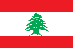 Beqaa Valley, Lebanon
 Coimbatore, India
 Csongrad County, Hungary
 Delmenhorst, Germany
 Hyderabad, Pakistan
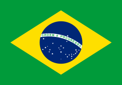 Londrina, Brazil
 Poznań, Poland[71]
 Qinhuangdao, Hebei, China
- Szeged, Hungary
 Tanga, Tanzania
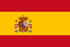 Toledo, Spain
 Toyohashi, Japan
See also
- Auto-Lite strike
- Baseball parks of Toledo, Ohio
- Glassmen Drum and Bugle Corps, Drum Corps International World Class Drum and Bugle Corps
- Greater Toledo
- Outbreak of green-blue algae in Lake Erie
- Roman Catholic Diocese of Toledo
- Toledo Area Regional Transit Authority, local bus transportation
- Toledo City League, high school sports league
Notes
- ↑ Mean monthly maxima and minima (i.e. the highest and lowest temperature readings during an entire month or year) calculated based on data at said location from 1981 to 2010.
- ↑ Official records for Toledo were kept at downtown from January 1871 to January 1943, Toledo Municipal Airport from February 1943 to December 1945, Metcalf Field from January 1946 to 11 January 1955, and at Toledo Express Airport since 12 January 1955. For more information, see ThreadEx.
References
- ↑ "Toledo Mayor D. Michael Collins taken off life support, dies at 70". Toledo Blade.
- 1 2 "US Gazetteer files 2010". United States Census Bureau. Retrieved January 6, 2013.
- 1 2 "American FactFinder". United States Census Bureau. Retrieved January 16, 2013.
- ↑ "US Census QuickFacts". United States Census Bureau. Retrieved 2014-12-02.
- ↑ "Zip Code Lookup". USPS. Retrieved December 2, 2014.
- ↑ "US Board on Geographic Names". United States Geological Survey. October 25, 2007. Retrieved 2008-01-31.
- ↑ "Find a County". National Association of Counties. Retrieved June 7, 2011.
- ↑ "Geographic Identifiers: 2010 Demographic Profile Data (G001): Toledo, OH Metro Area". U.S. Census Bureau, American Factfinder. Retrieved February 6, 2013.
- 1 2 Charles E. Slocum, "Forts Miami and Fort Industry", Ohio Archaeological and Historical Publications, Volume XII, 1903; hosted at American History and Genealogy Project, accessed 26 December 2015
- 1 2 3 Federal Writers' Project (1940). The Ohio Guide. US History Publishers. ISBN 9781603540346.
- ↑ Atlas of Great Lakes Indian History (University of Oklahoma Press: Norman, 1986) pp. 3, 58–59
- ↑ R. Douglas Hurt, The Ohio Frontier: Crucible of the Old Northwest, 1720–1830 (Indiana University Press: Bloomington, 1998), pp. 8–12
- ↑ "Treaty Between the Ottawa, Chippewa, Wyandot, and Potawatomi Indians". World Digital Library. 1807-11-17. Retrieved 2013-08-03.
- 1 2 Gieck, Jack (1988). A Photo Album of Ohio's Canal Era, 1825–1913. Kent: Kent State University Press. ISBN 9780873383530.
- ↑ "Handbook of American Indians North of Mexico: N-Z". Books.google.com. p. 167. Retrieved 2016-05-23.
- ↑ Helen Hornbeck Tanner, ed., Atlas of Great Lakes Indian History (University of Oklahoma Press: Norman, 1986) pp. 48-51
- ↑ Larry Angelo (2nd chief of the Ottawa Tribe of Oklahoma), The Migration of the Ottawas from 1615 to Present, (1997), pp. 3-6
- ↑ Mitchell, Gordon (June 2004). "History Corner: Ohio-Michigan Boundary War, Part 2". Professional Surveyor Magazine. Archived from the original on July 28, 2011. Retrieved August 3, 2014.
- ↑ Simonis, Louis A. (1979). Maumee River, 1835. Defiance: Defiance County Historical Society.
- 1 2 3 4 5 "Ohio - Race and Hispanic Origin for Selected Cities and Other Places: Earliest Census to 1990". U.S. Census Bureau. Retrieved April 30, 2012.
- ↑ Griffin, Jason (April 16, 2007). "Toledo Arena Sports, Inc. Acquire ECHL Hockey Team". Toledo Arena Sports, Inc. Retrieved March 27, 2008.
- ↑ "Archived copy". Archived from the original on July 7, 2014. Retrieved August 4, 2014.
- ↑ "US Gazetteer files: 2010, 2000, and 1990". United States Census Bureau. February 12, 2011. Retrieved April 23, 2011.
- ↑ "History of the Oak Openings Region". Green Ribbon Initiative. Archived from the original on February 21, 2010. Retrieved August 3, 2014.
- 1 2 3 "NowData - NOAA Online Weather Data". National Oceanic and Atmospheric Administration. Retrieved March 29, 2015.
- ↑ "Station Name: OH TOLEDO EXPRESS AP". National Oceanic and Atmospheric Administration. Retrieved March 31, 2014.
- ↑ "Thread Stations Extremes". National Oceanic and Atmospheric Administration. Retrieved February 27, 2011.
- ↑ "WMO Climate Normals for TOLEDO/EXPRESS, OH 1961–1990". National Oceanic and Atmospheric Administration. Retrieved March 10, 2014.
- ↑ "Annual Estimates of the Resident Population for Incorporated Places: April 1, 2010 to July 1, 2015". Retrieved July 2, 2016.
- ↑ United States Census Bureau. "Census of Population and Housing". Retrieved December 2, 2014.
- ↑ "State & County QuickFacts: Toledo (city), Ohio". U.S. Census Bureau. July 8, 2014. Retrieved August 3, 2014.
- 1 2 From 15% sample
- ↑ "Thousands added to Toledo census count". The Blade. Toledo. January 14, 2009. Retrieved February 14, 2009.
- ↑ "State & County QuickFacts: Toledo (city), Ohio". U.S. Census Bureau. Retrieved April 30, 2012.
- ↑ "QT-P13. Ancestry: 2000 - Toledo city, Ohio". United States Census Bureau. Archived from the original on June 6, 2011. Retrieved August 3, 2014.
- ↑ neighborhoodscout.com (registration required)
- ↑ "FBI — Table 4 Montana - Ohio". FBI.
- ↑ "Toledo's crime rate takes plunge". Toledo Blade.
- ↑ Ohio Human Trafficking Task Force: Recommendations to Governor John R. Kasich
- ↑ Clymer, Floyd (1950). Treasury of Early American Automobiles, 1877–1925. New York: Bonanza Books. p. 158.
- ↑ "Toledo, Ohio". Ohio History Central. July 1, 2005. Retrieved August 4, 2014.
- ↑ Ramsey, Duane (July 30, 2009). "State awards solar research grant to UT, BGSU". Toledo Free Press. Toledo. Retrieved August 4, 2014.
- ↑ Swicord, Jeff (July 28, 2009). "Old US Industrial Town Looking Forward to a Green Future". Voice of America. Washington, D.C. Archived from the original on August 25, 2009.
- ↑ Lane, Tahree; Smith, Ryan E. (January 20, 2008). "Public art effort expands as Toledo program takes on change in 30th year". The Blade. Toledo. Retrieved August 4, 2014.
- ↑ "Toledo Sculpture Tours" (PDF). Arts Commission of Greater Toledo. Retrieved August 4, 2014.
- ↑ "Ballet Theatre of Toledo". Destination Toledo. Retrieved August 4, 2014.
- ↑ Barhite, Brandi (December 26, 2008). "'Saturday Night In Toledo' author changes his tune". Toledo Free Press. Toledo. Retrieved August 4, 2014.
- ↑ "Saturday Night in Toledo, Ohio". Toledo History Box. August 9, 2011. Retrieved August 4, 2014.
- ↑ Reindl, J. C. (March 22, 2010). "Music fades, curtain closes on once-hot Toledo night spot". The Blade. Retrieved August 4, 2014.
- ↑ Kisiel, Ralph (March 1, 1984). "Sweltering Night Keeps City Fresh in the Memory of Yes". The Blade. p. 2. Retrieved November 7, 2010.
- ↑ "Supernatural: "Bloody Mary" Review - IGN". Au.ign.com. 2008-04-18. Retrieved 2016-05-23.
- ↑ Baird, Kirk (August 26, 2010). "TV series 'Melissa & Joey' is set in Toledo, but city lacks starring role". The Blade. Toledo. Retrieved August 4, 2014.
- ↑ Kent, Julie (December 17, 2013). "Cleveland Losing its Lingerie Sporting Football Team the Crush to Toledo". The Cleveland Leader. Retrieved August 4, 2014.
- ↑ Toledo Maroons Franchise Encyclopedia
- ↑ "Best US Zoo Winners: 2014 10Best Readers' Choice Travel Awards". 10Best.
- 1 2 "The Great Lakes Historical Society: Museum". The Great Lakes Historical Society. Retrieved April 7, 2015.
- ↑ "History of Tony Packo's: The Real Story". Tony Packo's. Retrieved August 4, 2014.
- ↑ Curry Lance, Keith; Lyons, Ray (November 15, 2009). "America's Star Libraries: Who's In, Who's Out". Library Journal. New York. Archived from the original on April 20, 2013. Retrieved August 4, 2014.
- ↑ "University/Parks Trail". Metroparks of the Toledo Area. Retrieved August 4, 2014.
- 1 2 3 4 5 "Colleges and Universities in Toledo, Ohio". MyCollegeOptions.org. Retrieved 23 February 2015.
- ↑ "Ohio DOT endorses design for Maumee River crossing". Civil Engineering. 70 (9): 12. September 2000. Retrieved August 4, 2014 – via Transportation Research Board.
- ↑ Patch, David (May 27, 2007). "Toledo was hub of interurban 100 years ago". The Blade. Toledo. Retrieved August 4, 2014.
- ↑ "Amtrak Fact Sheet, Fiscal Year 2011: State of Ohio" (PDF). Amtrak. December 2011. Retrieved August 4, 2014.
- ↑ "Division of Water Treatment". City of Toledo. Retrieved August 4, 2014.
- ↑ "Division of Water Distribution". City of Toledo. Retrieved August 4, 2014.
- ↑ Henry, Tom (August 3, 2014). "Water crisis grips hundreds of thousands in Toledo area, state of emergency declared". The Blade. Toledo. Retrieved August 4, 2014.
- ↑ Capelouto, Susanna; Morgenstein, Mark (August 3, 2014). "400,000 in Toledo, Ohio, water scare await test results". CNN. Retrieved August 3, 2014.
- ↑ Queally, James (August 2, 2014). "Toxic Ohio tap water tested as 500,000 residents wait". Los Angeles Times. Retrieved August 3, 2014.
- ↑ Karimi, Faith; Morgenstein, Mark (August 4, 2014). "'Our water is safe,' Toledo mayor says in lifting ban". CNN. Retrieved August 4, 2014.
- ↑ "Interactive City Directory". Sister Cities International. Retrieved March 11, 2014.
- ↑ "Poznań - Miasta partnerskie". 1998–2013 Urząd Miasta Poznania (in Polish). City of Poznań. Archived from the original on September 23, 2013. Retrieved December 11, 2013.
Further reading
- Bloom, Matthew (Spring 2010). "Symbiotic Growth in the Swamp: Toledo and Northwest Ohio, 1860–1900". Northwest Ohio History. 77 (2): 85–104.
External links
- Official website
- Greater Toledo Convention and Visitors Bureau
- Toledo, Ohio, 1876 from the World Digital Library

Municipalities and communities of Lucas County, Ohio, United States | ||
|---|---|---|
| Cities | 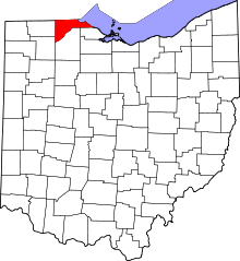 | |
| Villages | ||
| Townships | ||
| CDPs | ||
| Unincorporated communities |
| |
| Ghost town | ||
| Footnotes | ‡This populated place also has portions in an adjacent county or counties | |
Columbus (capital) | |
| Topics |
|
| Society | |
| Regions | |
| Metro areas | |
| Largest cities | |
| Counties |
|
| ||
| ||