Seoni district
| Seoni district सिवनी जिला | |
|---|---|
| District of Madhya Pradesh | |
 Location of Seoni district in Madhya Pradesh | |
| Country | India |
| State | Madhya Pradesh |
| Administrative division | Jabalpur |
| Headquarters | Seoni (Madhya Pradesh) |
| Government | |
| • Lok Sabha constituencies | Balaghat |
| Area | |
| • Total | 8,758 km2 (3,381 sq mi) |
| Population (2011) | |
| • Total | 1,378,876 |
| • Density | 160/km2 (410/sq mi) |
| Demographics | |
| • Literacy | 73.01 per cent |
| • Sex ratio | 984 |
| Average annual precipitation | 1384 mm |
| Website | Official website |
Seoni District is a district of Madhya Pradesh state in central India. The town of Seoni is the district headquarters.
Geography
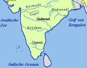
Seoni district forms part of the Satpura tableland, containing the headwaters of the Wainganga. It is largely covered with forest. The district is remarkable for the beauty of its scenery and the fertility of its valleys.[1]
The northern and western portions include the plateaus of Lakhnadon and Seoni; the eastern section consists of the watershed and elevated basin of the Wainganga; and in the south-west is a narrow strip of rocky land known as Dongartal. The plateaus of Seoni and Lakhnadon vary in height from 1,800 to 2,000 ft.; they are well cultivated and clear of jungle, and their temperature is always moderate and healthy.[1]
Geologically the north part of Seoni consists of trap hills and the south of crystalline rock. The soil of the plateaus is the rich black cotton soil formed by disintegrated trap, of which about two-thirds of the district are said to consist; but towards the south, where cliffs of gneiss and other primitive formations occur, the soil is siliceous and contains a large proportion of clay.[1]
The chief river is the Wainganga, with its affluents the Sagar, Theli, Bijna and Thanwar; other streams are the Timar and the Sher, tributaries of the Nerbudda. The annual rainfall averages 53 in. The principal crops are wheat, millets, rice, pulse, oil-seeds and cotton.[1]
It extends over an area of 8,758 km2.[2]
History
The district was formed on 1 November 1956. The name of the district originated from the word Seona (Gudina arborea), a species of tree commonly found in the area.[2]
Economy
In 2006 the Ministry of Panchayati Raj named Seoni one of the country's 250 most backward districts (out of a total of 640).[3] It is one of the 24 districts in Madhya Pradesh currently receiving funds from the Backward Regions Grant Fund Programme (BRGF).[3]
Demographics
According to the 2011 census Seoni District has a population of 1,378,876,[4] roughly equal to the nation of Swaziland[5] or the US state of Hawaii.[6] This gives it a ranking of 355th in India (out of a total of 640).[4] The district has a population density of 157 inhabitants per square kilometre (410/sq mi).[4] Its population growth rate over the decade 2001-2011 was 18.2%.[4] Seoni has a sex ratio of 984 females for every 1000 males,[4] and a literacy rate of 73.01%.[4]
As per 2001 census, Seoni district had a total population of 1,165,893, out of which 588,135 were males and 577,758 were females. During the decade 1991-2001 population growth rate was 16.49 per cent. Sex ratio was 982. Density of population was 133 / km2.[7]
Scheduled tribes constitute over 36 per cent of the population in the district.[2] Gonds have a major concentration in Seoni district.[8]
Bagri (Baghel) are major residents of the district. They occupy about 250 villages of the district.
Culture
Rudyard Kipling's Jungle Books are set in the Seoni District (spelled Seeonee in the books).
References
- 1 2 3 4 "Seoni". Classic Encyclopedia (based on the 11th edition of Encyclopaedia Britannica, published 1911). Retrieved 2010-08-19.
- 1 2 3 "Seoni, Madhya Pradesh". District administration. Retrieved 2010-08-19.
- 1 2 Ministry of Panchayati Raj (September 8, 2009). "A Note on the Backward Regions Grant Fund Programme" (PDF). National Institute of Rural Development. Retrieved September 27, 2011.
- 1 2 3 4 5 6 "District Census 2011". Census2011.co.in. 2011. Retrieved 2011-09-30.
- ↑ US Directorate of Intelligence. "Country Comparison:Population". Retrieved 2011-10-01.
Swaziland 1,370,424
- ↑ "2010 Resident Population Data". U. S. Census Bureau. Retrieved 2011-09-30.
Hawaii 1,360,301
- ↑ "Population, decadal growth rate, sex ratio and density – States/Union territories and Districts : 2001". Table 1. Education for all in India, Source:Registrar General of India, Government of India, New Delhi. Retrieved 2010-08-12.
- ↑ "Madhya Pradesh: DATA HIGHLIGHTS: THE SCHEDULED TRIBES, Census of India 2001" (PDF). Govt. of Madhya Pradesh. Retrieved 2010-08-20.
![]() This article incorporates text from a publication now in the public domain: Chisholm, Hugh, ed. (1911). "article name needed". Encyclopædia Britannica (11th ed.). Cambridge University Press.
This article incorporates text from a publication now in the public domain: Chisholm, Hugh, ed. (1911). "article name needed". Encyclopædia Britannica (11th ed.). Cambridge University Press.
External links
| Wikimedia Commons has media related to Seoni district. |
 |
Narsimhapur district | Jabalpur district | Mandla district | |
| Chhindwara district | |
Balaghat district | ||
| ||||
| | ||||
| Nagpur district, Maharashtra |

Coordinates: 22°05′24″N 79°33′00″E / 22.09000°N 79.55000°E