Khargone district
| Khargone district खरगोन ज़िला | |
|---|---|
| District of Madhya Pradesh | |
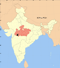 Location of Khargone district in Madhya Pradesh | |
| Country | India |
| State | Madhya Pradesh |
| Administrative division | Indoreप्रशासनिक प्रभाग |
| Headquarters | Khargone |
| Government | |
| • Lok Sabha constituencies | Khargone |
| Area | |
| • Total | 8,030 km2 (3,100 sq mi) |
| Population (2011) | |
| • Total | 1,872,413 |
| • Density | 230/km2 (600/sq mi) |
| Demographics | |
| • Literacy | 63.98 per cent |
| • Sex ratio | 963 |
| Website | Official website |
Khargone district (Hindi: खरगोन ज़िला), formerly known as West Nimar district (Hindi: पश्चिम निमाड़ ज़िला), is a district of Madhya Pradesh state in central India. The district lies in Nimar region, and is part of Indore Division. Khargone town is the headquarters of this district.
History
The district has a long history. In ancient period, the Haihayas of Mahishmati (present-day Maheshwar) ruled this region. In early medieval age, the area was under the Paramaras of Malwa and the Ahirs of Asirgarh. In late medieval age, the area was under Malwa Sultanate of Mandu. In 1531, Gujarat sultan Bahadur Shah brought this area under his control. In 1562, Akbar annexed this territory along with the whole Malwa to Mughal empire. In 1740 Marathas under the Peshwa brought the area under their control. In 1778, Peshwa distributed this territory to the Maratha rulers, Holkars of Indore, Sindhias of Gwalior and Ponwars of Dhar. After the independence and merger of the Princely states with Union of India in 1948, this territory became West Nimar district of Madhya Bharat. Khargone district had been part of the Nerbudda (Narmada) Division of the Central Provinces and Berar, which became the state of Madhya Bharat (later Madhya Pradesh) after India's independence in 1947.[1] On 1 November 1956 this district became part of the newly formed state of Madhya Pradesh. On 25 May 1998 West Nimar district was bifurcated into two districts: Khargone and Barwani.
Geography
Area of the district is 8030 km². The district is situated between 21°22' and 22°35' north latitudes and 74°25' and 76°14' east longitudes. The district is surrounded by Dhar, Indore and Dewas in the north, state of Maharashtra state in the south, Khandwa, Burhanpur in the east and Barwani in the West. Deepali was the princess who ruled city in 20th century.
Economy
In 2006 the Ministry of Panchayati Raj named Khargone one of the country's 250 most backward districts (out of a total of 640).[2] It is one of the 24 districts in Madhya Pradesh currently receiving funds from the Backward Regions Grant Fund Programme (BRGF).[2]
Divisions
The district is divided into 5 sub-divisions, which are further divided into 9 tehsils. Barwaha sub-division has only one tehsil, Barwaha with the town bigger than Barwaha name Sanawad. Bhikangaon sub-division has two tehsils, Bhikangaon and Jhirnya.[3] Kasrawad sub-division has only Kasrawad tehsil while Khargone sub-division has four tehsils, Khargone, Gogawan, Bhagwanpura, Madhya Pradesh and Segaon. Mandaleshwar sub-division has one tehsil, Maheshwar. Khargone town is the administrative headquarters of the district. Other towns are Maheshwar, Kasrawad, Segaon, Bhagwanpura, Jhirnya, Bhikangaon, Gogawan and Barwah. Maheshwar is a place of tourist attraction as the former capital of the Haihayas and the Holkars of Indore.
The district consists 6 Vidhan Sabha constituencies. These constituencies are: Bhikangaon, Badwah, Maheshwar, Kasrawad, Khargone and Bhagwanpura. While, Bhikangaon and Badwah are part of Khnadwa Lok Sabha constituency, the rest are part of Khargone Lok Sabha constituency.
Demographics
According to the 2011 census Khargone District has a population of 1,872,413,[4] roughly equal to the nation of Kosovo[5] or the US state of West Virginia.[6] This gives it a ranking of 252nd in India (out of a total of 640).[4] The district has a population density of 233 inhabitants per square kilometre (600/sq mi) .[4] Its population growth rate over the decade 2001-2011 was 22.81%.[4] West Nimar has a sex ratio of 963 females for every 1000 males,[4] and a literacy rate of 63.98%.[4]
Languages
Languages spoken include nimadi is the most spoking language in west nimar and gujrati Bareli Palya, a Bhil language with approximately 10 000 speakers centred in Madhya Pradesh;[7] Bareli Rathwi, another Bhil language, with approximately 64 000 speakers, written in the Devanagari script;[8] and Bhilali, with 1 150 000 speakers.[9]
References
- ↑ Hunter, William Wilson, Sir, et al. (1908). Imperial Gazetteer of India, Volume 6. 1908-1931; Clarendon Press, Oxford
- 1 2 Ministry of Panchayati Raj (8 September 2009). "A Note on the Backward Regions Grant Fund Programme" (PDF). National Institute of Rural Development. Retrieved 27 September 2011.
- ↑ "Man helps cops arrest rape accused, gets beaten up in Chenpur jail". Hindustan Times. HT Media Limited. 26 July 2014. Retrieved 26 March 2015.
- 1 2 3 4 5 6 "District Census 2011". Census2011.co.in. 2011. Retrieved 2011-09-30.
- ↑ US Directorate of Intelligence. "Country Comparison:Population". Retrieved 2011-10-01.
Kosovo 1,825,632 July 2011 est.
- ↑ "2010 Resident Population Data". U. S. Census Bureau. Retrieved 2011-09-30.
West Virginia 1,852,994
- ↑ M. Paul Lewis, ed. (2009). "Bareli, Palya: A language of India". Ethnologue: Languages of the World (16th ed.). Dallas, Texas: SIL International. Retrieved 2011-09-28.
- ↑ M. Paul Lewis, ed. (2009). "Bareli, Rathwi: A language of India". Ethnologue: Languages of the World (16th ed.). Dallas, Texas: SIL International. Retrieved 2011-09-28.
- ↑ M. Paul Lewis, ed. (2009). "Bhilali: A language of India". Ethnologue: Languages of the World (16th ed.). Dallas, Texas: SIL International. Retrieved 2011-09-30.
External links
| Wikimedia Commons has media related to Khargone district. |
- Official "Khargone District" website in Hindi language
- list of places in Khargone
 |
Dhar district | Indore district | | |
| Barwani district | |
East Nimar district | ||
| ||||
| | ||||
| Jalgaon district, Maharashtra | Burhanpur district |
Coordinates: 21°49′23″N 75°36′37″E / 21.82306°N 75.61028°E