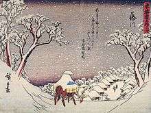
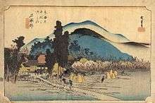
53 Stations of the Tōkaidō
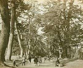
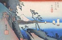
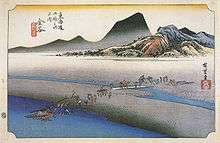
The 53 Stations of the Tōkaidō (東海道五十三次 Tōkaidō Gojūsan-tsugi) are the rest areas along the Tōkaidō, which was a coastal route that ran from Nihonbashi in Edo (modern-day Tokyo) to Sanjō Ōhashi in Kyoto.[1]
Stations of the Tōkaidō
There were originally 53 government post stations along the Tōkaidō, where travelers had to present traveling permits at each station if wanting to cross. All of the stations, in addition to the starting and ending locations (which are shared with the Nakasendō), are listed below in order. The stations are divided by their present-day prefecture and include the name of their present-day city/town/village/districts, with historic provinces listed below.
Tokyo


- Starting Location: Nihonbashi (Chūō-ku)
- 1. Shinagawa-juku (Shinagawa)
Kanagawa Prefecture
- 2. Kawasaki-juku (Kawasaki-ku, Kawasaki)
- 3. Kanagawa-juku (Kanagawa-ku, Yokohama)
- 4. Hodogaya-juku (Hodogaya-ku, Yokohama)
- 5. Totsuka-juku (Totsuka-ku, Yokohama)
- 6. Fujisawa-shuku (Fujisawa)
- 7. Hiratsuka-juku (Hiratsuka)
- 8. Ōiso-juku (Ōiso, Naka District)
- 9. Odawara-juku (Odawara)
- 10. Hakone-juku (Hakone, Ashigarashimo District)
Shizuoka Prefecture
- 11. Mishima-shuku (Mishima)
- 12. Numazu-juku (Numazu)
- 13. Hara-juku (Numazu)
- 14. Yoshiwara-juku (Fuji)
- 15. Kanbara-juku (Shimizu-ku, Shizuoka)
- 16. Yui-shuku (Shimizu-ku, Shizuoka)
- 17. Okitsu-juku (Shimizu-ku, Shizuoka)
- 18. Ejiri-juku (Shimizu-ku, Shizuoka)
- 19. Fuchū-shuku (Aoi-ku, Shizuoka)
- 20. Mariko-juku (Suruga-ku, Shizuoka)
- 21. Okabe-juku (Fujieda)
- 22. Fujieda-juku (Fujieda)
- 23. Shimada-juku (Shimada)
- 24. Kanaya-juku (Shimada)
- 25. Nissaka-shuku (Kakegawa)
- 26. Kakegawa-juku (Kakegawa)
- 27. Fukuroi-juku (Fukuroi)
- 28. Mitsuke-juku (Iwata)
- 29. Hamamatsu-juku (Naka-ku, Hamamatsu)
- 30. Maisaka-juku (Nishi-ku, Hamamatsu)
- 31. Arai-juku (Kosai)
- 32. Shirasuka-juku (Kosai)
Aichi Prefecture
- 33. Futagawa-juku (Toyohashi)
- 34. Yoshida-juku (Toyohashi)
- 35. Goyu-shuku (Toyokawa)
- 36. Akasaka-juku (Toyokawa)
- 37. Fujikawa-shuku (Okazaki)
- 38. Okazaki-shuku (Okazaki) (also part of the Shio no Michi)
- 39. Chiryū-juku (Chiryū)
- 40. Narumi-juku (Midori-ku, Nagoya)
- 41. Miya-juku (Atsuta-ku, Nagoya)
Mie Prefecture
- 42. Kuwana-juku (Kuwana)
- 43. Yokkaichi-juku (Yokkaichi)
- 44. Ishiyakushi-juku (Suzuka)
- 45. Shōno-juku (Suzuka)
- 46. Kameyama-juku (Kameyama)
- 47. Seki-juku (Kameyama)
- 48. Sakashita-juku (Kameyama)
Shiga Prefecture
- 49. Tsuchiyama-juku (Kōka)
- 50. Minakuchi-juku (Kōka)
- 51. Ishibe-juku (Konan)
- 52. Kusatsu-juku (Kusatsu) (also part of the Nakasendō)
- 53. Ōtsu-juku (Ōtsu) (also part of the Nakasendō)
Kyoto Prefecture
- Ending Location: Sanjō Ōhashi (Kyoto)
Ōsaka Kaidō
In 1619, the Ōsaka Kaidō (大阪街道) was developed to extend the Tōkaidō so that it would reach Kōraibashi in modern-day Osaka. Instead of going to Sanjō Ōhashi, travelers would leave from Ōtsu-juku and travel towards Fushimi-juku. Because of the addition of these four post towns, the Tōkaidō is occasionally referred to as having 57 stations. Another name for this extension was Kyōkaidō (京街道).
Kyoto Prefecture

- 54. Fushimi-juku (Fushimi-ku, Kyoto)
- 55. Yodo-juku (Fushimi-ku, Kyoto)
Osaka Prefecture
- 56. Hirakata-juku (Hirakata)
- 57. Moriguchi-juku (Moriguchi)
- Ending location: Kōraibashi (Chūō-ku, Osaka)
By historical provinces
During the Edo period, when the Tōkaidō was established, it ran through the following ten historical provinces of Japan.
- Musashi Province: Nihonbashi (start) to Hodogaya-juku (#4)
- Sagami Province: Totsuka-juku (#5) to Hakone-juku (#10)
- Izu Province: Mishima-shuku (#11)
- Suruga Province: Numazu-juku (#12) to Shimada-juku (#23)
- Tōtōmi Province: Kanaya-juku (#24) to Shirasuka-juku (#32)
- Mikawa Province: Futagawa-juku (#33) to Chiryū-juku (#39)
- Owari Province: Narumi-juku (#40) and Miya-juku (#41)
- Ise Province: Kuwana-juku (#42) to Sakanoshita-juku (#48)
- Ōmi Province: Tsuchiyama-juku (#49) to Ōtsu-juku (#53)
- Yamashiro Province: Sanjō Ōhashi (original finish), Fushimi-juku (#54) and Yodo-juku (#55)
- Kawachi Province: Hirakata-juku (#56) and Moriguchi-juku (#57)
- Settsu Province: Kōraibashi (finish)
See also
- Edo Five Routes
- Other Routes
Notes
- ↑ Louis Frédéric; Käthe Roth (2002). Japan Encyclopedia. Harvard University Press. p. 973. ISBN 978-0-674-01753-5..
References
- Louis Frédéric; Käthe Roth (2002). Japan Encyclopedia. Belknap Press. ISBN 978-0-674-01753-5.