Vanderburgh County, Indiana
| Vanderburgh County, Indiana | ||
|---|---|---|
 | ||
| ||
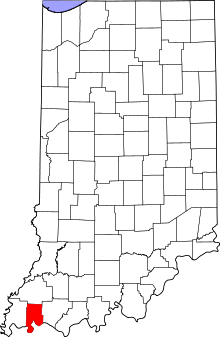 Location in the U.S. state of Indiana | ||
 Indiana's location in the U.S. | ||
| Founded | January 7, 1818 | |
| Named for | Henry Vanderburgh | |
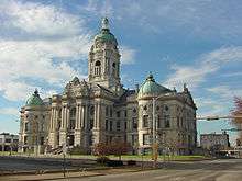
| Seat | Evansville | |
| Largest city | Evansville | |
| Area | ||
| • Total | 236.33 sq mi (612 km2) | |
| • Land | 233.48 sq mi (605 km2) | |
| • Water | 2.86 sq mi (7 km2), 1.21% | |
| Population (est.) | ||
| • (2014) | 182,006 | |
| • Density | 766/sq mi (295.81/km²) | |
| Congressional district | 8th | |
| Time zone | Central: UTC-6/-5 | |
| Website |
www | |
|
Footnotes:
| ||

| Vanderburgh County Sheriff's Department | |
|---|---|
| Agency overview | |
| Legal personality | Governmental: Government agency |
| Jurisdictional structure | |
| Operations jurisdiction* | County (US) of Vanderburgh in the state of Indiana, United States |
| Legal jurisdiction | As per operations jurisdiction. |
| General nature | |
| Operational structure | |
| Agency executive | Dave Wedding, Acting Sheriff |
| Facilities | |
| Jails | 1 |
| Footnotes | |
| * Divisional agency: Division of the country, over which the agency has usual operational jurisdiction. | |
Vanderburgh County is a county located in the U.S. state of Indiana. As of 2010, the population was 179,703.[1] The county seat is in Evansville.[2] While Vanderburgh County was the seventh largest county in 2010 population with 179,703 people, it is also the eighth smallest county in area in Indiana and the smallest in Southwestern Indiana, covering only 236 sq mi. In 2012, the population was 180,835.[3]
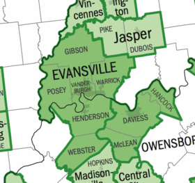
Vanderburgh County forms the core of the Evansville Metropolitan Statistical Area.
History
Vanderburgh County was formed on January 7, 1818, from Gibson, Posey, and Warrick counties. It was named for Captain Henry Vanderburgh, Revolutionary War veteran and judge for the Indiana Territory.
Geography
According to the 2010 census, the county has a total area of 236.33 square miles (612.1 km2), of which 233.48 square miles (604.7 km2) (or 98.79%) is land and 2.86 square miles (7.4 km2) (or 1.21%) is water.[4]
Regional
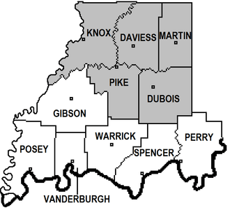
Adjacent counties
|
|
Cities and towns
Census-designated places
Unincorporated towns
Townships
(2000 Population)
Major highways
Climate and weather
| Evansville, Indiana | ||||||||||||||||||||||||||||||||||||||||||||||||||||||||||||
|---|---|---|---|---|---|---|---|---|---|---|---|---|---|---|---|---|---|---|---|---|---|---|---|---|---|---|---|---|---|---|---|---|---|---|---|---|---|---|---|---|---|---|---|---|---|---|---|---|---|---|---|---|---|---|---|---|---|---|---|---|
| Climate chart (explanation) | ||||||||||||||||||||||||||||||||||||||||||||||||||||||||||||
| ||||||||||||||||||||||||||||||||||||||||||||||||||||||||||||
| ||||||||||||||||||||||||||||||||||||||||||||||||||||||||||||
In recent years, average temperatures in Evansville have ranged from a low of 25 °F (−4 °C) in January to a high of 91 °F (33 °C) in July, although a record low of −17 °F (−27 °C) was recorded in January 1985 and a record high of 109 °F (43 °C) was recorded in July 1954. Average monthly precipitation ranged from 2.96 inches (75 mm) in October to 4.78 inches (121 mm) in May.[5]
Government
| Year | Republican | Democratic |
|---|---|---|
| 2012 | 54.3% 39,389 | 43.7% 31,725 |
| 2008 | 48.2% 37,512 | 50.6% 39,423 |
| 2004 | 58.7% 41,463 | 40.7% 28,767 |
| 2000 | 54.1% 35,846 | 44.1% 29,222 |
| 1996 | 43.2% 28,509 | 46.9% 30,934 |
| 1992 | 39.4% 30,271 | 44.0% 33,799 |
| 1988 | 55.3% 38,928 | 44.4% 31,270 |
| 1984 | 56.7% 40,994 | 42.9% 31,049 |
| 1980 | 51.1% 36,248 | 42.2% 29,930 |
| 1976 | 51.9% 37,975 | 47.7% 34,911 |
| 1972 | 68.3% 48,806 | 31.0% 22,163 |
| 1968 | 49.3% 38,231 | 40.4% 31,326 |
| 1964 | 37.1% 27,231 | 62.4% 45,796 |
| 1960 | 52.9% 41,068 | 46.8% 36,330 |
The county government is a constitutional body, and is granted specific powers by the Constitution of Indiana, and by the Indiana Code.
County Council: The county council is the fiscal branch of the county government that has the legislative responsibilities for the spending and revenue collection in the county. Four representatives are elected from county districts and three are elected at-large by the entire county. The council members serve four-year terms. They are responsible for setting salaries, the annual budget, and special spending. The council also has limited authority to impose local taxes, in the form of an income and property tax that is subject to state level approval, excise taxes, and service taxes.[6][7]
Board of Commissioners: The executive body of the county is made of a board of commissioners. The commissioners are elected county-wide but must live within the district of the seat they hold, in staggered terms, and each serves a four-year term. One of the commissioners, typically the most senior, serves as president. The commissioners are charged with executing the acts legislated by the council, collecting revenue, and managing the day-to-day functions of the county government.[6][7]
Court: The county has eight state trial courts of original jurisdiction. One circuit court and seven superior courts. The judges offices are non-partisan with terms of six years. A judge must be a member of the Indiana Bar Association. The judges are assisted by magistrates that are appointed. circuit court.[7]
County Officials: The county has several other elected offices, including sheriff, coroner, auditor, treasurer, recorder, surveyor, and circuit court clerk. Each of these elected officers serves a term of four years and oversees a different part of county government. Members elected to county government positions are required to declare party affiliations and to be residents of the county.[7]
Demographics
| Historical population | |||
|---|---|---|---|
| Census | Pop. | %± | |
| 1820 | 1,798 | — | |
| 1830 | 2,611 | 45.2% | |
| 1840 | 6,250 | 139.4% | |
| 1850 | 11,414 | 82.6% | |
| 1860 | 20,552 | 80.1% | |
| 1870 | 33,145 | 61.3% | |
| 1880 | 42,193 | 27.3% | |
| 1890 | 59,809 | 41.8% | |
| 1900 | 71,769 | 20.0% | |
| 1910 | 77,438 | 7.9% | |
| 1920 | 92,293 | 19.2% | |
| 1930 | 113,320 | 22.8% | |
| 1940 | 130,783 | 15.4% | |
| 1950 | 160,422 | 22.7% | |
| 1960 | 165,794 | 3.3% | |
| 1970 | 168,772 | 1.8% | |
| 1980 | 167,515 | −0.7% | |
| 1990 | 165,058 | −1.5% | |
| 2000 | 171,922 | 4.2% | |
| 2010 | 179,703 | 4.5% | |
| Est. 2015 | 181,877 | [8] | 1.2% |
| U.S. Decennial Census[9] 1790-1960[10] 1900-1990[11] 1990-2000[12] 2010-2013[1] | |||
As of the 2010 United States Census, there were 179,703 people, 74,454 households, and 45,118 families residing in the county.[13] The population density was 769.7 inhabitants per square mile (297.2/km2). There were 83,003 housing units at an average density of 355.5 per square mile (137.3/km2).[4] The racial makeup of the county was 86.2% white, 9.1% black or African American, 1.1% Asian, 0.2% American Indian, 0.1% Pacific islander, 1.0% from other races, and 2.3% from two or more races. Those of Hispanic or Latino origin made up 2.2% of the population.[13] In terms of ancestry, 32.3% were German, 18.3% were American, 11.7% were Irish, and 9.4% were English.[14]
Of the 74,454 households, 28.9% had children under the age of 18 living with them, 42.9% were married couples living together, 13.1% had a female householder with no husband present, 39.4% were non-families, and 32.3% of all households were made up of individuals. The average household size was 2.31 and the average family size was 2.93. The median age was 37.5 years.[13]
The median income for a household in the county was $47,697 and the median income for a family was $57,076. Males had a median income of $42,663 versus $31,037 for females. The per capita income for the county was $23,945. About 10.7% of families and 15.6% of the population were below the poverty line, including 22.4% of those under age 18 and 7.7% of those age 65 or over.[15]
See also
References
![]() Media related to Vanderburgh County, Indiana at Wikimedia Commons
Media related to Vanderburgh County, Indiana at Wikimedia Commons
- 1 2 "Vanderburgh County QuickFacts". United States Census Bureau. Retrieved 2011-09-25.
- ↑ "Find a County". National Association of Counties. Retrieved 2011-06-07.
- ↑ "Annual Estimates of the Resident Population: April 1, 2010 to July 1, 2012". United States Census Bureau. Retrieved 6 June 2013.
- 1 2 "Population, Housing Units, Area, and Density: 2010 - County". United States Census Bureau. Retrieved 2015-07-10.
- 1 2 "Monthly Averages for Evansville, Indiana". The Weather Channel. Retrieved 2011-01-27.
- 1 2 Indiana Code. "Title 36, Article 2, Section 3". IN.gov. Retrieved 2008-09-16.
- 1 2 3 4 Indiana Code. "Title 2, Article 10, Section 2" (PDF). IN.gov. Retrieved 2008-09-16.
- ↑ "County Totals Dataset: Population, Population Change and Estimated Components of Population Change: April 1, 2010 to July 1, 2015". Retrieved July 2, 2016.
- ↑ "U.S. Decennial Census". United States Census Bureau. Retrieved July 10, 2014.
- ↑ "Historical Census Browser". University of Virginia Library. Retrieved July 10, 2014.
- ↑ "Population of Counties by Decennial Census: 1900 to 1990". United States Census Bureau. Retrieved July 10, 2014.
- ↑ "Census 2000 PHC-T-4. Ranking Tables for Counties: 1990 and 2000" (PDF). United States Census Bureau. Retrieved July 10, 2014.
- 1 2 3 "DP-1 Profile of General Population and Housing Characteristics: 2010 Demographic Profile Data". United States Census Bureau. Retrieved 2015-07-10.
- ↑ "DP02 SELECTED SOCIAL CHARACTERISTICS IN THE UNITED STATES – 2006-2010 American Community Survey 5-Year Estimates". United States Census Bureau. Retrieved 2015-07-10.
- ↑ "DP03 SELECTED ECONOMIC CHARACTERISTICS – 2006-2010 American Community Survey 5-Year Estimates". United States Census Bureau. Retrieved 2015-07-10.
 |
Gibson County | | ||
| Posey County | |
Warrick County | ||
| ||||
| | ||||
| Henderson County, Kentucky |


Coordinates: 38°01′N 87°35′W / 38.02°N 87.58°W