Henderson County, Kentucky
| Henderson County, Kentucky | |
|---|---|
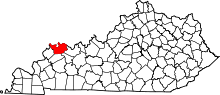 Location in the U.S. state of Kentucky | |
 Kentucky's location in the U.S. | |
| Founded | 1798 |
| Named for | Richard Henderson |
| Seat | Henderson |
| Largest city | Henderson |
| Area | |
| • Total | 466 sq mi (1,207 km2) |
| • Land | 437 sq mi (1,132 km2) |
| • Water | 30 sq mi (78 km2), 6.4% |
| Population | |
| • (2010) | 46,250 |
| • Density | 106/sq mi (41/km²) |
| Congressional district | 1st |
| Time zone | Central: UTC-6/-5 |
| Website |
hendersonky |
Henderson County is a county located in the U.S. state of Kentucky. As of the 2010 census, the population was 46,250.[1] The county seat is Henderson.[2] The county was formed in 1798[3] and named for Colonel Richard Henderson[4] who purchased 17,000,000 acres (69,000 km2) of land from the Cherokee Indians, part of which would eventually make up the county.
Henderson County is part of the Evansville, IN-KY Metropolitan Statistical Area.
History
Henderson County was established in 1798, using land taken from Christian County.[5]
A peninsula across the Ohio from Henderson, which now forms Union Township, Vanderburgh County, Indiana, was the subject of Handly's Lessee v. Anthony, a U.S. Supreme Court case in 1820.[6] An area known as "Green River Island" is part of Kentucky, even though is on the Indiana side of the Ohio River. The Ellis Park Race Course is located there.
Once home to part of the Cherokee Nation, members of the Southern Cherokee were welcomed to Kentucky in 1893 and recognized as an Indian tribe by Governor John Young Brown. The Southern Cherokee still live in Henderson County.
A workplace shooting occurred at an Atlantis Plastics factory in Henderson, Kentucky, United States on June 25, 2008. The gunman, 25-year-old Wesley Neal Higdon, shot and killed five people and critically injured a sixth, before taking his own life.[7][8] The mass murder is the worst in the history of Henderson County, surpassing the triple homicides that took place in 1799 and 1955.[9]
Geography
According to the U.S. Census Bureau, the county has a total area of 466 square miles (1,210 km2), of which 437 square miles (1,130 km2) is land and 30 square miles (78 km2) (6.4%) is water.[10] The county's northern border with Indiana is formed by the Ohio River.
Adjacent counties
- Posey County, Indiana (northwest)
- Vanderburgh County, Indiana (north)
- Warrick County, Indiana (northeast)
- Daviess County (east)
- McLean County (southeast)
- Webster County (south)
- Union County (west)
Demographics
| Historical population | |||
|---|---|---|---|
| Census | Pop. | %± | |
| 1800 | 1,468 | — | |
| 1810 | 4,703 | 220.4% | |
| 1820 | 5,714 | 21.5% | |
| 1830 | 6,659 | 16.5% | |
| 1840 | 9,548 | 43.4% | |
| 1850 | 12,171 | 27.5% | |
| 1860 | 14,262 | 17.2% | |
| 1870 | 18,457 | 29.4% | |
| 1880 | 24,515 | 32.8% | |
| 1890 | 29,536 | 20.5% | |
| 1900 | 32,907 | 11.4% | |
| 1910 | 29,352 | −10.8% | |
| 1920 | 27,609 | −5.9% | |
| 1930 | 26,295 | −4.8% | |
| 1940 | 27,020 | 2.8% | |
| 1950 | 30,715 | 13.7% | |
| 1960 | 33,519 | 9.1% | |
| 1970 | 36,031 | 7.5% | |
| 1980 | 40,849 | 13.4% | |
| 1990 | 43,044 | 5.4% | |
| 2000 | 44,829 | 4.1% | |
| 2010 | 46,250 | 3.2% | |
| Est. 2015 | 46,407 | [11] | 0.3% |
| U.S. Decennial Census[12] 1790-1960[13] 1900-1990[14] 1990-2000[15] 2010-2013[1] | |||
As of the census[16] of 2000, there were 44,829 people, 18,095 households, and 12,576 families residing in the county. The population density was 102 per square mile (39/km2). There were 19,466 housing units at an average density of 44 per square mile (17/km2). The racial makeup of the county was 91.16% White, 7.10% Black or African American, 0.16% Native American, 0.33% Asian, 0.01% Pacific Islander, 0.39% from other races, and 0.86% from two or more races. Hispanic or Latino of any race were 0.97% of the population.
There were 18,095 households out of which 32.40% had children under the age of 18 living with them, 54.40% were married couples living together, 11.60% had a female householder with no husband present, and 30.50% were non-families. 26.40% of all households were made up of individuals and 10.60% had someone living alone who was 65 years of age or older. The average household size was 2.43 and the average family size was 2.93.
In the county the population was spread out with 24.60% under the age of 18, 8.40% from 18 to 24, 30.00% from 25 to 44, 23.90% from 45 to 64, and 13.10% who were 65 years of age or older. The median age was 37 years. For every 100 females there were 93.60 males. For every 100 females age 18 and over, there were 90.60 males.
The median income for a household in the county was $35,892, and the median income for a family was $44,703. Males had a median income of $33,838 versus $22,572 for females. The per capita income for the county was $18,470. About 9.70% of families and 12.30% of the population were below the poverty line, including 17.20% of those under age 18 and 10.10% of those age 65 or over.
Communities
- Alzey
- Anthoston
- Baskett
- Bluff City
- Cairo
- Corydon
- Dixie
- Finley Addition
- Geneva
- Graham Hill
- Henderson (county seat)
- Niagara
- Reed
- Robards
- Scuffletown
- Smith Mills
- Spottsville
- Weaverton
- Zion
Notable people
- Happy Chandler, 44th and 49th governor of Kentucky; and Commissioner of Baseball from 1945-51.
- Ewing Galloway, a journalist and one time county prosecutor, in 1920 founded the Ewing Galloway Agency in New York City, a stock photography agency. By the time of his death 33 years later, his catalog of photos had grown to 400,000 images. Although most, if not all, of the photographs were either purchased from other agencies or shot by employees, the name "Ewing Galloway" appeared beside photos that appeared in books, encyclopedias, schoolbooks and magazine, making his name world-famous. .[17]
- Kentucky clergyman and university president LaVerne Butler was born in Henderson County in 1926.[18]
- Country entertainer Grandpa Jones was born and raised in Henderson County.
See also
References
- 1 2 "State & County QuickFacts". United States Census Bureau. Retrieved March 8, 2014.
- ↑ "Find a County". National Association of Counties. Archived from the original on 2011-05-31. Retrieved 2011-06-07.
- ↑ "Henderson County". The Kentucky Encyclopedia. 2000. Retrieved August 22, 2014.
- ↑ The Register of the Kentucky State Historical Society, Volume 1. Kentucky State Historical Society. 1903. p. 35.
- ↑ Hogan, Roseann Reinemuth (1992). Kentucky Ancestry: A Guide to Genealogical and Historical Research. Ancestry Publishing. p. 250. Retrieved 26 July 2013.
- ↑ Handly's Lessee v. Anthony, 18 U.S. 374 (1820)
- ↑ "6 dead in Henderson, Ky., plastics plant shooting". CNN. 2008-06-25.
- ↑ Lenz, Ryan (2008-06-25). "Police: Plant shooter kills 5 co-workers, then self". Associated Press. Archived from the original on July 6, 2008.
- ↑ Smith, Beth (2008-06-26). "Rampage at Atlantis Plastics ends with six dead". Henderson Gleaner.
- ↑ "2010 Census Gazetteer Files". United States Census Bureau. August 22, 2012. Retrieved August 16, 2014.
- ↑ "County Totals Dataset: Population, Population Change and Estimated Components of Population Change: April 1, 2010 to July 1, 2015". Retrieved July 2, 2016.
- ↑ "U.S. Decennial Census". United States Census Bureau. Archived from the original on May 11, 2015. Retrieved August 16, 2014.
- ↑ "Historical Census Browser". University of Virginia Library. Retrieved August 16, 2014.
- ↑ "Population of Counties by Decennial Census: 1900 to 1990". United States Census Bureau. Retrieved August 16, 2014.
- ↑ "Census 2000 PHC-T-4. Ranking Tables for Counties: 1990 and 2000" (PDF). United States Census Bureau. Retrieved August 16, 2014.
- ↑ "American FactFinder". United States Census Bureau. Archived from the original on 2013-09-11. Retrieved 2008-01-31.
- ↑ "Ewing Galloway Dies of Injury". Kentucky New Era. 29 June 1953. Retrieved 4 June 2013.
- ↑ "LaVerne Butler". Lexington Herald Leader, December 18, 2010. Retrieved December 23, 2010.
| Central City |  | |
|---|---|---|
| Municipalities with population over 5,000 in 2010 | ||
| Municipalities with population 1,000-5,000 in 2010 | ||
| Indiana Counties | ||
| Kentucky Counties | ||
Municipalities and communities of Henderson County, Kentucky, United States | ||
|---|---|---|
| Cities | | |
| CDP | ||
| Other communities | ||
| Ghost town | ||

Coordinates: 37°48′N 87°34′W / 37.80°N 87.57°W