Greensburg, Kentucky
| Greensburg, Kentucky | ||
|---|---|---|
| City | ||
|
Downtown Greensburg | ||
| ||
 Location of Greensburg, Kentucky | ||
| Coordinates: 37°15′35″N 85°29′52″W / 37.25972°N 85.49778°WCoordinates: 37°15′35″N 85°29′52″W / 37.25972°N 85.49778°W | ||
| Country | United States | |
| State | Kentucky | |
| County | Green | |
| Established | 1794 | |
| Incorporated | 1795 | |
| Named for | its county | |
| Government | ||
| • Mayor | Lisle Cheatham | |
| Area | ||
| • Total | 1.9 sq mi (4.9 km2) | |
| • Land | 1.9 sq mi (4.9 km2) | |
| • Water | 0.0 sq mi (0.0 km2) | |
| Elevation | 600 ft (183 m) | |
| Population (2000) | ||
| • Total | 2,396 | |
| • Density | 1,255.4/sq mi (484.7/km2) | |
| Time zone | Central (CST) (UTC-6) | |
| • Summer (DST) | CDT (UTC-5) | |
| ZIP code | 42743 | |
| Area code(s) | 270 & 364 | |
| FIPS code | 21-32968 | |
| GNIS feature ID | 0493339 | |
| Website | greensburgonline.com | |

Greensburg is a home rule-class city[1] in and the county seat of Green County, Kentucky, United States.[2] The population was 2,396 at the 2000 census.
The Downtown Greensburg Historic District is on the National Register of Historic Places and includes the oldest courthouse west of the Allegheny Mountains.
Geography
Greensburg is located at 37°15′35″N 85°29′52″W / 37.25972°N 85.49778°W (37.259665, -85.497863).[3]
According to the United States Census Bureau, the city has a total area of 1.9 square miles (4.9 km2), all land.
History
The 1780 settlement was originally known as "Glover's Station" for local landowner John Glover, who received 193 acres (0.78 km2) in the area as a military grant after the American Revolution.[4]
Following the establishment of Green County (itself named for Revolutionary War Maj. Gen. Nathanael Greene[4]) from parts of Lincoln and Nelson counties in 1792, Greensburg was laid out and established two years later as its eponymous seat of government.[5] It was incorporated as a city a year after that.[4] The central Public Square was also laid out in 1795 and has been retained as designed since then, with the only changes being the paving of the square with concrete and the installation of concrete dividers and parking meters in the four quadrants.[6]
The first post office arrived in 1807 and was variously known as "Greensburg" and "Greensburg Court House" during the early 19th century.[4]
Demographics
| Historical population | |||
|---|---|---|---|
| Census | Pop. | %± | |
| 1800 | 70 | — | |
| 1810 | 132 | 88.6% | |
| 1830 | 669 | — | |
| 1840 | 585 | −12.6% | |
| 1860 | 536 | — | |
| 1870 | 351 | −34.5% | |
| 1880 | 620 | 76.6% | |
| 1890 | 552 | −11.0% | |
| 1900 | 564 | 2.2% | |
| 1910 | 450 | −20.2% | |
| 1920 | 488 | 8.4% | |
| 1930 | 770 | 57.8% | |
| 1940 | 1,176 | 52.7% | |
| 1950 | 1,032 | −12.2% | |
| 1960 | 2,334 | 126.2% | |
| 1970 | 1,990 | −14.7% | |
| 1980 | 2,377 | 19.4% | |
| 1990 | 1,990 | −16.3% | |
| 2000 | 2,396 | 20.4% | |
| 2010 | 2,163 | −9.7% | |
| Est. 2015 | 2,123 | [7] | −1.8% |
As of the census[9] of 2000, there were 2,396 people, 1,061 households, and 648 families residing in the city. The population density was 1,255.4 people per square mile (484.3/km²). There were 1,190 housing units at an average density of 623.5 per square mile (240.6/km²). The racial makeup of the city was 92.99% White, 4.63% African American, 0.08% Native American, 0.38% Asian, 0.50% from other races, and 1.42% from two or more races. Hispanic or Latino of any race were 0.96% of the population.
There were 1,061 households out of which 24.8% had children under the age of 18 living with them, 43.6% were married couples living together, 14.1% had a female householder with no husband present, and 38.9% were non-families. 37.1% of all households were made up of individuals and 21.3% had someone living alone who was 65 years of age or older. The average household size was 2.12 and the average family size was 2.75.
In the city the population was spread out with 21.5% under the age of 18, 7.7% from 18 to 24, 22.1% from 25 to 44, 23.4% from 45 to 64, and 25.3% who were 65 years of age or older. The median age was 44 years. For every 100 females there were 78.5 males. For every 100 females age 18 and over, there were 71.5 males.
The median income for a household in the city was $20,556, and the median income for a family was $29,818. Males had a median income of $26,065 versus $18,031 for females. The per capita income for the city was $14,296. About 21.3% of families and 24.8% of the population were below the poverty line, including 34.8% of those under age 18 and 13.5% of those age 65 or over.
Notable people
- Aylette Buckner — U.S. Representative from Kentucky
- William Herndon — friend and biographer of Abraham Lincoln
- Edward H. Hobson — Union Army general during the Civil War
- William Thomas Ward — Union general during the Civil War and United States Congressman
- Dakota Meyer — United States Marine and Medal of Honor recipient
- Blake Judd (filmmaker) — Independent filmmaker
- Mentor Graham — American teacher best known for tutoring Abraham Lincoln
- John W. Lewis — U.S. Representative from Kentucky
- Richard Aylett Buckner — U.S. Representative from Kentucky and father of Aylette Buckner
- John Richard Barret — U.S. Representative from Missouri
- George Washington Buckner — Physician and diplomat; United States minister to Liberia from 1913 to 1915.
- Rod Henderson — A former Major League Baseball pitcher
- Aaron Harding — U.S. Representative from Kentucky
Climate
The climate in this area is characterized by hot, humid summers and generally mild to cool winters. According to the Köppen Climate Classification system, Greensburg has a humid subtropical climate, abbreviated "Cfa" on climate maps.[10]
The highest recorded temperature at Greensburg was 114 °F (46 °C) on July 28, 1930.
References
- ↑ "Summary and Reference Guide to House Bill 331 City Classification Reform" (PDF). Kentucky League of Cities. Retrieved December 30, 2014.
- ↑ "Find a County". National Association of Counties. Retrieved 2011-06-07.
- ↑ "US Gazetteer files: 2010, 2000, and 1990". United States Census Bureau. 2011-02-12. Retrieved 2011-04-23.
- 1 2 3 4 Rennick, Robert M. (1987). Kentucky Place Names. University Press of Kentucky. p. 125. Retrieved 28 Apr 2013.
- ↑ Commonwealth of Kentucky. Office of the Secretary of State. Land Office. "Greensburg, Kentucky". Accessed 28 Jul 2013.
- ↑ MRA NRHP. "Green County".
- ↑ "Annual Estimates of the Resident Population for Incorporated Places: April 1, 2010 to July 1, 2015". Retrieved July 2, 2016.
- ↑ "Census of Population and Housing". Census.gov. Retrieved June 4, 2015.
- ↑ "American FactFinder". United States Census Bureau. Retrieved 2008-01-31.
- ↑ Climate Summary for Greensburg, Kentucky
External links
Municipalities and communities of Green County, Kentucky, United States | ||
|---|---|---|
| City | 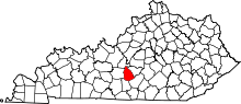 | |
| CDP | ||
| Other unincorporated communities |
| |