Winchester, Kentucky
| Winchester, Kentucky | |
|---|---|
| City | |
|
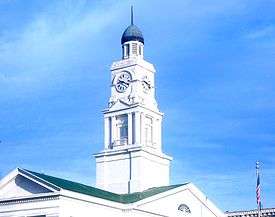
The Clark County Court House clock | |
| Motto: Rich in History & Ready for the Future | |
 Location of Winchester, Kentucky | |
| Coordinates: 37°59′41″N 84°11′3″W / 37.99472°N 84.18417°WCoordinates: 37°59′41″N 84°11′3″W / 37.99472°N 84.18417°W | |
| Country | United States |
| State | Kentucky |
| County | Clark |
| Area | |
| • Total | 7.9 sq mi (20.4 km2) |
| • Land | 7.8 sq mi (20.3 km2) |
| • Water | 0.04 sq mi (0.1 km2) |
| Elevation | 994 ft (303 m) |
| Population (2010) | |
| • Total | 18,368 |
| • Density | 2,344/sq mi (905.0/km2) |
| Time zone | Eastern (EST) (UTC-5) |
| • Summer (DST) | EDT (UTC-4) |
| ZIP codes | 40391-40392 |
| Area code(s) | 859 |
| FIPS code | 21-83676 |
| GNIS feature ID | 0506924 |
| Website |
winchesterky |
Winchester is a city in and the county seat of Clark County, Kentucky, United States.[1] The population was 18,368 at the 2010 census.[2] It is part of the Lexington-Fayette, KY Metropolitan Statistical Area.
History
It was named after Winchester, Virginia.[3]
Geography
Winchester is located northwest of the center of Clark County, 18 miles (29 km) east of Lexington and 15 miles (24 km) west of Mt. Sterling. Kentucky Route 1958 (Bypass Road) is an outer loop around the town. Kentucky Route 627 (Boonesborough Road) leads towards Richmond, 21 miles (34 km) to the south. U.S. Route 60 (Winchester-Lexington Road/Lexington Avenue) runs through downtown Winchester. Interstate 64 passes through the northern part of the city, with access from exits 94 and 96. The Mountain Parkway turns off I-64 just northeast of Winchester and leads 75 miles (121 km) east to Salyersville.
According to the United States Census Bureau, Winchester has a total area of 7.9 square miles (20.4 km2), of which 7.8 square miles (20.3 km2) is land and 0.04 square miles (0.1 km2), or 0.67%, is water.[2]
Climate
The climate in this area is characterized by hot, humid summers and generally mild to cool winters. According to the Köppen Climate Classification system, Winchester has a humid subtropical climate, abbreviated "Cfa" on climate maps.[4]
Historic sites
- Bluegrass Heritage Museum
- Clark County Court House
- Clark Mansion (Gov. Clark House)
- Indian old fields
- Kerr Building
- Leeds Theater
- Oakwood Estate
- Old Providence Church
- Winchester Opera House
Demographics
| Historical population | |||
|---|---|---|---|
| Census | Pop. | %± | |
| 1800 | 130 | — | |
| 1810 | 538 | 313.8% | |
| 1830 | 620 | — | |
| 1840 | 1,047 | 68.9% | |
| 1860 | 1,142 | — | |
| 1870 | 1,616 | 41.5% | |
| 1880 | 2,277 | 40.9% | |
| 1890 | 4,519 | 98.5% | |
| 1900 | 5,964 | 32.0% | |
| 1910 | 7,156 | 20.0% | |
| 1920 | 8,333 | 16.4% | |
| 1930 | 8,233 | −1.2% | |
| 1940 | 8,594 | 4.4% | |
| 1950 | 9,226 | 7.4% | |
| 1960 | 10,187 | 10.4% | |
| 1970 | 13,402 | 31.6% | |
| 1980 | 15,216 | 13.5% | |
| 1990 | 15,799 | 3.8% | |
| 2000 | 16,724 | 5.9% | |
| 2010 | 18,368 | 9.8% | |
| Est. 2015 | 18,446 | [5] | 0.4% |
As of the census[7] of 2000, there were 16,724 people, 6,907 households, and 4,620 families residing in the city. The population density was 2,187.6 per square mile (844.6/km2). There were 7,400 housing units at an average density of 968.0 per square mile (373.7/km2). The racial makeup of the city was 88.94% White, 8.83% African American, 0.22% Native American, 0.25% Asian, 0.01% Pacific Islander, 0.81% from other races, and 0.94% from two or more races. Hispanic or Latino of any race were 1.60% of the population.
There were 6,907 households out of which 31.4% had children under the age of 18 living with them, 47.0% were married couples living together, 16.4% had a female householder with no husband present, and 33.1% were non-families. 28.5% of all households were made up of individuals and 12.6% had someone living alone who was 65 years of age or older. The average household size was 2.39 and the average family size was 2.93.
In the city the population was spread out with 24.9% under the age of 18, 9.9% from 18 to 24, 30.0% from 25 to 44, 21.1% from 45 to 64, and 14.0% who were 65 years of age or older. The median age was 35 years. For every 100 females there were 88.7 males. For every 100 females age 18 and over, there were 84.4 males.
The median income for a household in the city was $31,254, and the median income for a family was $36,797. Males had a median income of $31,295 versus $21,747 for females. The per capita income for the city was $15,611. About 13.1% of families and 15.5% of the population were below the poverty line, including 21.1% of those under age 18 and 14.4% of those age 65 or over.
Economy
| Winchester's top 10 employers in manufacturing, service, and technology (2016)[8] | ||
| Employer | Number of employees | Year established in Winchester |
|---|---|---|
| Amazon.com | 400 | 2012 |
| Catalent Pharma | 400 | 1992 |
| East Kentucky Power Cooperative | 300 | 1941 |
| General Dynamics Information Technology | 208 | 2014 |
| Infiltrator Water Technologies | 182 | 1986 |
| Leggett & Platt | 250 | 1910 |
| Save-A-Lot Distribution Center | 210 | 1998 |
| The Freeman Corporation | 223 | 1913 |
| Walle Corporation | 140 | 1991 |
| Winchester Farms Dairy | 183 | 1982 |
Small business
Winchester's economy supports opportunities for small business. All are locally owned, but many expand into surrounding counties.
Ale-8-One, a Kentucky-specific brand of soft drink, has been bottled in Winchester since 1926.[9]
Education
Higher education
Winchester has been home to several higher education establishments. Kentucky Wesleyan College was located in the city from 1890 to 1954. When Kentucky Wesleyan left, the local Churches of Christ organized Southeastern Christian College on the former Kentucky Wesleyan campus. After SCC folded in the 1970s, the campus was preserved as a public park. Today, Clark County is home to the Winchester Campus of Bluegrass Community and Technical College.
High school
George Rogers Clark High School is the city's only public high school.
Notable people
- Armstead M. Alexander (1834–1892), congressman from Missouri[10]
- Chilton Allan (1786–1858), congressman from Kentucky
- Yeremiah Bell, safety for the New York Jets NFL team
- George French Ecton, second African-American state legislator in Illinois[11]
- William Harrow (1822–1871), Union general in the Civil War
- Joel Tanner Hart (1810–1877), sculptor
- Preston Knowles, basketball player for the University of Louisville
- Homer Ledford (1927–2006), instrument maker and bluegrass musician
- Matt Long, TV's "Jack & Bobby", "Mad Men", "Helix".
- Claude Sullivan, sports broadcaster
- Allen Tate (1899–1979), poet associated with the Agrarians, a group of Southern poets, and most noted for "Ode to the Confederate Dead"
- Helen Thomas, White House press correspondent
Sister city
Winchester has two sister cities, as designated by Sister Cities International:
References
- ↑ "Find a County". National Association of Counties. Retrieved 2011-06-07.
- 1 2 "Geographic Identifiers: 2010 Demographic Profile Data (G001): Winchester city, Kentucky". U.S. Census Bureau, American Factfinder. Retrieved August 12, 2014.
- ↑ Collins, Lewis (1877). History of Kentucky. p. 130.
- ↑ "Winchester, Kentucky Köppen Climate Classification (Weatherbase)". Weatherbase.
- ↑ "Annual Estimates of the Resident Population for Incorporated Places: April 1, 2010 to July 1, 2015". Retrieved July 2, 2016.
- ↑ "Census of Population and Housing". Census.gov. Retrieved June 4, 2015.
- ↑ "American FactFinder". United States Census Bureau. Retrieved 2008-01-31.
- ↑ "Business & Industry". Kentucky Cabinet for Economic Development. September 16, 2016.
- ↑ Walton, Riley Rogers (1992). "Ale-8-One". In Kleber, John E. The Kentucky Encyclopedia. University Press of Kentucky. p. 11.
- ↑ Who Was Who in America, Historical Volume, 1607-1896. Marquis Who's Who. 1967.
- ↑ Smith, Gerald L., Karen Cotton McDaniel, and John A. Hardin, eds. The Kentucky African American Encyclopedia. University Press of Kentucky, 2015. p161
External links
| Wikimedia Commons has media related to Winchester, Kentucky. |
| Wikisource has the text of The New Student's Reference Work article Winchester, Ky.. |
Municipalities and communities of Clark County, Kentucky, United States | ||
|---|---|---|
| City | 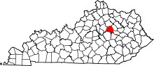 | |
| Unincorporated communities | ||
| Central city |  | |
|---|---|---|
| Municipalities with population over 10,000 | ||
| Municipalities with population 5,000-10,000 | ||
| Municipalities with population under 5,000 | ||
| Counties | ||
