Inez, Kentucky
| Inez, Kentucky | |
|---|---|
| City | |
|
Martin County courthouse in Inez | |
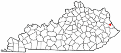 Location of Inez, Kentucky | |
| Coordinates: 37°51′59″N 82°32′21″W / 37.86639°N 82.53917°WCoordinates: 37°51′59″N 82°32′21″W / 37.86639°N 82.53917°W | |
| Country | United States |
| State | Kentucky |
| County | Martin |
| Incorporated | February 5, 1942 |
| Named for | the daughter of a local postmaster |
| Government | |
| • Type | City Commission |
| • Mayor | Terry Fraley |
| Area | |
| • Total | 0.7 sq mi (1.7 km2) |
| • Land | 0.7 sq mi (1.7 km2) |
| • Water | 0.0 sq mi (0.0 km2) |
| Elevation | 636 ft (194 m) |
| Population (2010) | |
| • Total | 717 |
| • Density | 1,024.7/sq mi (421.7/km2) |
| Time zone | Eastern (EST) (UTC-5) |
| • Summer (DST) | EDT (UTC-4) |
| ZIP code | 41224 |
| Area code(s) | 606 |
| FIPS code | 21-39430 |
| GNIS feature ID | 0494986 |
| Website | www.inez.ky.gov |

Inez (local /ɑːnəz/[1] and /aɪnəz/) is a city in and the county seat of Martin County, Kentucky, United States.[2] The population was 466 at the 2000 census.
History
The area was first settled c. 1810 by James Ward and named Arminta Ward's Bottom. This community was made the seat of Martin County in 1873, replacing its earlier court at Warfield. Upon the occasion, J.M. Stepp renamed it Eden after the Biblical garden. As there was already a post office named Eden, Kentucky, the local postmaster was obliged to rename his Inez on June 23, 1874. The name is usually held to have been derived from that of Inez Frank, the daughter of Louisa's postmaster in neighboring Lawrence County.[3]
President Lyndon B. Johnson visited Inez in 1964, landing by helicopter with his party at an abandoned miniature golf course, to promote the War on Poverty. "At the time, the poverty rate in this coal-mining area was more than 60 percent."[4]
Geography
Inez is located at 37°51′59″N 82°32′21″W / 37.86639°N 82.53917°W (37.866431, -82.539058).[5] According to the United States Census Bureau, the city has a total area of 0.7 square miles (1.8 km2), all land.
Economy
Inez is home to several industrial employers primarily focused on the area's robust energy market. A multitude of coal, gas and oil exploration and affiliated services companies operate in the mineral-rich areas in and around Martin County. Outside the city is another major regional employer, the Federal Bureau of Prisons' Big Sandy facility.
Demographics
| Historical population | |||
|---|---|---|---|
| Census | Pop. | %± | |
| 1880 | 108 | — | |
| 1890 | 309 | 186.1% | |
| 1900 | 412 | 33.3% | |
| 1910 | 381 | −7.5% | |
| 1950 | 622 | — | |
| 1960 | 566 | −9.0% | |
| 1980 | 413 | — | |
| 1990 | 511 | 23.7% | |
| 2000 | 466 | −8.8% | |
| 2010 | 717 | 53.9% | |
| Est. 2015 | 684 | [6] | −4.6% |
As of the census[8] of 2000, there were 466 people, 212 households, and 132 families residing in the city. The population density was 710.5 people per square mile (272.6/km²). There were 253 housing units at an average density of 385.7 per square mile (148.0/km²). The racial makeup of the city was 98.28% White, and 1.72% from two or more races. Hispanic or Latino of any race were 0.64% of the population.
There were 212 households out of which 30.7% had children under the age of 18 living with them, 44.8% were married couples living together, 15.1% had a female householder with no husband present, and 37.7% were non-families. 35.4% of all households were made up of individuals and 14.2% had someone living alone who was 65 years of age or older. The average household size was 2.18 and the average family size was 2.83.
In the city the population was spread out with 24.0% under the age of 18, 10.3% from 18 to 24, 29.4% from 25 to 44, 22.3% from 45 to 64, and 13.9% who were 65 years of age or older. The median age was 36 years. For every 100 females there were 75.2 males. For every 100 females age 18 and over, there were 67.0 males.
The median income for a household in the city was $21,875, and the median income for a family was $25,938. Males had a median income of $41,875 versus $17,292 for females. This compares to a median household income in all of the United States of $46,326 in 2006 while the median personal income (including only those above the age of 25) was $32,140. The per capita income for the city was $14,183. About 37.0% of families and 35.3% of the population were below the poverty line, including 41.7% of those under age 18 and 21.4% of those age 65 or over.
Government and infrastructure
The United States Postal Service operates the Inez Post Office.[9]
The Federal Bureau of Prisons U.S. Penitentiary, Big Sandy is located near Inez, in unincorporated Martin County.[10]
Education
The Martin County School System serves Inez. Sheldon Clark High School is the area high school.
References
- ↑ Rennick (1987), who also claims some locals pronounce the city as /ɑːnɪz/.
- ↑ "Find a County". National Association of Counties. Retrieved 2011-06-07.
- ↑ Rennick, Robert M. (1988). "Place Names". Kentucky Place Names. Lexington, Kentucky: The University Press of Kentucky. ISBN 0-8131-0179-4. Accessed 8 Apr 2010.
- ↑ Fessler, Pam (2014-01-08). "Kentucky County That Gave War On Poverty A Face Still Struggles". NPR. Retrieved 2014-05-31.
- ↑ "US Gazetteer files: 2010, 2000, and 1990". United States Census Bureau. 2011-02-12. Retrieved 2011-04-23.
- ↑ "Annual Estimates of the Resident Population for Incorporated Places: April 1, 2010 to July 1, 2015". Retrieved July 2, 2016.
- ↑ "Census of Population and Housing". Census.gov. Retrieved June 4, 2015.
- ↑ "American FactFinder". United States Census Bureau. Retrieved 2008-01-31.
- ↑ "Post Office™ Location - INEZ." United States Postal Service. Retrieved on February 21, 2011.
- ↑ "Institution Supplement." United States Penitentiary, Big Sandy. 2 (2/18). Retrieved on February 21, 2011. "USP Big Sandy is located at 1197 Airport Rd, Inez, Kentucky." and "Directions from Interstate 64: From the following areas: Ashland, KY, Huntington, WV, and the Ohio area, travel Interstate 64 to Kentucky Exit 191 to Route 23 South. Follow 23 South for approximately 38 miles until you reach Route 645. Turn left onto Route 645 South and travel approximately 11 miles until you reach Route 3. Turn right onto Route 3 and travel for approximately 10 miles until you reach Airport Road. Turn left onto Airport Road and follow signs to the institution."
External links
Municipalities and communities of Martin County, Kentucky, United States | ||
|---|---|---|
| Cities | 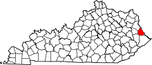 | |
| Unincorporated communities | ||