Liberty, Kentucky
| Liberty, Kentucky | |
|---|---|
| City | |
|
City Hall | |
 Location of Liberty, Kentucky | |
| Coordinates: 37°19′16″N 84°55′50″W / 37.32111°N 84.93056°WCoordinates: 37°19′16″N 84°55′50″W / 37.32111°N 84.93056°W | |
| Country | United States |
| State | Kentucky |
| County | Casey |
| Incorporated | 1860[1] |
| Government | |
| • Mayor | Steven Brown |
| Area | |
| • Total | 1.89 sq mi (4.90 km2) |
| • Land | 1.88 sq mi (4.87 km2) |
| • Water | 0.01 sq mi (0.03 km2) |
| Elevation | 810 ft (250 m) |
| Population (2010) | |
| • Total | 2,168 |
| • Density | 1,100/sq mi (440/km2) |
| Time zone | Eastern (EST) (UTC-5) |
| • Summer (DST) | EDT (UTC-4) |
| ZIP code | 42539 |
| Area code(s) | 606 |
| FIPS code | 21-46072 |
| GNIS feature ID | 0496352 |
| Website |
libertykentucky |

Liberty is a home rule-class city[2] in Casey County, Kentucky, in the United States. It is the seat of its county.[3] Its population was 2,168 at the 2010 U.S. census.[4]
History
It was founded prior to 1806 by several Revolutionary War veterans upon their military grants and named out of patriotic sentiment. In 1808, it was made the seat of Casey County owing to its central location. The post office was opened in 1814.[5] The town was formally established by the state assembly in 1830 and incorporated in 1860.[1]
In 2012, the Kentucky Supreme Court stuck down Liberty Police using road blocks as a means for writing tickets for failure to display a city sticker. The blasted Liberty for selecting the most intrusive means possible to achieve its goal.[6][7]
Geography
Liberty is located in central Casey County at 37°19′16″N 84°55′50″W / 37.32111°N 84.93056°W (37.321195, -84.930513),[8] in the valley of the Green River. U.S. Route 127 passes through the city, leading north 26 miles (42 km) to Danville and south 21 miles (34 km) to Russell Springs. According to the United States Census Bureau, Liberty has a total area of 1.9 square miles (4.9 km2), of which 0.01 square miles (0.03 km2), or 0.71%, is water.[4]
Climate
The climate in this area is characterized by hot, humid summers and generally mild to cool winters. According to the Köppen Climate Classification system, Liberty has a humid subtropical climate, abbreviated "Cfa" on climate maps.[9]
Demographics
| Historical population | |||
|---|---|---|---|
| Census | Pop. | %± | |
| 1810 | 33 | — | |
| 1830 | 118 | — | |
| 1840 | 135 | 14.4% | |
| 1890 | 136 | — | |
| 1900 | 450 | 230.9% | |
| 1910 | 330 | −26.7% | |
| 1920 | 368 | 11.5% | |
| 1930 | 549 | 49.2% | |
| 1940 | 676 | 23.1% | |
| 1950 | 1,291 | 91.0% | |
| 1960 | 1,578 | 22.2% | |
| 1970 | 1,765 | 11.9% | |
| 1980 | 2,206 | 25.0% | |
| 1990 | 1,937 | −12.2% | |
| 2000 | 1,850 | −4.5% | |
| 2010 | 2,168 | 17.2% | |
| Est. 2015 | 2,160 | [10] | −0.4% |
As of the census[12] of 2000, there were 1,850 people, 875 households, and 494 families residing in the city. The population density was 1,059.8 per square mile (409.2/km2). There were 979 housing units at an average density of 560.8 per square mile (216.5/km2). The racial makeup of the city was 98.16% White, 0.70% African American, 0.22% Native American, 0.05% Asian, 0.11% from other races, and 0.76% from two or more races. Hispanic or Latino of any race were 0.43% of the population.
There were 875 households out of which 20.6% had children under the age of 18 living with them, 38.2% were married couples living together, 15.5% had a female householder with no husband present, and 43.5% were non-families. 41.1% of all households were made up of individuals and 23.0% had someone living alone who was 65 years of age or older. The average household size was 1.98 and the average family size was 2.65.
In the city the population was spread out with 17.9% of the population under the age of 18, 7.7% from 18 to 24, 22.0% from 25 to 44, 24.4% from 45 to 64, and 28.0% who were 65 years of age or older. The median age was 47 years. For every 100 females there were 76.0 males. For every 100 females age 18 and over, there were 70.9 males.
The median income for a household in the city was $18,525, and the median income for a family was $27,105. Males had a median income of $25,954 versus $18,173 for females. The per capita income for the city was $14,269. About 24.9% of families and 28.3% of the population were below the poverty line, including 37.6% of those under age 18 and 28.7% of those age 65 or over.
Media
The town is served by low-power community station WIHE-LP and full-power stations WKDO and WKDO-FM.
Notable people
- Carl Mays, Major League Baseball pitcher
- William N. Sweeney, congressman from Kentucky
- Wallace Wilkinson, governor of Kentucky
References
- 1 2 Commonwealth of Kentucky. Office of the Secretary of State. Land Office. "Liberty, Kentucky". Accessed 1 Aug 2013.
- ↑ "Summary and Reference Guide to House Bill 331 City Classification Reform" (PDF). Kentucky League of Cities. Retrieved December 30, 2014.
- ↑ "Find a County". National Association of Counties. Archived from the original on May 31, 2011. Retrieved 2011-06-07.
- 1 2 "Geographic Identifiers: 2010 Demographic Profile Data (G001): Liberty city, Kentucky". U.S. Census Bureau, American Factfinder. Retrieved August 11, 2014.
- ↑ Rennick, Robert. Kentucky Place Names, pp. 171–172. University Press of Kentucky (Lexington), 1987. Accessed 1 Aug 2013.
- ↑ Kentucky Supreme Court Strikes Down City Sticker Roadblock; TheNewspaper; May 1, 2012.
- ↑ Singleton v. Kentucky; Kentucky Supreme Court; April 25, 2012.
- ↑ "US Gazetteer files: 2010, 2000, and 1990". United States Census Bureau. 2011-02-12. Retrieved 2011-04-23.
- ↑ Climate Summary for Liberty, Kentucky
- ↑ "Annual Estimates of the Resident Population for Incorporated Places: April 1, 2010 to July 1, 2015". Retrieved July 2, 2016.
- ↑ "Census of Population and Housing". Census.gov. Archived from the original on May 11, 2015. Retrieved June 4, 2015.
- ↑ "American FactFinder". United States Census Bureau. Archived from the original on September 11, 2013. Retrieved 2008-01-31.
External links
| Wikimedia Commons has media related to Liberty, Kentucky. |
Municipalities and communities of Casey County, Kentucky, United States | ||
|---|---|---|
| City | 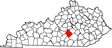 | |
| Unincorporated Communities | ||
| Ghost Town | ||