Sandy Hook, Kentucky
| Sandy Hook, Kentucky | |
|---|---|
| City | |
|
Elliott County courthouse in Sandy Hook | |
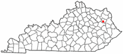 Location of Sandy Hook, Kentucky | |
| Coordinates: 38°5′33″N 83°7′26″W / 38.09250°N 83.12389°WCoordinates: 38°5′33″N 83°7′26″W / 38.09250°N 83.12389°W | |
| Country | United States |
| State | Kentucky |
| County | Elliott |
| Established | March 4, 1850[1] |
| Incorporated | 1872[1] |
| Reïncorporated | April 13, 1888[1] |
| Reäctivated | 1930[1] |
| Reäctivated | 1968[1] |
| Government | |
| • Type | Mayor-Council |
| • Mayor | James Adkins |
| Area | |
| • Total | 1.0 sq mi (2.5 km2) |
| • Land | 1.0 sq mi (2.5 km2) |
| • Water | 0.0 sq mi (0.0 km2) |
| Elevation | 771 ft (235 m) |
| Population (2010) | |
| • Total | 675 |
| • Density | 687/sq mi (265.4/km2) |
| Time zone | Eastern (EST) (UTC-5) |
| • Summer (DST) | EDT (UTC-4) |
| ZIP code | 41171 |
| Area code(s) | 606 |
| FIPS code | 21-68556 |
| GNIS feature ID | 0502983 |

Sandy Hook is a 5th-class city beside the Little Sandy River in Elliott County, Kentucky, in the United States. It is the seat of its county.[2] The population was 675 at the 2010 census.[3]
History
The head of navigation on the Little Sandy River was first settled in the 1820s. By the time of its establishment by the state legislature in 1850, it was known as "Sandy Hook" for the fishhook-shaped bend in the river at that point.[4]
It was chosen as the seat of the newly established Elliott County over nearby Newfoundland in 1869, owing to a generous donation of land for public buildings by resident James Hunter. In 1872, the city was incorporated as "Martinsburg" in honor of Congressman John P. Martin. The priority of another Martinsburg, Kentucky, meant that the post office (est. 1874) had to be named "Sandy Hook". The city resumed the name shortly after[4] and was reïncorporated as "Sandy Hook" in 1888.[1]
Geography
Sandy Hook is located near the center of Elliott County at 38°5′33″N 83°7′26″W / 38.09250°N 83.12389°W (38.092447, -83.123918)[5] at the head of navigation on the Little Sandy River in eastern Kentucky. According to the United States Census Bureau, the city has a total area of 0.97 square miles (2.5 km2), all land.[3]
Kentucky Route 7 passes through the center of town, leading northeast 22 miles (35 km) to Grayson and southwest 18 miles (29 km) to West Liberty. Kentucky Route 32 leads east 39 miles (63 km) to Louisa and heads north out of Sandy Hook with KY 7, eventually leading northwest 27 miles (43 km) to Morehead.
Demographics
| Historical population | |||
|---|---|---|---|
| Census | Pop. | %± | |
| 1870 | 62 | — | |
| 1880 | 83 | 33.9% | |
| 1890 | 151 | 81.9% | |
| 1900 | 148 | −2.0% | |
| 1910 | 160 | 8.1% | |
| 1920 | 115 | −28.1% | |
| 1930 | 155 | 34.8% | |
| 1940 | 184 | 18.7% | |
| 1950 | 238 | 29.3% | |
| 1960 | 195 | −18.1% | |
| 1970 | 561 | 187.7% | |
| 1980 | 627 | 11.8% | |
| 1990 | 548 | −12.6% | |
| 2000 | 678 | 23.7% | |
| 2010 | 675 | −0.4% | |
| Est. 2015 | 630 | [6] | −6.7% |
As of the census[8] of 2000, there were 678 people, 292 households, and 167 families residing in the city. The population density was 716.1 people per square mile (275.6/km²). There were 332 housing units at an average density of 350.7 per square mile (134.9/km²). The racial makeup of the city was 99.26% White, 0.15% African American, 0.15% Native American, and 0.44% from two or more races.
There were 292 households out of which 27.1% had children under the age of 18 living with them, 36.0% were married couples living together, 18.8% had a female householder with no husband present, and 42.8% were non-families. 41.8% of all households were made up of individuals and 18.5% had someone living alone who was 65 years of age or older. The average household size was 2.13 and the average family size was 2.90.
In the city the population was spread out with 23.5% under the age of 18, 8.4% from 18 to 24, 22.1% from 25 to 44, 20.8% from 45 to 64, and 25.2% who were 65 years of age or older. The median age was 42 years. For every 100 females there were 65.0 males. For every 100 females age 18 and over, there were 60.2 males.
The median income for a household in the city was $14,313, and the median income for a family was $21,071. Males had a median income of $40,417 versus $22,031 for females. The per capita income for the city was $13,278. About 28.2% of families and 31.2% of the population were below the poverty line, including 43.1% of those under age 18 and 26.4% of those age 65 or over.
Culture
Sandy Hook is the hometown of late country music singer Keith Whitley. A statue of Whitley playing his guitar can be seen in the local cemetery, and a local street was renamed "Keith Whitley Boulevard." Whitley's body is buried in the Spring Hill Cemetery in Nashville, Tennessee.
Elliot County is in a dry county, and it is illegal to sell alcohol within the city. The Little Sandy Correctional Complex, a medium-security prison operated by the Kentucky Department of Corrections, is located 6 miles (10 km) northeast of Sandy Hook.
References
- 1 2 3 4 5 6 Commonwealth of Kentucky. Office of the Secretary of State. Land Office. "Sandy Hook, Kentucky". Accessed 16 August 2013.
- ↑ "Find a County". National Association of Counties. Retrieved 2011-06-07.
- 1 2 "Geographic Identifiers: 2010 Demographic Profile Data (G001): Sandy Hook city, Kentucky". American Factfinder. U.S. Census Bureau. Retrieved February 1, 2016.
- 1 2 Rennick, Robert. Kentucky Place Names. University Press of Kentucky (Lexington), 1987.
- ↑ "US Gazetteer files: 2010, 2000, and 1990". United States Census Bureau. 2011-02-12. Retrieved 2011-04-23.
- ↑ "Annual Estimates of the Resident Population for Incorporated Places: April 1, 2010 to July 1, 2015". Retrieved July 2, 2016.
- ↑ "Census of Population and Housing". Census.gov. Retrieved June 4, 2015.
- ↑ "American FactFinder". United States Census Bureau. Retrieved 2008-01-31.
Municipalities and communities of Elliott County, Kentucky, United States | ||
|---|---|---|
| City | 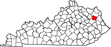 | |
| Unincorporated communities | ||
