Mayfield, Kentucky
| Mayfield, Kentucky | |
|---|---|
| City | |
|
Graves County Courthouse (2008) | |
 Location of Mayfield, Kentucky | |
| Coordinates: 36°44′16″N 88°38′24″W / 36.73778°N 88.64000°WCoordinates: 36°44′16″N 88°38′24″W / 36.73778°N 88.64000°W | |
| Country | United States |
| State | Kentucky |
| County | Graves |
| Established | 1824[1] |
| Incorporated | 1846[1] |
| Named for | Mayfield Creek[2] |
| Area | |
| • Total | 6.7 sq mi (17.3 km2) |
| • Land | 6.7 sq mi (17.3 km2) |
| • Water | 0.0 sq mi (0.0 km2) |
| Elevation | 476 ft (145 m) |
| Population (2010) | |
| • Total | 10,024 |
| • Density | 1,500/sq mi (580/km2) |
| Time zone | Central (CST) (UTC-6) |
| • Summer (DST) | CDT (UTC-5) |
| ZIP code | 42066 [3] |
| Area code(s) | 270 & 364 |
| FIPS code | 21-50898 [4] |
| GNIS feature ID | 0497715 [5] |
| Website | cityofmayfield.org |

Mayfield is a home rule-class city[6] in Graves County, Kentucky, in the United States. It is the seat of its county.[7] The population was 10,024 as of the 2010 U.S. census.[8]
History
Mayfield is in the center of the Jackson Purchase, an eight-county region purchased by Isaac Shelby and Andrew Jackson from the Chickasaw Indians in 1818. Mayfield was established as the county seat of Graves County in 1821, and the county was formally organized in 1823. John Anderson is believed to have been the first settler, arriving in 1819 and building a log home on Mayfield Creek. In December 1821, Anderson was appointed county court clerk and moved about two and a half miles to the site that became Mayfield. According to Trabue Davis, the town's name originates indirectly from a gambler named Mayfield, who was kidnapped about 1817 at a racetrack near what is now Hickman. He was carried to the site of today's Mayfield, where he carved his name into a tree in hopes that someone would see it. He then tried to escape, but he drowned trying to cross what is now called Mayfield Creek. The future town got its name from the creek.[2]
The completion of the Memphis, New Orleans, and Northern Railroad in 1858 connected Mayfield with the outside world. Beginning with the Mayfield Woolen Mills in 1860, manufacturing clothing became the main industry in Mayfield for the next hundred years. The town was also a major market for loose-leaf tobacco.
During the Civil War, the Jackson Purchase including Mayfield strongly supported the Confederate cause. The Jackson Purchase has even been called "Kentucky's South Carolina".[9] On May 29, 1861, a group of Southern sympathizers from Kentucky and Tennessee met at the Graves County Courthouse to discuss the possibility of joining the Jackson Purchase to West Tennessee. Most records of the event are lost, probably due to an 1887 fire that destroyed the courthouse. In 1907, Fulton County judge Herbert Carr recalled that the Mayfield Convention adopted a resolution for secession, and a historical marker in front of the courthouse now proclaims this as fact. However, records of the meeting kept by a Union sympathizer do not mention any such resolution, and historian Berry Craig argues that the convention believed Kentucky would eventually secede and a resolution to break away was unnecessary. Surviving records do show that the convention adopted resolutions condemning President Abraham Lincoln for "waging a bloody and cruel war" against the South, urging Gov. Beriah Magoffin to resist Union forces and praising him for refusing to answer Lincoln's demand for soldiers. They also condemned the Federal government for providing "Lincoln guns" to Union sympathizers in eastern Kentucky. The convention nominated Henry Burnett to represent Kentucky's First District in Congress. The Mayfield Convention was followed by the Russellville Convention, which created the provisional Confederate government of Kentucky.[10]
Following the war, these southern sympathies were demonstrated by the long dominance of the Democratic Party in local elections. During the Civil Rights Movement, the local schools were slow to integrate, but they finally did so without violence. The "Mayfield Ten", ten black students from the segregated Dunbar High School, were allowed to register at all-white Mayfield High School in 1956.
In 2000, Mayfield was shocked by the murder of Jessica Currin, a local resident. The case was finally closed nearly seven years later with the help of a local amateur investigator and a British journalist.
On May 10, 2016, an EF3 tornado passed just north of the city limits. There were ten injuries.[11]
Board of Zoning controversy
On August 24, 2010 the Board of Zoning reversed its decision to allow a group of refugees to hold Islamic religious services in a local building. Dick Conner, who owns a flower shop adjacent to the proposed mosque, told the media, "If the neighbor was a Baptist church it might be different". However, the five-member board of zoning adjustment, chaired by Austin Copeland, voted 4-0 with one board member, Roy D. Henley, absent due to jury duty, citing violations of State Zoning Statute 100 as the grounds to deny the permit.
Later the same day, one of the Somali refugees was accused and charged with attempting to kidnap a teenage girl. The events surrounding the alleged incident met with sharp criticism, with local news agencies ignoring it as an attempt to belittle the character of the Muslims.[12]
The building that had used by the Somalis as a community center and mosque was abandoned after the ruling.
Geography
Mayfield is located at 36°44′16″N 88°38′24″W / 36.73778°N 88.64000°W (36.737693, -88.640122).[13] According to the United States Census Bureau, the city has a total area of 6.7 square miles (17 km2), all land.
Climate
The climate in this area is characterized by hot, humid summers and generally mild to cool winters. According to the Köppen Climate Classification system, Mayfield has a humid subtropical climate, abbreviated "Cfa" on climate maps.[14]
Demographics
| Historical population | |||
|---|---|---|---|
| Census | Pop. | %± | |
| 1830 | 44 | — | |
| 1860 | 556 | — | |
| 1870 | 779 | 40.1% | |
| 1880 | 1,839 | 136.1% | |
| 1890 | 2,909 | 58.2% | |
| 1900 | 4,081 | 40.3% | |
| 1910 | 5,916 | 45.0% | |
| 1920 | 6,583 | 11.3% | |
| 1930 | 8,177 | 24.2% | |
| 1940 | 8,619 | 5.4% | |
| 1950 | 8,990 | 4.3% | |
| 1960 | 10,762 | 19.7% | |
| 1970 | 10,724 | −0.4% | |
| 1980 | 10,705 | −0.2% | |
| 1990 | 9,935 | −7.2% | |
| 2000 | 10,349 | 4.2% | |
| 2010 | 10,024 | −3.1% | |
| Est. 2015 | 10,080 | [15] | 0.6% |
As of the census[4] of 2000, there were 10,349 people, 4,358 households, and 2,667 families residing in the city. The population density was 1,549.8 people per square mile (598.2/km²). There were 4,907 housing units at an average density of 734.8 per square mile (283.6/km²). The racial makeup of the city was 60.57% White, 13.31% African American, 0.21% Native American, 0.37% Asian, 3.48% from other races, and 2.07% from two or more races. Hispanics or Latinos of any race were 25.86% of the population. Recent years have seen a large influx of Amish residents nearby.
There were 4,358 households out of which 26.9% had children under the age of 18 living with them, 42.4% were married couples living together, 15.6% had a female householder with no husband present, and 38.8% were non-families. 35.3% of all households were made up of individuals and 18.9% had someone living alone who was 65 years of age or older. The average household size was 2.27 and the average family size was 2.89.
The age distribution was 23.3% under the age of 18, 9.2% from 18 to 24, 24.9% from 25 to 44, 20.9% from 45 to 64, and 21.6% who were 65 years of age or older. The median age was 39 years. For every 100 females there were 86.0 males. For every 100 females age 18 and over, there were 80.0 males.
The median income for a household in the city was $20,400, and the median income for a family was $27,463. Males had a median income of $29,324 versus $18,575 for females. The per capita income for the city was $15,327. About 23.4% of families and 27.5% of the population were below the poverty line, including 40.4% of those under age 18 and 15.9% of those age 65 or over.
Despite being in a dry county (Graves), sales by the drink in restaurants of the city limits of Mayfield seating at least 100 diners and at the Mayfield Golf & Country Club are allowed. There are no Sunday sales of alcoholic beverages permitted, except at Mayfield Golf and Country Club.
Media
Local media in Mayfield includes the Mayfield Messenger, a five-day (Monday through Friday) daily newspaper. Radio stations WLLE-FM, WNGO-AM, and WYMC-AM are licensed to Mayfield.
Sports
Mayfield was home to the Class D "Kitty League" Mayfield Pantsmakers, Mayfield Clothiers, and Browns from the 1920s to the 1950s.[17]
In 2009, Mayfield will be the home of the new KIT League team, West Kentucky Mavericks. Despite being based in Mayfield, the team will not play any home games and will play all of its games as "away" games.
Education
Mid-Continent University, formerly Mid-Continent Baptist Bible College, was located just north of Mayfield off U.S. Route 45. It closed after the Spring 2014 term due to alleged financial (aid) mismanagement.
Mayfield Independent City School District was established on July 1, 1908 with the selection and meeting of its first Board Members, organized by Mr. W.J. Webb.[18]
Mayfield High School has won 12 Kentucky High School Athletic Association football championships in classes A and AA in a total of 21 title game appearances. At the conclusion of the 2015 season Mayfield moved into fourth place nationally with 846 all-time wins. Mayfield High School mascot is "Cardinals".
The Graves County High School Co-Ed Cheerleading Team won the titles of National Champions in 2006, 2007, 2009, 2010, and 2011 and State Champions in 2005, 2006, 2007 and 2008, 2010, and 2012. Graves County High School mascot is "Eagles.
Notable people
- Lucien Anderson[19][20] - former United States representative
- David Boaz – libertarian political thinker
- Andrew Boone[21] - former United States representative
- LaVerne Butler - president of Mid-Continent University from 1988–1997 and Southern Baptist clergyman[22]
- Betsy Cook - singer, songwriter, musician
- Randy Galloway - sports journalist and Texas radio personality
- Noble Jones Gregory[19][23] - former United States representative
- William Voris Gregory[19] - former United States representative
- Ed Gardner, president of the First National Bank, who built the beautiful home Edana Locus (quasi-Latin for "Ed and Annie's place") about 1928
- Robert C. McAlister - Lieutenant General (Retired), United States Army
- Bobbie Ann Mason[24] - author
- Kent Robbins[25] - songwriter
- Kevin Skinner - musician and America's Got Talent Season 4 winner
- Robert Burns Smith - third Governor of Montana[26]
- Chuck Taylor - professional wrestler
- Ellis Wilson - artist
References
- 1 2 Commonwealth of Kentucky. Office of the Secretary of State. Land Office. "Mayfield, Ky". Accessed 25 August 2013.
- 1 2 Davis, D. Trabue. Story of Mayfield Through a Century, 1823-1923.
- ↑ United States Postal Service (2012). "USPS - Look Up a ZIP Code". Retrieved 2012-02-15.
- 1 2 "American FactFinder". United States Census Bureau. Archived from the original on September 11, 2013. Retrieved 2008-01-31.
- ↑ "US Board on Geographic Names". United States Geological Survey. 2007-10-25. Retrieved 2008-01-31.
- ↑ "Summary and Reference Guide to House Bill 331 City Classification Reform" (PDF). Kentucky League of Cities. Retrieved December 30, 2014.
- ↑ "Find a County". National Association of Counties. Archived from the original on May 31, 2011. Retrieved 2011-06-07.
- ↑ United States Census. .
- ↑ Craig, Barry. "Kentucky's South Carolina: The Secession Crisis of 1860–1861". Accessed 25 August 2013.
- ↑ Craig, pp. 339, 346–347, 352–353, 359–360
- ↑ "EF3 Tornado Leaves Damage, 10 Injured in Mayfield, Kentucky; Flooding Leads to Water Rescues Near Nashville". The Weather Channel. Retrieved August 18, 2016.
- ↑ Kidnapping False
- ↑ "US Gazetteer files: 2010, 2000, and 1990". United States Census Bureau. 2011-02-12. Retrieved 2011-04-23.
- ↑ Climate Summary for Mayfield, Kentucky
- ↑ "Annual Estimates of the Resident Population for Incorporated Places: April 1, 2010 to July 1, 2015". Retrieved July 2, 2016.
- ↑ "Census of Population and Housing". Census.gov. Archived from the original on May 11, 2015. Retrieved June 4, 2015.
- ↑ http://www.baseball-reference.com/bullpen/Kentucky-Illinois-Tennessee_League
- ↑ http://www.mayfield.k12.ky.us/ABOUTOURDISTRICT/HISTORYANDTIMELINE/tabid/259/Default.aspx
- 1 2 3 The Political Graveyard
- ↑ United States Congress. "Lucien Anderson (id: A000201)". Biographical Directory of the United States Congress.
- ↑ United States Congress. "Andrew Boone (id: B000629)". Biographical Directory of the United States Congress.
- ↑ Michael Foust, Obituary of LaVerne Butler, Baptist Press, December 21, 2010
- ↑ United States Congress. "Noble Jones Gregory (id: G000447)". Biographical Directory of the United States Congress.
- ↑ 1995 answers by Mason to Kentucky high school students
- ↑ Kent Robbins Archived September 8, 2007, at the Wayback Machine.
- ↑ "Montana Governor Robert Burns Smith". National Governors Association. Retrieved October 10, 2012.
- Craig, Berry F. (Autumn 2001). "The Jackson Purchase Considers Secession: The 1861 Mayfield Convention". The Register of the Kentucky Historical Society. 99 (4): 339–361.
External links
- City of Mayfield
- Mayfield and Graves County Chamber of Commerce and Tourism
- Mayfield Independent Schools
- Graves County Schools
- Mayfield Graves County Airport
Municipalities and communities of Graves County, Kentucky, United States | ||
|---|---|---|
| Cities | 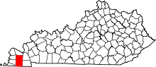 | |
| CDPs | ||
| Unincorporated communities | ||
| Footnotes | ‡This populated place also has portions in an adjacent county or counties | |
