Morgantown, Kentucky
| Morgantown, Kentucky | |
|---|---|
| City | |
|
Butler County Courthouse in Morgantown | |
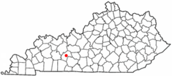 Location of Morgantown within Kentucky | |
| Coordinates: 37°13′10″N 86°41′33″W / 37.21944°N 86.69250°WCoordinates: 37°13′10″N 86°41′33″W / 37.21944°N 86.69250°W | |
| Country | United States |
| State | Kentucky |
| County | Butler |
| Incorporated | 1813[1] |
| Government | |
| • Mayor | Billy Phelps |
| Area | |
| • Total | 2.4 sq mi (6.3 km2) |
| • Land | 2.4 sq mi (6.3 km2) |
| • Water | 0.0 sq mi (0.0 km2) |
| Elevation | 564 ft (172 m) |
| Population (2010) | |
| • Total | 2,394 |
| Time zone | CST (UTC-6) |
| • Summer (DST) | CDT (UTC-5) |
| ZIP Code | 42261 |
| Area code(s) | 270 & 364 |
| FIPS code | 21-53490 |
| GNIS feature ID | 0498600 |
| Website |
www |

Morgantown is a home rule-class city[2] in, and the seat of, Butler County, Kentucky, United States.[3] The population was 2,394 at the time of the 2010 census.[4]
History
The settlement may have originally been called Funkhouser Hill after Christopher Funkhouser, the local landowner who donated 60 acres (24 ha) of land to establish a seat for the newly formed Butler County in 1811.[5] The etymology of the city's present name (originally written Morgan Town) is uncertain. It may have been chosen to honor a hunter named Morgan or to honor Daniel Morgan Smith, the first child born in the town.[6] It was incorporated as Morgantown by the state assembly in 1813,[1] although the post office also went by the name Butler Court House during the 19th century.[5]
Granville Allen, a member of the 17th Kentucky Infantry, was one of the first Union soldiers to die in the Civil War, in a skirmish on October 29, 1861. A monument was erected by the Granville Allen Post #93 GAR. This first skirmish between the North and South took place on the Daniel Boone Johnson property. The Johnson Cemetery is still there and is directly above the monument, which is a limestone marker cut into the side of the old Logansport road. Morgantown has one of only two monuments dedicated to soldiers of both sides who died in the Civil War, and it is located at the county courthouse, the Confederate-Union Veterans' Monument in Morgantown.
The city formerly had a sister city in Tatsuruhama, Japan, but that city is now part of Nanao.
Geography
Morgantown is located near the center of Butler County at 37°13′10″N 86°41′33″W / 37.21944°N 86.69250°W (37.219465, -86.692513).[7] It is situated on the top of a bluff on the west side of the Green River.
According to the United States Census Bureau, the city has a total area of 2.4 square miles (6.3 km2), of which 0.012 square miles (0.03 km2), or 0.49%, is water.[4]
Demographics
| Historical population | |||
|---|---|---|---|
| Census | Pop. | %± | |
| 1850 | 89 | — | |
| 1860 | 125 | 40.4% | |
| 1870 | 125 | 0.0% | |
| 1880 | 204 | 63.2% | |
| 1890 | 250 | 22.5% | |
| 1900 | 587 | 134.8% | |
| 1910 | 569 | −3.1% | |
| 1920 | 707 | 24.3% | |
| 1930 | 551 | −22.1% | |
| 1940 | 859 | 55.9% | |
| 1950 | 850 | −1.0% | |
| 1960 | 1,318 | 55.1% | |
| 1970 | 1,394 | 5.8% | |
| 1980 | 2,000 | 43.5% | |
| 1990 | 2,284 | 14.2% | |
| 2000 | 2,544 | 11.4% | |
| 2010 | 2,394 | −5.9% | |
| Est. 2015 | 2,475 | [8] | 3.4% |
As of the census[10] of 2000, there were 2,544 people, 1,051 households, and 627 families residing in the city. The population density was 754.8 people per square mile (291.5/km²). There were 1,148 housing units at an average density of 340.6 per square mile (131.5/km²). The racial makeup of the city was 95.52% White, 1.10% African American, 0.16% Native American, 0.31% Asian, 2.36% from other races, and 0.55% from two or more races. Hispanic or Latino of any race were 3.22% of the population.
There were 1,051 households out of which 29.0% had children under the age of 18 living with them, 40.9% were married couples living together, 15.3% had a female householder with no husband present, and 40.3% were non-families. 36.9% of all households were made up of individuals and 18.5% had someone living alone who was 65 years of age or older. The average household size was 2.23 and the average family size was 2.90.
In the city the population was spread out with 23.0% under the age of 18, 11.2% from 18 to 24, 24.8% from 25 to 44, 21.0% from 45 to 64, and 19.9% who were 65 years of age or older. The median age was 38 years. For every 100 females there were 82.9 males. For every 100 females age 18 and over, there were 76.9 males.
The median income for a household in the city was $19,912, and the median income for a family was $27,218. Males had a median income of $24,671 versus $18,594 for females. The per capita income for the city was $12,100. About 24.9% of families and 27.6% of the population were below the poverty line, including 36.0% of those under age 18 and 21.2% of those age 65 or over.
In 2010, Morgantown had the 16th-lowest median household income of all places in the United States with a population over 1,000.[11]
Transportation
Prior to 1917, the city's primary channel of transportation was the Green River. However, in 1917, the river froze, leaving the city without supplies for two months. A subsequent period of road-building began, and in 1930, a road connecting Morgantown with Bowling Green provided an alternate conduit for commerce.[6]
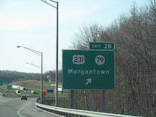
Morgantown is now served by the William H. Natcher Parkway, which is designated as part of the future Interstate 66 corridor and the future Interstate 67 corridor. Via the parkway it is 23 miles (37 km) southeast to Bowling Green and 48 miles (77 km) north to Owensboro on the Ohio River. Other roads include U.S. Highway 231, Kentucky Route 79, and Kentucky Route 70.
The city does not have railroad service.
Events of interest
Morgantown's municipal park, Charles Black City Park, is home to the annual Green River Catfish Festival held the week of July 4.[6]
Notable people
- William S. Taylor, 33rd Governor of Kentucky
- John Moore, bishop of the Methodist Episcopal Church, South
- Keith Butler, pitcher, St. Louis Cardinals organization[12]
- Tyler Reed (swimmer)[13]
Climate
The climate in this area is characterized by hot, humid summers and generally mild to cool winters. According to the Köppen Climate Classification system, Morgantown has a humid subtropical climate, abbreviated "Cfa" on climate maps.[14]
References
- 1 2 Commonwealth of Kentucky. Office of the Secretary of State. Land Office. "Morgantown, Kentucky". Accessed 26 Aug 2013.
- ↑ "Summary and Reference Guide to House Bill 331 City Classification Reform" (PDF). Kentucky League of Cities. Retrieved December 30, 2014.
- ↑ "Find a County". National Association of Counties. Retrieved 2011-06-07.
- 1 2 "Geographic Identifiers: 2010 Demographic Profile Data (G001): Morgantown city, Kentucky". U.S. Census Bureau, American Factfinder. Retrieved November 27, 2013.
- 1 2 Rennick, Robert. Kentucky Place Names, p. 203. University Press of Kentucky (Lexington), 1987. Accessed 1 Aug 2013.
- 1 2 3 Kleber, John E., ed. (1992). "Morgantown". The Kentucky Encyclopedia. Lexington, Ky.: The University Press of Kentucky. ISBN 0-8131-1772-0.
- ↑ "US Gazetteer files: 2010, 2000, and 1990". United States Census Bureau. 2011-02-12. Retrieved 2011-04-23.
- ↑ "Annual Estimates of the Resident Population for Incorporated Places: April 1, 2010 to July 1, 2015". Retrieved July 2, 2016.
- ↑ "Census of Population and Housing". Census.gov. Retrieved June 4, 2015.
- ↑ "American FactFinder". United States Census Bureau. Retrieved 2008-01-31.
- ↑ "US Census". Retrieved 18 January 2014.
- ↑ "Wabash Valley College roster". National Junior College Athletic Association. 2013. Retrieved 7 June 2013.
- ↑ "University of Kentucky Swimming Roster". University of Kentucky Athletics. Retrieved 14 November 2016.
- ↑ Climate Summary for Morgantown, Kentucky
External links
| Wikivoyage has a travel guide for Morgantown, Kentucky. |
 Media related to Morgantown, Kentucky at Wikimedia Commons
- City of Morgantown official website
- BeechTree News - News and Information for the Butler County, Kentucky area
Municipalities and communities of Butler County, Kentucky, United States | ||
|---|---|---|
| Cities | 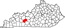 | |
| Unincorporated communities | ||