Cuddalore district
| Cuddalore district கடலூர் மாவட்டம் | |
|---|---|
| District | |
 Location in Tamil Nadu, India | |
| Coordinates: 11°45′0″N 79°45′0″E / 11.75000°N 79.75000°ECoordinates: 11°45′0″N 79°45′0″E / 11.75000°N 79.75000°E | |
| Country |
|
| State | Tamil Nadu |
| Headquarters | Cuddalore |
| Talukas | Chidambaram, Cuddalore, Kattumannarkoil, Panruti, Titakudi, Vriddachalam |
| Government | |
| • Collector & District Magistrate | Shri. T.P.Rajesh I.A.S |
| Population (2011) | |
| • Total | 2,605,914 |
| • Density | 702/km2 (1,820/sq mi) |
| Languages | |
| • Official | Tamil, English |
| Time zone | IST (UTC+5:30) |
| PIN | 607xxx |
| Telephone code | 91 04142 |
| ISO 3166 code | [[ISO 3166-2:IN|]] |
| Vehicle registration | TN-31,TN-91 [1] |
| Largest city | Cuddalore |
| Nearest city | Pondicherry, Chennai |
| Sex ratio | 984 ♂/♀ |
| Literacy | 79.04% |
| Legislature type | elected |
| Vidhan Sabha constituency | Cuddalore |
| Avg. summer temperature | 41 °C (106 °F) |
| Avg. winter temperature | 20 °C (68 °F) |
| Website |
www |
Cuddalore District (Tamil: கடலூர் மாவட்டம்) is one of the districts of Tamil Nadu state in southern India. The city of Cuddalore is the district headquarters. According to Census 2011, Cuddalore district had a population of 2,605,914 with a sex-ratio of 987 females for every 1,000 males.
History
From ancient times the old town has been a seaport. Through the centuries, Cuddalore has been subject to a number of foreign powers including the Netherlands, Portugal, France and more recently, the British. In the 1600s, the French and English came to Cuddalore for trade and business. The French established a settlement at Pondicherry and the British at Cuddalore. The French and English, while engaged in the Seven Years' War, fought the naval "Battle of Cuddalore" on 29 April 1758. It was an indecisive battle between a British squadron, under Vice-Admiral George Pocock and a French squadron, under Comte d'Aché and the newly appointed Governor General Comte Thomas Lally. Cuddalore surrendered to French troops on 29 April 1758. From 1789 to 1794, there was further unrest in Cuddalore due to the War of American Independence and the Second Anglo-Mysore War culminating in the siege of Cuddalore, after which the town was returned to Britain as part of a peace treaty. In 1782, during the Second Anglo Mysore war, the French troops allied with Tipu Sultan and won over the British, after which Cuddalore became a chief port against the French. In 1783, General James Stuart (1735-93) led his troops to fend off French troops. There were five different naval actions off the coast during the same year, all of which were indecisive.[1] Some streets in Cuddalore retain British names such as Clive street, Wellington street, Sloper Street, Canning Street, Rope Street (Rope Street, Wellington Street, Sloper Street and Canning Street jointly known as Salangukara Village), Lawrence road and Imperial road. The Cuddalore Central Prison, opened in 1865, is an historically important landmark.Subramanya Bharathi and other political leaders served prison terms there.
The siege of Cuddalore in 1783 in sea Tsunami waves that followed the 2004 Indian Ocean earthquake near Sumatra hit the eastern coast of India on 26 December 2004 at 0832h, resulting in 572 casualties. Several fishing hamlets disappeared, while Silver Beach and the historically important Cuddalore Port were devastated. Fort St. David survived without damage. In 2012, Cyclone Thane caused widespread damage to crops and buildings.
Geography
The district has an area of 3,564 km². It is bounded on the north by Viluppuram District, on the east by the Bay of Bengal, on the south by Nagapattinam District, and on the west by Perambalur District. The district is drained by Gadilam and Pennaiyar rivers in the north, Vellar and Kollidam River(Coleroon) in south.
Economy
In 2006 the Ministry of Panchayati Raj named Cuddalore one of the country's 250 most backward districts (out of a total of 640).[2] It is one of the six districts in Tamil Nadu currently receiving funds from the Backward Regions Grant Fund Programme (BRGF).[2]
Demographics
According to 2011 census, Cuddalore district had a population of 2,605,914 with a sex-ratio of 987 females for every 1,000 males, much above the national average of 929.[3] A total of 279,950 were under the age of six, constituting 147,644 males and 132,306 females. Scheduled Castes and Scheduled Tribes accounted for 29.32% and .6% of the population respectively. The average literacy of the district was 69.66%, compared to the national average of 72.99%.[3] The district had a total of 635,578 households. There were a total of 1,169,880 workers, comprising 136,035 cultivators, 325,599 main agricultural labourers, 19,151 in house hold industries, 356,486 other workers, 332,609 marginal workers, 29,135 marginal cultivators, 213,813 marginal agricultural labourers, 12,876 marginal workers in household industries and 76,785 other marginal workers.[4] The district has a population density of 702 inhabitants per square kilometre (1,820/sq mi) .[5]
Divisions
Cuddalore District comprises 8 taluks, 13 Blocks, 5 Municipalities and 18 Town Panchayats.
Urban centres
Cuddalore district consists of the following urban cities:
- Cuddalore town
- Chidambaram town
- Panruti town
- Virudhachalam town
- Neyveli
- Nellikuppam
Agriculture
The district contributes significantly to the Tamil Nadu state production of cashew nut and jack fruit.[6]
Tourist attractions
- Natraja Temple at Chidambaram
- Bhuvaraha kshetra or Bhuvaraga temple Srimushnam and Shri Nitheeswara temple
- Sri Virudhagireeswarar Temple, Virudhachalam [7]
- Thiru ArutPrakasa Vallalar Deiva Nilayam, Vadalur aka vallalar nilayam at vadalur [8]
- Pataleeswarar temple, a Hindu temple, built during the 7th century and dated a millenia earlier is the most prominent landmark in Cuddalore.[9] The name, Thirupathipuliyur, is associated with the legend behind the temple. The temple is revered in the verses of 7th century Saiva saints Appar and Tirugnanasambandar in their works in Tevaram.[10]
- The Devanathaswami Temple, located in Thiruvanthipuram, is another Hindu pilgrimage site located in the outskirts of Cuddalore.[9]
- Silver Beach at Devanampatinam (Cuddalore)
- Veerattaneswarar Temple, near Panruti
- Pichavaram, one of the world's largest mangrove forests
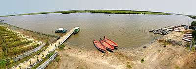
- Veeranam Lake, Kattumannarkoil
- Wellington Lake, Keezhseruvai Village, Tittakudi taluk.
2015 Floods
Cuddalore district was among those most severely affected by the flooding. Six of the district's 13 blocks suffered extensive damage during the floods in November. The resumption of heavy rainfall from 1 December again inundated the Cuddalore municipality and the district, displacing tens of thousands of people. Rains continued through 9 December. Despite the state government and individuals sending rescue teams and tonnes of relief materials to the district, thousands of those affected continued to lack basic supplies due to inadequate distribution efforts; this resulted in several relief lorries being stopped and looted by survivors. Large swaths of Cuddalore city and the district remained inundated as of 10 December, with thousands of residents marooned by floodwaters and over 60,000 hectares of farmland inundated; over 30,000 people had been evacuated to relief camps
See also
References
- ↑ www.tn.gov.in
- 1 2 Ministry of Panchayati Raj (September 8, 2009). "A Note on the Backward Regions Grant Fund Programme" (PDF). National Institute of Rural Development. Archived from the original (PDF) on April 5, 2012. Retrieved September 27, 2011.
- 1 2 "Census Info 2011 Final population totals". Office of The Registrar General and Census Commissioner, Ministry of Home Affairs, Government of India. 2013. Retrieved 26 January 2014.
- ↑ "Census Info 2011 Final population totals - Cuddalore district". Office of The Registrar General and Census Commissioner, Ministry of Home Affairs, Government of India. 2013. Retrieved 26 January 2014.
- ↑ "District Census 2011". Census2011.co.in. 2011. Retrieved 2011-09-30.
- ↑ Agriculture, Tamil Nadu state
- ↑ http://virudhagireeswartemple.org/e1.htm
- ↑ http://www.vallalardheivanilayam.org
- 1 2 "Tourist attraction in Cuddalore". Cuddalore municipality. 2011. Retrieved 2012-12-29.
- ↑ "Sri Padaleeswarar temple". Dinamalar. Retrieved 2014-01-03.
External links
| Wikimedia Commons has media related to Cuddalore district. |
| District Headquarters | 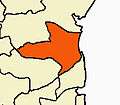 | |
|---|---|---|
| Country | ||
| State | ||
| Region | ||
| Taluks | ||
| Blocks | ||
| Municipalities | ||
| Rivers | ||
| Lakes | ||
| History | ||
| Places of interest | ||
| Universities | ||
| State symbols |
|
|---|---|
| Governance |
|
| Topics | |
| Districts |
|
| Major cities | |