Lawrenceburg, Kentucky
| Lawrenceburg, Kentucky | |
|---|---|
| City | |
|
Anderson County Courthouse in Lawrenceburg | |
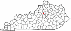 Location in the Commonwealth of Kentucky | |
| Coordinates: 38°01′53″N 84°53′46″W / 38.03139°N 84.89611°WCoordinates: 38°01′53″N 84°53′46″W / 38.03139°N 84.89611°W | |
| Country | United States |
| State | Kentucky |
| County | Anderson |
| Established | 1820 |
| Incorporated | 1850 |
| Named for | a local landowner |
| Government | |
| • Mayor | Robert "Sandy" Goodlett |
| Area | |
| • Total | 5.87 sq mi (15.2 km2) |
| • Land | 5.87 sq mi (15.2 km2) |
| • Water | 0.0 sq mi (0 km2) |
| Elevation | 787 ft (240 m) |
| Population (2014) | |
| • Total | 11,093 |
| • Density | 1,789/sq mi (691/km2) |
| Time zone | EST (UTC-5) |
| • Summer (DST) | EDT (UTC-4) |
| ZIP code | 40342 |
| Area code(s) | 502 |
| FIPS code | 21-44146 |
| GNIS feature ID | 0496081 |
| Website | www.lawrenceburgky.org |

Lawrenceburg is a home rule-class city[1] in Anderson County, Kentucky, in the United States. The population was 10,505 at the 2010 census. It is the seat of its county.[2] Lawrenceburg is part of the Frankfort, Kentucky, micropolitan statistical area.
Geography
Lawrenceburg is located at 38°02′14″N 84°53′48″W / 38.03722°N 84.89667°W (38.0372967, -84.8966171).[3] According to the United States Census Bureau, the city has a total area of 3.7 square miles (9.6 km2), all land.
History
The site of Lawrenceburg was settled in the early 1780s by a German immigrant named Jacob Kaufman and was first called Kaufman's or Coffman's Station. The post office was established as Lawrenceburgh on January 22, 1817, for William Lawrence, a local tavern owner. The community was incorporated as Lawrence in 1820[4] by the Court of Franklin County (of which it was then a part) but renamed Lawrenceburg in 1827.[5] James Lawrence, a naval officer, is the namesake.[6]
The city was formally incorporated by the state assembly in 1850.[4]
The Four Roses distillery in Lawrenceburg was founded in 1888 and the physical distillery was built in 1910 in Spanish Mission-style architecture, and it is listed on the National Register of Historic Places. The Wild Turkey bourbon distillery is also located in Lawrenceburg.
Education
Primary schools
- Early Childhood Center
- Emma B. Ward Elementary School
- Robert B. Turner Elementary School
- Saffell Street Elementary School
- Christian Academy of Lawrenceburg (private)
- Harvest Christian School (private)
Secondary schools
- Anderson County Middle School
- Anderson County High School
- Christian Academy of Lawrenceburg (private)
- Harvest Christian School (private)
Colleges
Demographics
| Historical population | |||
|---|---|---|---|
| Census | Pop. | %± | |
| 1830 | 297 | — | |
| 1870 | 393 | — | |
| 1880 | 638 | 62.3% | |
| 1890 | 1,382 | 116.6% | |
| 1900 | 1,253 | −9.3% | |
| 1910 | 1,723 | 37.5% | |
| 1920 | 1,811 | 5.1% | |
| 1930 | 1,763 | −2.7% | |
| 1940 | 2,046 | 16.1% | |
| 1950 | 2,369 | 15.8% | |
| 1960 | 2,523 | 6.5% | |
| 1970 | 3,579 | 41.9% | |
| 1980 | 5,167 | 44.4% | |
| 1990 | 5,911 | 14.4% | |
| 2000 | 9,014 | 52.5% | |
| 2010 | 10,505 | 16.5% | |
| Est. 2015 | 11,103 | [7] | 5.7% |
As of the census[9] of 2010, there were 10,505 people, 4,194 households, and 2,882 families residing in the city. The population density was 2,839.19 per square mile (1,096.22/km2). There were 4,582 housing units at an average density of 1,238.38 per square mile (478.14/km2). The racial makeup of the city was 93.3% White, 3.2% African American, 0.2% Native American, 0.8% Asian, 0.0% Pacific Islander, 0.9% from other races, and 1.5% from two or more races. Hispanics or Latinos of any race were 1.9% of the population.
There were 4,194 households out of which 34.9% had children under the age of 18 living with them, 47.7% were married couples living together, 15.7% had a female householder with no husband present, and 31.3% were non-families. 26.3% of all households were made up of individuals living alone and 10.0% had someone living alone who was 65 years of age or older. The average household size was 2.48 and the average family size was 2.96.
The age distribution was 26.7% under 18, 5.7% from 20 to 24, 29.9% from 25 to 44, 23.3% from 45 to 64, and 12.1% who were 65 or older. The median age was 35.2 years. For every 100 females there were 88.2 males. For every 100 females age 18 and over, there were 82.6 males.
The median income for a household in the city was $44,778, and the median income for a family was $58,582. Males had a median income of $38,040 versus $35,184 for females. The per capita income for the city was $21,427. About 9.1% of families and 13.5% of the population were below the poverty line, including 23.2% of those under age 18 and 8.5% of those age 65 or over.
Notable residents
- Sean Baker, a military policeman who was injured during training at Guantanamo — without his military superiors being held accountable.[10]
- James Beauchamp Clark, Speaker of the United States House of Representatives from 1911 to 1919.
- Andrew McKee, submarine pioneer.
- Forest Shely, Campbellsville physician and trustee for fifty-six years of Campbellsville University, was born in Lawrenceburg in 1924.
- Ted Turner, Major League Baseball pitcher who played in 1920 with the Chicago Cubs.
See also
References
- ↑ "Summary and Reference Guide to House Bill 331 City Classification Reform" (PDF). Kentucky League of Cities. Retrieved December 30, 2014.
- ↑ "Find a County". National Association of Counties. Retrieved 2011-06-07.
- ↑ U.S. Geological Survey Geographic Names Information System: Lawrenceburg, Kentucky Retrieved on 2010-03-26
- 1 2 Commonwealth of Kentucky. Office of the Secretary of State. Land Office. "Lawrenceburg, Kentucky". Accessed 1 Aug 2013.
- ↑ Rennick, Robert M. Kentucky's Bluegrass: A Survey of the Post Offices, pp. 128–129. The Depot (Lake Grove, Ore.), 1993. ISBN 0-943645-31-X
- ↑ Collins, Lewis (1877). History of Kentucky. p. 36.
- ↑ "Annual Estimates of the Resident Population for Incorporated Places: April 1, 2010 to July 1, 2015". Retrieved July 2, 2016.
- ↑ "Census of Population and Housing". Census.gov. Retrieved June 4, 2015.
- ↑ "American FactFinder". United States Census Bureau. Retrieved 2008-01-31.
- ↑ http://articles.latimes.com/2005/jun/18/nation/na-gitmo18 "Last June, a military spokesman said an internal investigation in February 2003 had concluded that no one was liable for Baker's injuries. He said training procedures at Guantanamo had been reviewed after the incident. — "While it is unfortunate that Spc. Baker was injured, the standards of professionalism we expect of our soldiers mandate that our training be as realistic as possible," the spokesman said."
External links
- City of Lawrenceburg, Kentucky
- Downtown Lawrenceburg KY
- The Anderson News
- Anderson County Schools
- Documentary about Lawrenceburg
Municipalities and communities of Anderson County, Kentucky, United States | ||
|---|---|---|
| City | 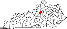 | |
| Unincorporated communities | ||
| Ghost town | ||