Birmingham, Missouri
| Birmingham, Missouri | |
|---|---|
| Village | |
 Location of Birmingham, Missouri | |
| Coordinates: 39°10′0″N 94°27′7″W / 39.16667°N 94.45194°WCoordinates: 39°10′0″N 94°27′7″W / 39.16667°N 94.45194°W | |
| Country | United States |
| State | Missouri |
| County | Clay |
| Area[1] | |
| • Total | 0.56 sq mi (1.45 km2) |
| • Land | 0.56 sq mi (1.45 km2) |
| • Water | 0 sq mi (0 km2) |
| Elevation | 735 ft (224 m) |
| Population (2010)[2] | |
| • Total | 183 |
| • Estimate (2012[3]) | 187 |
| • Density | 326.8/sq mi (126.2/km2) |
| Time zone | Central (CST) (UTC-6) |
| • Summer (DST) | CDT (UTC-5) |
| ZIP code | 64161 |
| Area code(s) | 816 |
| FIPS code | 29-05824[4] |
| GNIS feature ID | 0714269[5] |
Birmingham is a village in Clay County, Missouri, United States. The population was 183 at the 2010 census.
History
Birmingham was founded in 1887.[6] The village was named after Birmingham, in England.[7] A post office was established at Birmingham in 1888, and remained in operation until 1956.[8]
Geography
Birmingham is located at 39°10′0″N 94°27′7″W / 39.16667°N 94.45194°W (39.166653, -94.451845).[9]
According to the United States Census Bureau, the village has a total area of 0.56 square miles (1.45 km2), all of it land.[1] Birmingham is entirely surrounded by Kansas City.[10]
Demographics
| Historical population | |||
|---|---|---|---|
| Census | Pop. | %± | |
| 1890 | 401 | — | |
| 1900 | 217 | −45.9% | |
| 1910 | 136 | −37.3% | |
| 1920 | 175 | 28.7% | |
| 1930 | 273 | 56.0% | |
| 1940 | 160 | −41.4% | |
| 1950 | 236 | 47.5% | |
| 1960 | 201 | −14.8% | |
| 1970 | 266 | 32.3% | |
| 1980 | 240 | −9.8% | |
| 1990 | 222 | −7.5% | |
| 2000 | 214 | −3.6% | |
| 2010 | 183 | −14.5% | |
| Est. 2015 | 193 | [11] | 5.5% |
2010 census
As of the census[2] of 2010, there were 183 people, 75 households, and 52 families residing in the village. The population density was 326.8 inhabitants per square mile (126.2/km2). There were 85 housing units at an average density of 151.8 per square mile (58.6/km2). The racial makeup of the village was 94.5% White, 0.5% African American, 3.8% Native American, and 1.1% from other races. Hispanic or Latino of any race were 2.7% of the population.
There were 75 households of which 29.3% had children under the age of 18 living with them, 46.7% were married couples living together, 13.3% had a female householder with no husband present, 9.3% had a male householder with no wife present, and 30.7% were non-families. 24.0% of all households were made up of individuals and 8% had someone living alone who was 65 years of age or older. The average household size was 2.44 and the average family size was 2.87.
The median age in the village was 36.8 years. 22.4% of residents were under the age of 18; 11.5% were between the ages of 18 and 24; 24.6% were from 25 to 44; 31.8% were from 45 to 64; and 9.8% were 65 years of age or older. The gender makeup of the village was 54.6% male and 45.4% female.
2000 census
As of the census[4] of 2000, there were 214 people, 82 households, and 56 families residing in the village. The population density was 419.5 people per square mile (162.0/km²). There were 89 housing units at an average density of 174.4 per square mile (67.4/km²). The racial makeup of the village was 97.66% White, 0.93% African American, and 1.40% from two or more races.
There were 82 households out of which 42.7% had children under the age of 18 living with them, 52.4% were married couples living together, 8.5% had a female householder with no husband present, and 31.7% were non-families. 24.4% of all households were made up of individuals and 7.3% had someone living alone who was 65 years of age or older. The average household size was 2.61 and the average family size was 3.20.
In the village the population was spread out with 31.3% under the age of 18, 9.8% from 18 to 24, 26.6% from 25 to 44, 24.8% from 45 to 64, and 7.5% who were 65 years of age or older. The median age was 33 years. For every 100 females there were 132.6 males. For every 100 females age 18 and over, there were 107.0 males.
The median income for a household in the village was $36,563, and the median income for a family was $45,000. Males had a median income of $38,125 versus $22,857 for females. The per capita income for the village was $16,420. About 8.1% of families and 5.1% of the population were below the poverty line, including 2.6% of those under the age of eighteen and 22.2% of those sixty five or over.
Sources
- 1 2 "US Gazetteer files 2010". United States Census Bureau. Archived from the original on 2012-01-24. Retrieved 2012-07-08.
- 1 2 "American FactFinder". United States Census Bureau. Retrieved 2012-07-08.
- ↑ "Population Estimates". United States Census Bureau. Archived from the original on 2013-06-17. Retrieved 2013-05-30.
- 1 2 "American FactFinder". United States Census Bureau. Archived from the original on 2013-09-11. Retrieved 2008-01-31.
- ↑ "US Board on Geographic Names". United States Geological Survey. 2007-10-25. Retrieved 2008-01-31.
- ↑ Ramsay, Robert L. (1952). Our Storehouse of Missouri Place Names. University of Missouri Press. p. 29.
- ↑ "Clay County Place Names, 1928–1945 (archived)". The State Historical Society of Missouri. Archived from the original on 24 June 2016. Retrieved 19 September 2016.
- ↑ "Post Offices". Jim Forte Postal History. Archived from the original on 6 March 2016. Retrieved 19 September 2016.
- ↑ "US Gazetteer files: 2010, 2000, and 1990". United States Census Bureau. 2011-02-12. Retrieved 2011-04-23.
- ↑ Andriot, John L. Township Atlas of the United States (McLean, Virginia: Andriot Associates, 1979) p. 366
- ↑ "Annual Estimates of the Resident Population for Incorporated Places: April 1, 2010 to July 1, 2015". Retrieved July 2, 2016.
- ↑ "Census of Population and Housing". Census.gov. Archived from the original on May 11, 2015. Retrieved June 4, 2015.
External links
Kansas City metropolitan area's cities and counties | ||
|---|---|---|
| Central city | 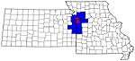 | |
| Largest cities (over 100,000 in 2000) | ||
| Medium-sized cities (10,000 to 100,000 in 2000) | ||
| Smaller Cities (between 5,000 and 9,900 in 2010) | ||
| Counties | ||
Municipalities and communities of Clay County, Missouri, United States | ||
|---|---|---|
| Cities | 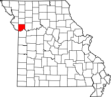 | |
| Villages | ||
| Townships |
| |
| Unincorporated communities | ||
| Footnotes | ‡This populated place also has portions in an adjacent county or counties | |