Dade County, Missouri
| Dade County, Missouri | |
|---|---|
 Dade County Courthouse in Greenfield | |
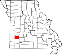 Location in the U.S. state of Missouri | |
 Missouri's location in the U.S. | |
| Founded | January 29, 1841 |
| Named for | Francis L. Dade |
| Seat | Greenfield |
| Largest city | Greenfield |
| Area | |
| • Total | 506 sq mi (1,311 km2) |
| • Land | 490 sq mi (1,269 km2) |
| • Water | 16 sq mi (41 km2), 3.2% |
| Population (est.) | |
| • (2015) | 7,595 |
| • Density | 16/sq mi (6/km²) |
| Congressional district | 4th |
| Time zone | Central: UTC-6/-5 |
Dade County is a county located in the southwest part of the U.S. state of Missouri. As of the 2010 census, the population was 7,883.[1] Its county seat is Greenfield.[2] The county was organized in 1841 and named after Major Francis L. Dade of Virginia, who was killed in the Seminole War in 1835.[3]
Geography
According to the U.S. Census Bureau, the county has a total area of 506 square miles (1,310 km2), of which 490 square miles (1,300 km2) is land and 16 square miles (41 km2) (3.2%) is water.[4]
Adjacent counties
- Cedar County (north)
- Polk County (northeast)
- Greene County (southeast)
- Lawrence County (south)
- Jasper County (southwest)
- Barton County (west)
Major highways
Demographics
| Historical population | |||
|---|---|---|---|
| Census | Pop. | %± | |
| 1850 | 4,246 | — | |
| 1860 | 7,072 | 66.6% | |
| 1870 | 8,086 | 14.3% | |
| 1880 | 12,557 | 55.3% | |
| 1890 | 17,528 | 39.6% | |
| 1900 | 18,125 | 3.4% | |
| 1910 | 15,613 | −13.9% | |
| 1920 | 14,173 | −9.2% | |
| 1930 | 11,764 | −17.0% | |
| 1940 | 11,248 | −4.4% | |
| 1950 | 9,324 | −17.1% | |
| 1960 | 7,577 | −18.7% | |
| 1970 | 6,850 | −9.6% | |
| 1980 | 7,383 | 7.8% | |
| 1990 | 7,449 | 0.9% | |
| 2000 | 7,923 | 6.4% | |
| 2010 | 7,883 | −0.5% | |
| Est. 2015 | 7,595 | [5] | −3.7% |
| U.S. Decennial Census[6] 1790-1960[7] 1900-1990[8] 1990-2000[9] 2010-2015[1] | |||
As of the census[10] of 2000, there were 7,923 people, 3,202 households, and 2,276 families residing in the county. The population density was 16 people per square mile (6/km²). There were 3,758 housing units at an average density of 8 per square mile (3/km²). The racial makeup of the county was 97.45% White, 0.27% Black or African American, 0.71% Native American, 0.14% Asian, 0.05% Pacific Islander, 0.19% from other races, and 1.20% from two or more races. Approximately 0.85% of the population were Hispanic or Latino of any race.
There were 3,202 households out of which 29.10% had children under the age of 18 living with them, 61.30% were married couples living together, 6.50% had a female householder with no husband present, and 28.90% were non-families. 26.50% of all households were made up of individuals and 14.70% had someone living alone who was 65 years of age or older. The average household size was 2.44 and the average family size was 2.93.
In the county the population was spread out with 24.30% under the age of 18, 6.80% from 18 to 24, 24.10% from 25 to 44, 24.40% from 45 to 64, and 20.30% who were 65 years of age or older. The median age was 42 years. For every 100 females there were 95.90 males. For every 100 females age 18 and over, there were 92.50 males.
The median income for a household in the county was $29,097, and the median income for a family was $33,651. Males had a median income of $26,092 versus $18,464 for females. The per capita income for the county was $14,254. About 9.30% of families and 13.40% of the population were below the poverty line, including 17.10% of those under age 18 and 13.10% of those age 65 or over.
Education
Public schools
- Dadeville R-II School District – Dadeville
- Dadeville Elementary School (K-06)
- Dadeville High School (07-12)
- Everton R-III School District – Everton
- Everton Elementary School (K-05)
- Everton Middle School (06-08)
- Everton High School (09-12)
- Greenfield R-IV School District – Greenfield
- Greenfield Elementary School (PK-06)
- Greenfield High School (07-12)
- Lockwood R-I School District – Lockwood
- Lockwood Elementary School (PK-08)
- Lockwood High School (09-12)
Private schools
- Immanuel Lutheran School – Lockwood (PK-08) – Lutheran
- Faith Fellowship Christian Academy – Greenfield (PK-10) - Baptist
Politics
Local
The Republican Party predominantly controls politics at the local level in Dade County. Republicans hold all but one of the elected positions in the county.
| Dade County, Missouri | ||||
|---|---|---|---|---|
| Elected countywide officials | ||||
| Assessor | Annette Black | Republican | ||
| Circuit Clerk | Mary McGee | Republican | ||
| County Clerk | Melinda Wright | Republican | ||
| Collector | Rod O’Connor | Republican | ||
| Commissioner (Presiding) |
Randy Daniel | Republican | ||
| Commissioner (District 1) |
William G. Marshall | Republican | ||
| Commissioner (District 2) |
David Rusch | Republican | ||
| Coroner | Gary Banta | Independent | ||
| Prosecuting Attorney | Gary Troxell | Republican | ||
| Public Administrator | Judy McGuire | Republican | ||
| Recorder | Carolyn Kile | Republican | ||
| Sheriff | Steven Stapp | Republican | ||
| Surveyor | Justin Hunt | Republican | ||
| Treasurer | Rod O’Connor | Republican | ||
State
| Year | Republican | Democratic | Third Parties |
|---|---|---|---|
| 2008 | 50.22% 2,049 | 46.05% 1,879 | 3.72% 152 |
| 2004 | 72.03% 2,938 | 27.02% 1,102 | 0.96% 39 |
| 2000 | 62.43% 2,306 | 36.19% 1,337 | 1.39% 51 |
| 1996 | 56.10% 1,954 | 40.88% 1,424 | 3.01% 105 |
All of Dade County is a part of Missouri’s 126th District in the Missouri House of Representatives and is represented by Mike Kelley (R-Lamar).
| Party | Candidate | Votes | % | ± | |
|---|---|---|---|---|---|
| Republican | Mike Kelley | 2,610 | 100.00 | ||
All of Dade County is a part of Missouri’s 32nd District in the Missouri Senate and is currently represented by Ron Richard (R-Joplin.
| Party | Candidate | Votes | % | ± | |
|---|---|---|---|---|---|
| Republican | Ron Richard | 2,571 | 100.00 | ||
Federal
All of Dade County is included in Missouri's 4th Congressional District and is currently represented by Vicky Hartzler (R-Harrisonville) in the U.S. House of Representatives.
| Party | Candidate | Votes | % | ± | |
|---|---|---|---|---|---|
| Republican | Vicky Hartzler | 2,059 | 64.08 | ||
| Democratic | Ike Skelton* | 973 | 30.28 | ||
| Libertarian | Jason Michael Braun | 97 | 3.02 | ||
| Constitution | Greg Cowan | 84 | 2.61 | ||
Political Culture
| Year | Republican | Democratic | Third Parties |
|---|---|---|---|
| 2008 | 69.65% 2,864 | 28.79% 1,184 | 1.56% 64 |
| 2004 | 72.46% 2,963 | 27.00% 1,104 | 0.53% 22 |
| 2000 | 65.78% 2,468 | 31.80% 1,193 | 2.43% 91 |
| 1996 | 51.40 1,822 | 35.06% 1,243 | 13.54% 480 |
Missouri Presidential Preference Primary (2008)
- Former Governor Mike Huckabee (R-Arkansas) received more votes, a total of 769, than any candidate from either party in Dade County during the 2008 presidential primary. He fell just 25 votes short from receiving the same amount of votes cast in the entire Democratic primary in Dade County.
| Dade County, Missouri | ||
|---|---|---|
| 2008 Republican primary in Missouri | ||
| John McCain | 418 (27.52%) | |
| Mike Huckabee | 769 (50.63%) | |
| Mitt Romney | 275 (18.10%) | |
| Ron Paul | 43 (2.83%) | |
| Dade County, Missouri | ||
|---|---|---|
| 2008 Democratic primary in Missouri | ||
| Hillary Clinton | 494 (62.22%) | |
| Barack Obama | 263 (33.12%) | |
| John Edwards (withdrawn) | 28 (3.53%) | |
Communities
- Arcola
- Bona
- Dadeville
- Everton
- Greenfield (county seat)
- Lockwood
- South Greenfield
See also
References
- 1 2 "State & County QuickFacts". United States Census Bureau. Retrieved September 8, 2013.
- ↑ "Find a County". National Association of Counties. Retrieved 2011-06-07.
- ↑ Eaton, David Wolfe (1916). How Missouri Counties, Towns and Streams Were Named. The State Historical Society of Missouri. p. 282.
- ↑ "2010 Census Gazetteer Files". United States Census Bureau. August 22, 2012. Retrieved November 15, 2014.
- ↑ "County Totals Dataset: Population, Population Change and Estimated Components of Population Change: April 1, 2010 to July 1, 2015". Retrieved July 2, 2016.
- ↑ "U.S. Decennial Census". United States Census Bureau. Retrieved November 15, 2014.
- ↑ "Historical Census Browser". University of Virginia Library. Retrieved November 15, 2014.
- ↑ "Population of Counties by Decennial Census: 1900 to 1990". United States Census Bureau. Retrieved November 15, 2014.
- ↑ "Census 2000 PHC-T-4. Ranking Tables for Counties: 1990 and 2000" (PDF). United States Census Bureau. Retrieved November 15, 2014.
- ↑ "American FactFinder". United States Census Bureau. Retrieved 2011-05-14.
External links
- Digitized 1930 Plat Book of Dade County from University of Missouri Division of Special Collections, Archives, and Rare Books
 |
Cedar County | Polk County | | |
| Barton County | |
|||
| ||||
| | ||||
| Jasper County | Lawrence County | Greene County |
Municipalities and communities of Dade County, Missouri, United States | ||
|---|---|---|
| Cities | | |
| Villages | ||
| Townships | ||
| Unincorporated communities | ||
| Ghost towns | ||
| Footnotes | ‡This populated place also has portions in an adjacent county or counties | |
Coordinates: 37°26′N 93°51′W / 37.43°N 93.85°W