Choranche
| Choranche | |
|---|---|
 | |
 Choranche | |
|
Location within Auvergne-Rhône-Alpes region  Choranche | |
| Coordinates: 45°04′04″N 5°23′30″E / 45.0678°N 5.3917°ECoordinates: 45°04′04″N 5°23′30″E / 45.0678°N 5.3917°E | |
| Country | France |
| Region | Auvergne-Rhône-Alpes |
| Department | Isère |
| Arrondissement | Grenoble |
| Canton | Pont-en-Royans |
| Intercommunality | De la Bourne à l'Isère |
| Government | |
| • Mayor (2001–2008) | Henri-Jacques Sentis |
| Area1 | 10.63 km2 (4.10 sq mi) |
| Population (2009)2 | 132 |
| • Density | 12/km2 (32/sq mi) |
| Time zone | CET (UTC+1) |
| • Summer (DST) | CEST (UTC+2) |
| INSEE/Postal code | 38108 / 38680 |
| Elevation | 200–1,200 m (660–3,940 ft) |
|
1 French Land Register data, which excludes lakes, ponds, glaciers > 1 km² (0.386 sq mi or 247 acres) and river estuaries. 2 Population without double counting: residents of multiple communes (e.g., students and military personnel) only counted once. | |
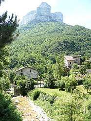
Choranche is a commune in the Isère department in southeastern France.
Famous is Choranche Cave - Fr: Grotte de Choranche. The grottoes were discovered end the 19th Century and hide a unique sight of fine stalactites.[1]
Population
| Historical population | ||
|---|---|---|
| Year | Pop. | ±% |
| 1793 | 416 | — |
| 1800 | 439 | +5.5% |
| 1821 | 432 | −1.6% |
| 1831 | 418 | −3.2% |
| 1841 | 445 | +6.5% |
| 1851 | 478 | +7.4% |
| 1861 | 423 | −11.5% |
| 1872 | 369 | −12.8% |
| 1881 | 390 | +5.7% |
| 1891 | 292 | −25.1% |
| 1901 | 288 | −1.4% |
| 1911 | 276 | −4.2% |
| 1921 | 236 | −14.5% |
| 1931 | 217 | −8.1% |
| 1946 | 180 | −17.1% |
| 1954 | 216 | +20.0% |
| 1962 | 151 | −30.1% |
| 1968 | 149 | −1.3% |
| 1975 | 115 | −22.8% |
| 1982 | 130 | +13.0% |
| 1990 | 132 | +1.5% |
| 1999 | 130 | −1.5% |
| 2011 | 130 | +0.0% |
See also
References
| Wikimedia Commons has media related to Choranche. |
This article is issued from Wikipedia - version of the 2/18/2016. The text is available under the Creative Commons Attribution/Share Alike but additional terms may apply for the media files.