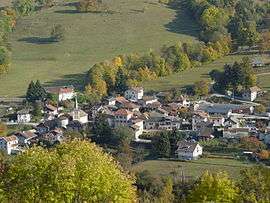
La Chapelle-du-Bard
| La Chapelle-du-Bard | |
|---|---|
 | |
 La Chapelle-du-Bard | |
|
Location within Auvergne-Rhône-Alpes region  La Chapelle-du-Bard | |
| Coordinates: 45°25′25″N 6°05′47″E / 45.4236°N 6.0964°ECoordinates: 45°25′25″N 6°05′47″E / 45.4236°N 6.0964°E | |
| Country | France |
| Region | Auvergne-Rhône-Alpes |
| Department | Isère |
| Arrondissement | Grenoble |
| Canton | Allevard |
| Intercommunality | Pays du Grésivaudan |
| Government | |
| • Mayor (2014–2020) | Michel Bellin=Croyat |
| Area1 | 28 km2 (11 sq mi) |
| Population (2011)2 | 525 |
| • Density | 19/km2 (49/sq mi) |
| Time zone | CET (UTC+1) |
| • Summer (DST) | CEST (UTC+2) |
| INSEE/Postal code | 38078 / 38580 |
| Elevation |
358–2,526 m (1,175–8,287 ft) (avg. 440 m or 1,440 ft) |
|
1 French Land Register data, which excludes lakes, ponds, glaciers > 1 km² (0.386 sq mi or 247 acres) and river estuaries. 2 Population without double counting: residents of multiple communes (e.g., students and military personnel) only counted once. | |
La Chapelle-du-Bard is a commune in the Isère department in southeastern France.
Population
| Historical population | ||
|---|---|---|
| Year | Pop. | ±% |
| 1793 | 978 | — |
| 1800 | 985 | +0.7% |
| 1821 | 1,121 | +13.8% |
| 1831 | 1,277 | +13.9% |
| 1841 | 1,332 | +4.3% |
| 1851 | 1,221 | −8.3% |
| 1861 | 1,096 | −10.2% |
| 1872 | 1,018 | −7.1% |
| 1881 | 922 | −9.4% |
| 1891 | 844 | −8.5% |
| 1901 | 750 | −11.1% |
| 1911 | 690 | −8.0% |
| 1921 | 558 | −19.1% |
| 1931 | 513 | −8.1% |
| 1946 | 471 | −8.2% |
| 1954 | 430 | −8.7% |
| 1862 | 378 | −12.1% |
| 1968 | 351 | −7.1% |
| 1975 | 314 | −10.5% |
| 1982 | 295 | −6.1% |
| 1990 | 346 | +17.3% |
| 1999 | 426 | +23.1% |
| 2011 | 525 | +23.2% |
See also
References
| Wikimedia Commons has media related to La Chapelle-du-Bard. |
This article is issued from Wikipedia - version of the 2/12/2016. The text is available under the Creative Commons Attribution/Share Alike but additional terms may apply for the media files.