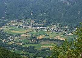
Valbonnais
| Valbonnais | |
|---|---|
 | |
 Valbonnais | |
|
Location within Auvergne-Rhône-Alpes region  Valbonnais | |
| Coordinates: 44°54′03″N 5°54′18″E / 44.9008°N 5.905°ECoordinates: 44°54′03″N 5°54′18″E / 44.9008°N 5.905°E | |
| Country | France |
| Region | Auvergne-Rhône-Alpes |
| Department | Isère |
| Arrondissement | Grenoble |
| Canton | Valbonnais |
| Intercommunality | Vallées du Valbonnais |
| Government | |
| • Mayor (2014–2020) | Denis Macé |
| Area1 | 23.95 km2 (9.25 sq mi) |
| Population (2012)2 | 511 |
| • Density | 21/km2 (55/sq mi) |
| Time zone | CET (UTC+1) |
| • Summer (DST) | CEST (UTC+2) |
| INSEE/Postal code | 38518 / 38740 |
| Elevation |
672–2,544 m (2,205–8,346 ft) (avg. 800 m or 2,600 ft) |
|
1 French Land Register data, which excludes lakes, ponds, glaciers > 1 km² (0.386 sq mi or 247 acres) and river estuaries. 2 Population without double counting: residents of multiple communes (e.g., students and military personnel) only counted once. | |
Valbonnais is a commune in the Isère department in southeastern France.
Population
| Historical population | ||
|---|---|---|
| Year | Pop. | ±% |
| 1793 | 1,820 | — |
| 1806 | 1,251 | −31.3% |
| 1821 | 1,258 | +0.6% |
| 1831 | 1,386 | +10.2% |
| 1841 | 1,327 | −4.3% |
| 1851 | 1,339 | +0.9% |
| 1861 | 1,307 | −2.4% |
| 1872 | 1,290 | −1.3% |
| 1881 | 1,451 | +12.5% |
| 1891 | 1,204 | −17.0% |
| 1901 | 1,110 | −7.8% |
| 1911 | 1,014 | −8.6% |
| 1921 | 822 | −18.9% |
| 1931 | 793 | −3.5% |
| 1946 | 641 | −19.2% |
| 1954 | 606 | −5.5% |
| 1962 | 597 | −1.5% |
| 1968 | 521 | −12.7% |
| 1975 | 431 | −17.3% |
| 1982 | 434 | +0.7% |
| 1990 | 486 | +12.0% |
| 1999 | 440 | −9.5% |
| 2006 | 491 | +11.6% |
| 2012 | 511 | +4.1% |
See also
References
| Wikimedia Commons has media related to Valbonnais. |
This article is issued from Wikipedia - version of the 3/15/2016. The text is available under the Creative Commons Attribution/Share Alike but additional terms may apply for the media files.