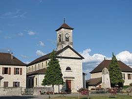
Le Bouchage, Isère
| Le Bouchage | |
|---|---|
 | |
 Le Bouchage | |
|
Location within Auvergne-Rhône-Alpes region  Le Bouchage | |
| Coordinates: 45°40′16″N 5°31′36″E / 45.6711°N 5.5267°ECoordinates: 45°40′16″N 5°31′36″E / 45.6711°N 5.5267°E | |
| Country | France |
| Region | Auvergne-Rhône-Alpes |
| Department | Isère |
| Arrondissement | La Tour-du-Pin |
| Canton | Morestel |
| Intercommunality | Pays des Couleurs |
| Government | |
| • Mayor (2008–2014) | Anne Pourtier |
| Area1 | 11.2 km2 (4.3 sq mi) |
| Population (1999)2 | 462 |
| • Density | 41/km2 (110/sq mi) |
| Time zone | CET (UTC+1) |
| • Summer (DST) | CEST (UTC+2) |
| INSEE/Postal code | 38050 / 38510 |
| Elevation |
207–210 m (679–689 ft) (avg. 209 m or 686 ft) |
|
1 French Land Register data, which excludes lakes, ponds, glaciers > 1 km² (0.386 sq mi or 247 acres) and river estuaries. 2 Population without double counting: residents of multiple communes (e.g., students and military personnel) only counted once. | |
Le Bouchage is a commune in the Isère department in southeastern France.
Population
| Historical population | ||
|---|---|---|
| Year | Pop. | ±% |
| 1999 | 462 | — |
| 2009 | 598 | +29.4% |
| 2012 | 592 | −1.0% |
See also
References
| Wikimedia Commons has media related to Le Bouchage (Isère). |
This article is issued from Wikipedia - version of the 10/28/2016. The text is available under the Creative Commons Attribution/Share Alike but additional terms may apply for the media files.