Proveysieux
| Proveysieux | |
|---|---|
 | |
 Proveysieux | |
|
Location within Auvergne-Rhône-Alpes region  Proveysieux | |
| Coordinates: 45°15′49″N 5°42′00″E / 45.2636°N 5.7°ECoordinates: 45°15′49″N 5°42′00″E / 45.2636°N 5.7°E | |
| Country | France |
| Region | Auvergne-Rhône-Alpes |
| Department | Isère |
| Arrondissement | Grenoble |
| Canton | Saint-Égrève |
| Intercommunality | Balcon Sud de la Chartreuse |
| Government | |
| • Mayor (2014–2020) | Christiane Raffin |
| Area1 | 20 km2 (8 sq mi) |
| Population (2011)2 | 517 |
| • Density | 26/km2 (67/sq mi) |
| Time zone | CET (UTC+1) |
| • Summer (DST) | CEST (UTC+2) |
| INSEE/Postal code | 38325 / 38120 |
| Elevation |
264–1,844 m (866–6,050 ft) (avg. 600 m or 2,000 ft) |
|
1 French Land Register data, which excludes lakes, ponds, glaciers > 1 km² (0.386 sq mi or 247 acres) and river estuaries. 2 Population without double counting: residents of multiple communes (e.g., students and military personnel) only counted once. | |
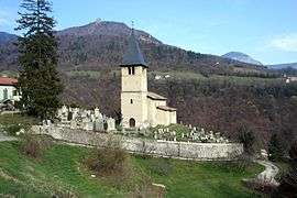
Proveysieux is a commune in the Isère department in southeastern France.
Population
| Historical population | ||
|---|---|---|
| Year | Pop. | ±% |
| 1793 | 610 | — |
| 1806 | 628 | +3.0% |
| 1821 | 559 | −11.0% |
| 1831 | 613 | +9.7% |
| 1841 | 604 | −1.5% |
| 1851 | 581 | −3.8% |
| 1861 | 504 | −13.3% |
| 1872 | 484 | −4.0% |
| 1881 | 479 | −1.0% |
| 1891 | 446 | −6.9% |
| 1901 | 390 | −12.6% |
| 1911 | 349 | −10.5% |
| 1921 | 318 | −8.9% |
| 1931 | 311 | −2.2% |
| 1946 | 268 | −13.8% |
| 1954 | 262 | −2.2% |
| 1962 | 210 | −19.8% |
| 1968 | 218 | +3.8% |
| 1975 | 260 | +19.3% |
| 1982 | 355 | +36.5% |
| 1990 | 469 | +32.1% |
| 1999 | 479 | +2.1% |
| 2006 | 511 | +6.7% |
| 2011 | 517 | +1.2% |
See also
References
| Wikimedia Commons has media related to Proveysieux. |
This article is issued from Wikipedia - version of the 10/28/2016. The text is available under the Creative Commons Attribution/Share Alike but additional terms may apply for the media files.