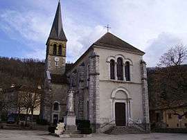
Saint-Aupre
| Saint-Aupre | |
|---|---|
 | |
 Saint-Aupre | |
|
Location within Auvergne-Rhône-Alpes region  Saint-Aupre | |
| Coordinates: 45°24′01″N 5°40′17″E / 45.4003°N 5.6714°ECoordinates: 45°24′01″N 5°40′17″E / 45.4003°N 5.6714°E | |
| Country | France |
| Region | Auvergne-Rhône-Alpes |
| Department | Isère |
| Arrondissement | Grenoble |
| Canton | Voiron |
| Intercommunality | Pays Voironnais |
| Government | |
| • Mayor (2014–2020) | Pierre Durand |
| Area1 | 11.93 km2 (4.61 sq mi) |
| Population (2011)2 | 1,096 |
| • Density | 92/km2 (240/sq mi) |
| Time zone | CET (UTC+1) |
| • Summer (DST) | CEST (UTC+2) |
| INSEE/Postal code | 38362 / 38960 |
| Elevation |
436–925 m (1,430–3,035 ft) (avg. 450 m or 1,480 ft) |
|
1 French Land Register data, which excludes lakes, ponds, glaciers > 1 km² (0.386 sq mi or 247 acres) and river estuaries. 2 Population without double counting: residents of multiple communes (e.g., students and military personnel) only counted once. | |
Saint-Aupre is a commune in the Isère department in southeastern France.
It is located near the city of Voiron.
Population
| Historical population | ||
|---|---|---|
| Year | Pop. | ±% |
| 1793 | 865 | — |
| 1806 | 843 | −2.5% |
| 1821 | 1,026 | +21.7% |
| 1831 | 1,041 | +1.5% |
| 1841 | 1,127 | +8.3% |
| 1851 | 1,124 | −0.3% |
| 1861 | 1,007 | −10.4% |
| 1872 | 947 | −6.0% |
| 1881 | 900 | −5.0% |
| 1891 | 867 | −3.7% |
| 1901 | 807 | −6.9% |
| 1911 | 718 | −11.0% |
| 1921 | 550 | −23.4% |
| 1931 | 488 | −11.3% |
| 1946 | 450 | −7.8% |
| 1954 | 394 | −12.4% |
| 1962 | 408 | +3.6% |
| 1968 | 389 | −4.7% |
| 1975 | 388 | −0.3% |
| 1982 | 560 | +44.3% |
| 1990 | 676 | +20.7% |
| 1999 | 872 | +29.0% |
| 2006 | 1,046 | +20.0% |
| 2011 | 1,096 | +4.8% |
See also
References
| Wikimedia Commons has media related to Saint-Aupre. |
This article is issued from Wikipedia - version of the 2/11/2016. The text is available under the Creative Commons Attribution/Share Alike but additional terms may apply for the media files.