La Tour-du-Pin
This article is about the French commune. For the French nobleman and politician (1727-1794), see Jean-Frédéric de la Tour du Pin-Gouvernet.
| La Tour-du-Pin | ||
|---|---|---|
 | ||
| ||
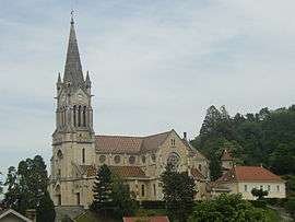
 La Tour-du-Pin | ||
|
Location within Auvergne-Rhône-Alpes region  La Tour-du-Pin | ||
| Coordinates: 45°33′54″N 5°26′40″E / 45.565°N 05.4444°ECoordinates: 45°33′54″N 5°26′40″E / 45.565°N 05.4444°E | ||
| Country | France | |
| Region | Auvergne-Rhône-Alpes | |
| Department | Isère | |
| Arrondissement | La Tour-du-Pin | |
| Canton | La Tour-du-Pin | |
| Intercommunality | Les Vallons de La Tour du Pin | |
| Government | ||
| • Mayor (2014–2020) | Fabien Rajon | |
| Area1 | 4.77 km2 (1.84 sq mi) | |
| Population (2012)2 | 7,927 | |
| • Density | 1,700/km2 (4,300/sq mi) | |
| Time zone | CET (UTC+1) | |
| • Summer (DST) | CEST (UTC+2) | |
| INSEE/Postal code | 38509 / 38110 | |
| Elevation |
309–461 m (1,014–1,512 ft) (avg. 339 m or 1,112 ft) | |
|
1 French Land Register data, which excludes lakes, ponds, glaciers > 1 km² (0.386 sq mi or 247 acres) and river estuaries. 2 Population without double counting: residents of multiple communes (e.g., students and military personnel) only counted once. | ||

La Tour-du-Pin (French pronunciation: [la tuʁ dy pɛ̃]) is a commune in the Isère department in southeastern France.
Geography
The Bourbre flows west through the southern part of the commune and crosses the town.
Population
| Historical population | ||
|---|---|---|
| Year | Pop. | ±% |
| 1793 | 3,098 | — |
| 1806 | 1,540 | −50.3% |
| 1821 | 1,971 | +28.0% |
| 1831 | 2,334 | +18.4% |
| 1841 | 2,456 | +5.2% |
| 1851 | 2,572 | +4.7% |
| 1861 | 2,699 | +4.9% |
| 1872 | 2,857 | +5.9% |
| 1881 | 3,571 | +25.0% |
| 1891 | 3,520 | −1.4% |
| 1901 | 3,803 | +8.0% |
| 1911 | 4,032 | +6.0% |
| 1921 | 3,959 | −1.8% |
| 1931 | 4,465 | +12.8% |
| 1946 | 4,117 | −7.8% |
| 1954 | 4,459 | +8.3% |
| 1962 | 4,694 | +5.3% |
| 1968 | 5,649 | +20.3% |
| 1975 | 6,641 | +17.6% |
| 1982 | 6,913 | +4.1% |
| 1990 | 6,770 | −2.1% |
| 1999 | 6,553 | −3.2% |
| 2006 | 7,431 | +13.4% |
| 2012 | 7,927 | +6.7% |
See also
References
| Wikimedia Commons has media related to La Tour-du-Pin. |
This article is issued from Wikipedia - version of the 10/28/2016. The text is available under the Creative Commons Attribution/Share Alike but additional terms may apply for the media files.