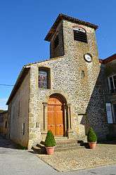
Revel-Tourdan
| Revel-Tourdan | |
|---|---|
 | |
 Revel-Tourdan | |
|
Location within Auvergne-Rhône-Alpes region  Revel-Tourdan | |
| Coordinates: 45°23′05″N 5°02′21″E / 45.3847°N 5.0392°ECoordinates: 45°23′05″N 5°02′21″E / 45.3847°N 5.0392°E | |
| Country | France |
| Region | Auvergne-Rhône-Alpes |
| Department | Isère |
| Arrondissement | Vienne |
| Canton | Beaurepaire |
| Intercommunality | Territoire de Beaurepaire |
| Government | |
| • Mayor (2014–2020) | Sylvie Dézamaud |
| Area1 | 11.62 km2 (4.49 sq mi) |
| Population (2011)2 | 1,035 |
| • Density | 89/km2 (230/sq mi) |
| Time zone | CET (UTC+1) |
| • Summer (DST) | CEST (UTC+2) |
| INSEE/Postal code | 38335 / 38270 |
| Elevation |
267–444 m (876–1,457 ft) (avg. 480 m or 1,570 ft) |
|
1 French Land Register data, which excludes lakes, ponds, glaciers > 1 km² (0.386 sq mi or 247 acres) and river estuaries. 2 Population without double counting: residents of multiple communes (e.g., students and military personnel) only counted once. | |
Population
| Historical population | ||
|---|---|---|
| Year | Pop. | ±% |
| 1806 | 803 | — |
| 1821 | 673 | −16.2% |
| 1831 | 884 | +31.4% |
| 1841 | 930 | +5.2% |
| 1851 | 979 | +5.3% |
| 1861 | 833 | −14.9% |
| 1872 | 791 | −5.0% |
| 1881 | 781 | −1.3% |
| 1891 | 744 | −4.7% |
| 1901 | 678 | −8.9% |
| 1911 | 664 | −2.1% |
| 1921 | 554 | −16.6% |
| 1931 | 564 | +1.8% |
| 1946 | 486 | −13.8% |
| 1954 | 477 | −1.9% |
| 1962 | 473 | −0.8% |
| 1968 | 531 | +12.3% |
| 1975 | 549 | +3.4% |
| 1982 | 630 | +14.8% |
| 1990 | 794 | +26.0% |
| 1999 | 842 | +6.0% |
| 2006 | 950 | +12.8% |
| 2011 | 1,035 | +8.9% |
Twin towns
Revel-Tourdan is twinned with:
-
 Sant Martí de Tous, Spain, since 1996
See also
References

The Tourdan Situla in the British Museum
| Wikimedia Commons has media related to Revel-Tourdan. |
This article is issued from Wikipedia - version of the 10/28/2016. The text is available under the Creative Commons Attribution/Share Alike but additional terms may apply for the media files.