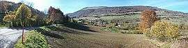
Saint-Jean-de-Vaulx
| Saint-Jean-de-Vaulx | |
|---|---|
 | |
 Saint-Jean-de-Vaulx | |
|
Location within Auvergne-Rhône-Alpes region  Saint-Jean-de-Vaulx | |
| Coordinates: 45°00′49″N 5°45′32″E / 45.0136°N 5.7589°ECoordinates: 45°00′49″N 5°45′32″E / 45.0136°N 5.7589°E | |
| Country | France |
| Region | Auvergne-Rhône-Alpes |
| Department | Isère |
| Arrondissement | Grenoble |
| Canton | Vizille |
| Intercommunality | La Matheysine |
| Government | |
| • Mayor (2014–2020) | Patrick Reynier-Poète |
| Area1 | 10.73 km2 (4.14 sq mi) |
| Population (2011)2 | 549 |
| • Density | 51/km2 (130/sq mi) |
| Time zone | CET (UTC+1) |
| • Summer (DST) | CEST (UTC+2) |
| INSEE/Postal code | 38402 / 38220 |
| Elevation |
890–1,631 m (2,920–5,351 ft) (avg. 1,000 m or 3,300 ft) |
|
1 French Land Register data, which excludes lakes, ponds, glaciers > 1 km² (0.386 sq mi or 247 acres) and river estuaries. 2 Population without double counting: residents of multiple communes (e.g., students and military personnel) only counted once. | |
Saint-Jean-de-Vaulx is a commune in the Isère department in southeastern France.
Population
| Historical population | ||
|---|---|---|
| Year | Pop. | ±% |
| 1793 | 478 | — |
| 1806 | 565 | +18.2% |
| 1821 | 600 | +6.2% |
| 1831 | 642 | +7.0% |
| 1841 | 631 | −1.7% |
| 1851 | 622 | −1.4% |
| 1861 | 608 | −2.3% |
| 1872 | 540 | −11.2% |
| 1881 | 525 | −2.8% |
| 1891 | 444 | −15.4% |
| 1901 | 417 | −6.1% |
| 1911 | 389 | −6.7% |
| 1921 | 306 | −21.3% |
| 1931 | 266 | −13.1% |
| 1946 | 246 | −7.5% |
| 1954 | 241 | −2.0% |
| 1962 | 203 | −15.8% |
| 1968 | 174 | −14.3% |
| 1975 | 131 | −24.7% |
| 1982 | 226 | +72.5% |
| 1990 | 331 | +46.5% |
| 1999 | 451 | +36.3% |
| 2006 | 486 | +7.8% |
| 2011 | 549 | +13.0% |
See also
References
| Wikimedia Commons has media related to Saint-Jean-de-Vaulx. |
This article is issued from Wikipedia - version of the 10/28/2016. The text is available under the Creative Commons Attribution/Share Alike but additional terms may apply for the media files.