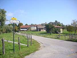
Vatilieu
| Vatilieu | |
|---|---|
 | |
 Vatilieu | |
|
Location within Auvergne-Rhône-Alpes region  Vatilieu | |
| Coordinates: 45°15′25″N 5°24′41″E / 45.2569°N 5.4114°ECoordinates: 45°15′25″N 5°24′41″E / 45.2569°N 5.4114°E | |
| Country | France |
| Region | Auvergne-Rhône-Alpes |
| Department | Isère |
| Arrondissement | Grenoble |
| Canton | Tullins |
| Intercommunality | Vinay |
| Government | |
| • Mayor (2014–2020) | Isabelle Dupraz-Forey |
| Area1 | 9.22 km2 (3.56 sq mi) |
| Population (2012)2 | 371 |
| • Density | 40/km2 (100/sq mi) |
| Time zone | CET (UTC+1) |
| • Summer (DST) | CEST (UTC+2) |
| INSEE/Postal code | 38526 / 38470 |
| Elevation |
352–787 m (1,155–2,582 ft) (avg. 560 m or 1,840 ft) |
|
1 French Land Register data, which excludes lakes, ponds, glaciers > 1 km² (0.386 sq mi or 247 acres) and river estuaries. 2 Population without double counting: residents of multiple communes (e.g., students and military personnel) only counted once. | |
Vatilieu is a commune in the Isère department in southeastern France.
Population
| Historical population | ||
|---|---|---|
| Year | Pop. | ±% |
| 1793 | 353 | — |
| 1806 | 559 | +58.4% |
| 1821 | 528 | −5.5% |
| 1831 | 604 | +14.4% |
| 1841 | 571 | −5.5% |
| 1851 | 553 | −3.2% |
| 1861 | 524 | −5.2% |
| 1872 | 487 | −7.1% |
| 1881 | 442 | −9.2% |
| 1891 | 413 | −6.6% |
| 1901 | 385 | −6.8% |
| 1911 | 345 | −10.4% |
| 1931 | 275 | −20.3% |
| 1946 | 254 | −7.6% |
| 1954 | 216 | −15.0% |
| 1962 | 203 | −6.0% |
| 1968 | 203 | +0.0% |
| 1975 | 165 | −18.7% |
| 1982 | 265 | +60.6% |
| 1990 | 315 | +18.9% |
| 1999 | 339 | +7.6% |
| 2006 | 369 | +8.8% |
| 2012 | 371 | +0.5% |
See also
References
| Wikimedia Commons has media related to Vatilieu. |
This article is issued from Wikipedia - version of the 2/12/2016. The text is available under the Creative Commons Attribution/Share Alike but additional terms may apply for the media files.