Trept
| Trept | |
|---|---|
 | |
 Trept | |
|
Location within Auvergne-Rhône-Alpes region  Trept | |
| Coordinates: 45°41′14″N 5°19′14″E / 45.6872°N 5.3206°ECoordinates: 45°41′14″N 5°19′14″E / 45.6872°N 5.3206°E | |
| Country | France |
| Region | Auvergne-Rhône-Alpes |
| Department | Isère |
| Arrondissement | La Tour-du-Pin |
| Canton | Crémieu |
| Intercommunality | Les Balmes Dauphinoises |
| Government | |
| • Mayor (2014–2020) | Martine Bert |
| Area1 | 15.87 km2 (6.13 sq mi) |
| Population (2020)2 | 1,836 |
| • Density | 120/km2 (300/sq mi) |
| Time zone | CET (UTC+1) |
| • Summer (DST) | CEST (UTC+2) |
| INSEE/Postal code | 38515 / 38460 |
| Elevation |
219–360 m (719–1,181 ft) (avg. 270 m or 890 ft) |
|
1 French Land Register data, which excludes lakes, ponds, glaciers > 1 km² (0.386 sq mi or 247 acres) and river estuaries. 2 Population without double counting: residents of multiple communes (e.g., students and military personnel) only counted once. | |
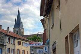
Trept is a commune in the Isère department in southeastern France.
Populations
| Historical population | ||
|---|---|---|
| Year | Pop. | ±% |
| 1793 | 784 | — |
| 1806 | 719 | −8.3% |
| 1821 | 641 | −10.8% |
| 1831 | 864 | +34.8% |
| 1841 | 1,149 | +33.0% |
| 1851 | 1,269 | +10.4% |
| 1861 | 1,339 | +5.5% |
| 1872 | 1,290 | −3.7% |
| 1881 | 1,387 | +7.5% |
| 1891 | 1,615 | +16.4% |
| 1901 | 1,732 | +7.2% |
| 1911 | 1,527 | −11.8% |
| 1921 | 1,323 | −13.4% |
| 1931 | 1,139 | −13.9% |
| 1946 | 931 | −18.3% |
| 1954 | 874 | −6.1% |
| 1962 | 817 | −6.5% |
| 1968 | 840 | +2.8% |
| 1975 | 853 | +1.5% |
| 1982 | 1,039 | +21.8% |
| 1990 | 1,164 | +12.0% |
| 1999 | 1,540 | +32.3% |
| 2006 | 1,688 | +9.6% |
| 2012 | 1,836 | +8.8% |
See also
References
| Wikimedia Commons has media related to Trept. |
This article is issued from Wikipedia - version of the 10/28/2016. The text is available under the Creative Commons Attribution/Share Alike but additional terms may apply for the media files.