Saint-Siméon-de-Bressieux
| Saint-Siméon-de-Bressieux | |
|---|---|
|
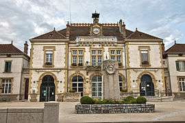
Town hall | |
 Saint-Siméon-de-Bressieux | |
|
Location within Auvergne-Rhône-Alpes region  Saint-Siméon-de-Bressieux | |
| Coordinates: 45°19′45″N 5°15′44″E / 45.3292°N 5.2622°ECoordinates: 45°19′45″N 5°15′44″E / 45.3292°N 5.2622°E | |
| Country | France |
| Region | Auvergne-Rhône-Alpes |
| Department | Isère |
| Arrondissement | Grenoble |
| Canton | Saint-Étienne-de-Saint-Geoirs |
| Intercommunality | Pays de Bièvre-Liers |
| Government | |
| • Mayor (2014–2020) | Éric Savignon |
| Area1 | 18.79 km2 (7.25 sq mi) |
| Population (2011)2 | 2,792 |
| • Density | 150/km2 (380/sq mi) |
| Time zone | CET (UTC+1) |
| • Summer (DST) | CEST (UTC+2) |
| INSEE/Postal code | 38457 / 38870 |
| Elevation |
337–627 m (1,106–2,057 ft) (avg. 378 m or 1,240 ft) |
|
1 French Land Register data, which excludes lakes, ponds, glaciers > 1 km² (0.386 sq mi or 247 acres) and river estuaries. 2 Population without double counting: residents of multiple communes (e.g., students and military personnel) only counted once. | |
Saint-Siméon-de-Bressieux is a commune in the Isère department in southeastern France.
Population
| Historical population | ||
|---|---|---|
| Year | Pop. | ±% |
| 1800 | 1,452 | — |
| 1806 | 1,872 | +28.9% |
| 1821 | 2,096 | +12.0% |
| 1831 | 2,277 | +8.6% |
| 1841 | 2,268 | −0.4% |
| 1851 | 2,115 | −6.7% |
| 1861 | 1,998 | −5.5% |
| 1872 | 1,975 | −1.2% |
| 1881 | 2,409 | +22.0% |
| 1891 | 2,407 | −0.1% |
| 1901 | 2,349 | −2.4% |
| 1911 | 2,173 | −7.5% |
| 1921 | 1,867 | −14.1% |
| 1931 | 1,669 | −10.6% |
| 1946 | 1,638 | −1.9% |
| 1954 | 1,746 | +6.6% |
| 1962 | 1,774 | +1.6% |
| 1968 | 1,861 | +4.9% |
| 1975 | 2,527 | +35.8% |
| 1982 | 2,600 | +2.9% |
| 1990 | 2,437 | −6.3% |
| 1999 | 2,498 | +2.5% |
| 2006 | 2,710 | +8.5% |
| 2011 | 2,792 | +3.0% |
See also
References
| Wikimedia Commons has media related to Saint-Siméon-de-Bressieux. |
This article is issued from Wikipedia - version of the 10/28/2016. The text is available under the Creative Commons Attribution/Share Alike but additional terms may apply for the media files.