Soleymieu
| Soleymieu | |
|---|---|
|
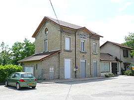
Former train station | |
 Soleymieu | |
|
Location within Auvergne-Rhône-Alpes region  Soleymieu | |
| Coordinates: 45°42′38″N 5°21′02″E / 45.7106°N 5.3506°ECoordinates: 45°42′38″N 5°21′02″E / 45.7106°N 5.3506°E | |
| Country | France |
| Region | Auvergne-Rhône-Alpes |
| Department | Isère |
| Arrondissement | La Tour-du-Pin |
| Canton | Crémieu |
| Intercommunality | L'Isle-Crémieu |
| Government | |
| • Mayor (2014–2020) | Yves Ginon |
| Area1 | 13.36 km2 (5.16 sq mi) |
| Population (2012)2 | 733 |
| • Density | 55/km2 (140/sq mi) |
| Time zone | CET (UTC+1) |
| • Summer (DST) | CEST (UTC+2) |
| INSEE/Postal code | 38494 / 38460 |
| Elevation |
221–363 m (725–1,191 ft) (avg. 280 m or 920 ft) |
|
1 French Land Register data, which excludes lakes, ponds, glaciers > 1 km² (0.386 sq mi or 247 acres) and river estuaries. 2 Population without double counting: residents of multiple communes (e.g., students and military personnel) only counted once. | |
Soleymieu is a commune in the Isère department in southeastern France.
Population
| Historical population | ||
|---|---|---|
| Year | Pop. | ±% |
| 1793 | 740 | — |
| 1806 | 509 | −31.2% |
| 1821 | 638 | +25.3% |
| 1831 | 669 | +4.9% |
| 1841 | 778 | +16.3% |
| 1851 | 720 | −7.5% |
| 1861 | 806 | +11.9% |
| 1872 | 721 | −10.5% |
| 1881 | 642 | −11.0% |
| 1891 | 687 | +7.0% |
| 1901 | 646 | −6.0% |
| 1911 | 545 | −15.6% |
| 1921 | 479 | −12.1% |
| 1931 | 410 | −14.4% |
| 1946 | 340 | −17.1% |
| 1954 | 326 | −4.1% |
| 1962 | 287 | −12.0% |
| 1968 | 277 | −3.5% |
| 1975 | 274 | −1.1% |
| 1982 | 377 | +37.6% |
| 1990 | 434 | +15.1% |
| 1999 | 574 | +32.3% |
| 2006 | 660 | +15.0% |
| 2012 | 733 | +11.1% |
See also
References
| Wikimedia Commons has media related to Soleymieu. |
This article is issued from Wikipedia - version of the 2/12/2016. The text is available under the Creative Commons Attribution/Share Alike but additional terms may apply for the media files.