Murianette
| Murianette | |
|---|---|
 | |
 Murianette | |
|
Location within Auvergne-Rhône-Alpes region  Murianette | |
| Coordinates: 45°11′28″N 5°49′13″E / 45.1911°N 5.8203°ECoordinates: 45°11′28″N 5°49′13″E / 45.1911°N 5.8203°E | |
| Country | France |
| Region | Auvergne-Rhône-Alpes |
| Department | Isère |
| Arrondissement | Grenoble |
| Canton | Domène |
| Intercommunality | Grenoble Alpes Métropole |
| Government | |
| • Mayor (2014–2020) | Lucie Grillo |
| Area1 | 6 km2 (2 sq mi) |
| Population (2011)2 | 890 |
| • Density | 150/km2 (380/sq mi) |
| Time zone | CET (UTC+1) |
| • Summer (DST) | CEST (UTC+2) |
| INSEE/Postal code | 38271 / 38420 |
| Elevation | 213–999 m (699–3,278 ft) |
|
1 French Land Register data, which excludes lakes, ponds, glaciers > 1 km² (0.386 sq mi or 247 acres) and river estuaries. 2 Population without double counting: residents of multiple communes (e.g., students and military personnel) only counted once. | |
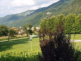
Murianette is a commune in the Isère department in southeastern France.
Population
| Historical population | ||
|---|---|---|
| Year | Pop. | ±% |
| 1793 | 225 | — |
| 1806 | 233 | +3.6% |
| 1821 | 225 | −3.4% |
| 1831 | 259 | +15.1% |
| 1841 | 268 | +3.5% |
| 1851 | 311 | +16.0% |
| 1861 | 320 | +2.9% |
| 1872 | 264 | −17.5% |
| 1881 | 251 | −4.9% |
| 1891 | 255 | +1.6% |
| 1901 | 231 | −9.4% |
| 1911 | 236 | +2.2% |
| 1921 | 256 | +8.5% |
| 1931 | 200 | −21.9% |
| 1946 | 255 | +27.5% |
| 1954 | 340 | +33.3% |
| 1962 | 416 | +22.4% |
| 1968 | 418 | +0.5% |
| 1975 | 467 | +11.7% |
| 1982 | 529 | +13.3% |
| 1990 | 542 | +2.5% |
| 1999 | 615 | +13.5% |
| 2006 | 713 | +15.9% |
| 2011 | 890 | +24.8% |
See also
References
| Wikimedia Commons has media related to Murianette. |
This article is issued from Wikipedia - version of the 10/28/2016. The text is available under the Creative Commons Attribution/Share Alike but additional terms may apply for the media files.