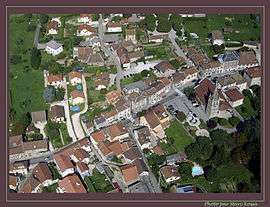
Vaulnaveys-le-Haut
| Vaulnaveys-le-Haut | |
|---|---|
 | |
 Vaulnaveys-le-Haut | |
|
Location within Auvergne-Rhône-Alpes region  Vaulnaveys-le-Haut | |
| Coordinates: 45°07′10″N 5°48′40″E / 45.1194°N 5.8111°ECoordinates: 45°07′10″N 5°48′40″E / 45.1194°N 5.8111°E | |
| Country | France |
| Region | Auvergne-Rhône-Alpes |
| Department | Isère |
| Arrondissement | Grenoble |
| Canton | Vizille |
| Intercommunality | Balcon de Belledonne |
| Government | |
| • Mayor (2014–2020) | Jean-Yves Porta |
| Area1 | 19.86 km2 (7.67 sq mi) |
| Population (2012)2 | 3,635 |
| • Density | 180/km2 (470/sq mi) |
| Time zone | CET (UTC+1) |
| • Summer (DST) | CEST (UTC+2) |
| INSEE/Postal code | 38529 / 38410 |
| Elevation |
338–1,714 m (1,109–5,623 ft) (avg. 365 m or 1,198 ft) |
|
1 French Land Register data, which excludes lakes, ponds, glaciers > 1 km² (0.386 sq mi or 247 acres) and river estuaries. 2 Population without double counting: residents of multiple communes (e.g., students and military personnel) only counted once. | |
Vaulnaveys-le-Haut is a commune in the Isère department in southeastern France.
Population
| Historical population | ||
|---|---|---|
| Year | Pop. | ±% |
| 1793 | 1,113 | — |
| 1806 | 1,269 | +14.0% |
| 1821 | 1,602 | +26.2% |
| 1831 | 1,664 | +3.9% |
| 1841 | 1,658 | −0.4% |
| 1851 | 1,638 | −1.2% |
| 1861 | 1,565 | −4.5% |
| 1872 | 1,653 | +5.6% |
| 1881 | 1,642 | −0.7% |
| 1891 | 1,525 | −7.1% |
| 1901 | 1,533 | +0.5% |
| 1911 | 1,401 | −8.6% |
| 1921 | 1,191 | −15.0% |
| 1931 | 1,159 | −2.7% |
| 1946 | 1,298 | +12.0% |
| 1954 | 1,472 | +13.4% |
| 1962 | 1,263 | −14.2% |
| 1968 | 1,813 | +43.5% |
| 1975 | 1,564 | −13.7% |
| 1982 | 2,058 | +31.6% |
| 1990 | 2,666 | +29.5% |
| 1999 | 3,096 | +16.1% |
| 2006 | 3,297 | +6.5% |
| 2012 | 3,635 | +10.3% |
See also
References
| Wikimedia Commons has media related to Vaulnaveys-le-Haut. |
This article is issued from Wikipedia - version of the 10/28/2016. The text is available under the Creative Commons Attribution/Share Alike but additional terms may apply for the media files.