Clyde, Missouri
| Clyde, Missouri | |
|---|---|
| Village | |
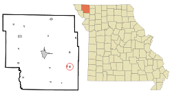 Location of Clyde, Missouri | |
| Coordinates: 40°16′2″N 94°40′8″W / 40.26722°N 94.66889°WCoordinates: 40°16′2″N 94°40′8″W / 40.26722°N 94.66889°W | |
| Country | United States |
| State | Missouri |
| County | Nodaway |
| Area[1] | |
| • Total | 0.15 sq mi (0.39 km2) |
| • Land | 0.15 sq mi (0.39 km2) |
| • Water | 0 sq mi (0 km2) |
| Elevation | 1,027 ft (313 m) |
| Population (2010)[2] | |
| • Total | 82 |
| • Estimate (2012[3]) | 82 |
| • Density | 546.7/sq mi (211.1/km2) |
| Time zone | Central (CST) (UTC-6) |
| • Summer (DST) | CDT (UTC-5) |
| ZIP code | 64432 |
| Area code(s) | 660 |
| FIPS code | 29-15130[4] |
| GNIS feature ID | 0716022[5] |
Clyde is a village in Nodaway County, Missouri, United States. The population was 82 at the 2010 census.
It is home to the Benedictine Convent of Perpetual Adoration which houses 550 documented saint relics—said to be the largest collection in the United States.
History
A post office called Clyde has been in operation since 1880.[6] The community was named from some Clydesdale horses an early citizen had purchased.[7] An early variant name was "New Conception".[8]
Geography
Clyde is located at 40°16′2″N 94°40′8″W / 40.26722°N 94.66889°W (40.267333, -94.668963).[9] According to the United States Census Bureau, the village has a total area of 0.15 square miles (0.39 km2), all of it land.[1]
Demographics
| Historical population | |||
|---|---|---|---|
| Census | Pop. | %± | |
| 1900 | 250 | — | |
| 1910 | 368 | 47.2% | |
| 1920 | 213 | −42.1% | |
| 1930 | 184 | −13.6% | |
| 1940 | 148 | −19.6% | |
| 1950 | 115 | −22.3% | |
| 1960 | 90 | −21.7% | |
| 1970 | 158 | 75.6% | |
| 1980 | 61 | −61.4% | |
| 1990 | 71 | 16.4% | |
| 2000 | 74 | 4.2% | |
| 2010 | 82 | 10.8% | |
| Est. 2015 | 79 | [10] | −3.7% |
2010 census
As of the census[2] of 2010, there were 82 people, 27 households, and 22 families residing in the village. The population density was 546.7 inhabitants per square mile (211.1/km2). There were 30 housing units at an average density of 200.0 per square mile (77.2/km2). The racial makeup of the village was 100.0% White.
There were 27 households of which 44.4% had children under the age of 18 living with them, 59.3% were married couples living together, 14.8% had a female householder with no husband present, 7.4% had a male householder with no wife present, and 18.5% were non-families. 14.8% of all households were made up of individuals. The average household size was 3.04 and the average family size was 3.27.
The median age in the village was 35 years. 34.1% of residents were under the age of 18; 5% were between the ages of 18 and 24; 26.9% were from 25 to 44; 24.4% were from 45 to 64; and 9.8% were 65 years of age or older. The gender makeup of the village was 56.1% male and 43.9% female.
2000 census
As of the census[4] of 2000, there were 74 people, 25 households, and 22 families residing in the village. The population density was 430.4 people per square mile (168.1/km²). There were 27 housing units at an average density of 157.0 per square mile (61.3/km²). The racial makeup of the village was 98.65% White, and 1.35% from two or more races.
There were 25 households out of which 44.0% had children under the age of 18 living with them, 80.0% were married couples living together, 8.0% had a female householder with no husband present, and 12.0% were non-families. 12.0% of all households were made up of individuals and 4.0% had someone living alone who was 65 years of age or older. The average household size was 2.96 and the average family size was 3.18.
In the village the population was spread out with 32.4% under the age of 18, 13.5% from 18 to 24, 27.0% from 25 to 44, 23.0% from 45 to 64, and 4.1% who were 65 years of age or older. The median age was 28 years. For every 100 females there were 76.2 males. For every 100 females age 18 and over, there were 78.6 males.
The median income for a household in the village was $36,250, and the median income for a family was $36,250. Males had a median income of $26,458 versus $28,750 for females. The per capita income for the village was $15,684. There were 12.5% of families and 13.9% of the population living below the poverty line, including 22.2% of under eighteens and none of those over 64.
References
- 1 2 "US Gazetteer files 2010". United States Census Bureau. Archived from the original on 2012-06-26. Retrieved 2012-07-08.
- 1 2 "American FactFinder". United States Census Bureau. Retrieved 2012-07-08.
- ↑ "Population Estimates". United States Census Bureau. Archived from the original on 2013-06-17. Retrieved 2013-05-30.
- 1 2 "American FactFinder". United States Census Bureau. Archived from the original on 2013-09-11. Retrieved 2008-01-31.
- ↑ "US Board on Geographic Names". United States Geological Survey. 2007-10-25. Retrieved 2008-01-31.
- ↑ "Post Offices". Jim Forte Postal History. Retrieved 24 November 2016.
- ↑ Eaton, David Wolfe (1917). How Missouri Counties, Towns and Streams Were Named. The State Historical Society of Missouri. p. 336.
- ↑ "Nodaway County Place Names, 1928–1945". The State Historical Society of Missouri. Archived from the original on June 24, 2016. Retrieved November 24, 2016.
- ↑ "US Gazetteer files: 2010, 2000, and 1990". United States Census Bureau. 2011-02-12. Retrieved 2011-04-23.
- ↑ "Annual Estimates of the Resident Population for Incorporated Places: April 1, 2010 to July 1, 2015". Retrieved July 2, 2016.
- ↑ "Census of Population and Housing". Census.gov. Archived from the original on May 11, 2015. Retrieved June 4, 2015.
Municipalities and communities of Nodaway County, Missouri, United States | ||
|---|---|---|
| Cities | 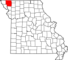 | |
| Villages | ||
| Townships | ||
| CDPs | ||
| Unincorporated communities | ||
| Ghost town | ||