River aux Vases (stream), Missouri
| River aux Vases Creek | |
| Stream | |
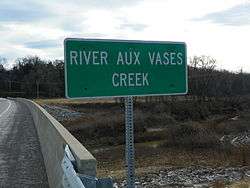 River aux Vases Creek sign at Highway 61 | |
| Name origin: French: La Rivière aux Vases meaning "Muddy" or "Swampy River". | |
| Country | United States |
|---|---|
| State | Missouri |
| Mouth | Mississippi River |
| - location | La Saline, MO |
| - elevation | 361 ft (110 m) |
| - coordinates | 37°54′23″N 89°58′31″W / 37.90639°N 89.97528°WCoordinates: 37°54′23″N 89°58′31″W / 37.90639°N 89.97528°W |
| Basin | 47.8 sq mi (124 km2) |
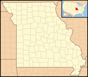 River aux Vases Creek within Missouri | |
River aux Vases is a creek that rises in Union Township in western Ste. Genevieve County, Missouri and flows into the Mississippi River about two miles north of St. Marys, Missouri.
Etymology
The stream's original name - La Rivière aux Vases - is French meaning The muddy or swampy River and referred to quicksand and soggy conditions around the creek, especially crossings.[1]
History
The earliest French colonial families had long-established family sugar camps (les sucreries) along the creek to process sugar.[2] In 1797 the younger son of Pierre de Lassus, Commandant of New Bourbon received a grant by the Spanish government to establish a sugar mill along the creek.[3] Over time the area around River aux Vases became known as a breeding center for mules. Mining was also prominent in the area and River aux Vases sandstone was used in the abutments of Eads Bridge in downtown St. Louis, with decorative onyx and limestone quarried nearby.[4]
Physical geography
River aux Vases rises near Jonca in Union Township in the western part of Ste. Genevieve County, and flows east through Hawn State Park and empties into the Mississippi River about two miles north of St. Marys, Missouri at an elevation of 361 feet. It has a watershed of 47.8 sq. mi.[5][6]
- Dodge Creek
- Flint Bottom Creek
- Jonca Creek
- Lake Kal-Tatri
- Mill Creek
- Pickle Creek
- Rainbow Lake
Cultural geography
There are a number of communities along River aux Vases Creek, most notably the community by the same name River aux Vases, as well as New Bremen (Ozora), and New Tennessee.[7]
Bridges that converse River aux Vases Creek include the River aux Vases Bridge on Old Kingshighway (Highway 61), the River aux Vases Route B Bridge, The Interstate 55 Bridge, and the River aux Vases US 61 Bridge.[8]
Gallery
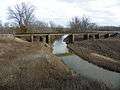 Rail bridge
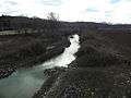 River aux Vases Creek
References
- ↑ "Ste. Genevieve County, Missouri Place Names, 1928-1945 | The State Historical Society of Missouri". Shs.umsystem.edu. Retrieved 2013-10-28.
- ↑ Walter A. Schroeder (2002). "Opening the Ozarks: A Historical Geography of Missouri's Ste. Genevieve District, 1760-1830". ISBN 9780826263063.
- ↑ The State Historical Society of Missouri http://shs.umsystem.edu/manuscripts/ramsay/ramsay_sainte_genevieve.html
- ↑ Rome of the West http://www.romeofthewest.com/2009/09/photos-of-saints-philip-and-james.html
- ↑ Biological Criteria for Streams of Missouri http://dnr.mo.gov/env/esp/docs/BiologicalCriteriaMUFinalReport.pdf
- ↑ lat-long.com http://www.lat-long.com/Latitude-Longitude-751895-Missouri-River_aux_Vases.html
- ↑ The library.org http://thelibrary.org/lochist/moser/stegenevievepl.html
- ↑ "Ste. Genevieve County, Missouri". Bridgehunter.com. Retrieved 2013-10-28.
Geographical features of Ste. Genevieve County, Missouri | ||
|---|---|---|
| Rivers | 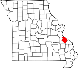 | |
| Streams | ||
| Capes | ||
| Alluvial plains | ||
| National forests | ||
| State parks | ||
| Historic sites | ||
Municipalities and communities of Sainte Genevieve County, Missouri, United States | ||
|---|---|---|
| Cities | | |
| Townships | ||
| CDPs |
| |
| Other communities |
| |
| Ghost towns | ||