Palau-de-Cerdagne
| Palau-de-Cerdagne | |
|---|---|
|
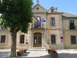
The town hall in Palau-de-Cerdagne | |
 Palau-de-Cerdagne | |
|
Location within Occitanie region  Palau-de-Cerdagne | |
| Coordinates: 42°25′00″N 1°58′02″E / 42.4167°N 1.9672°ECoordinates: 42°25′00″N 1°58′02″E / 42.4167°N 1.9672°E | |
| Country | France |
| Region | Occitanie |
| Department | Pyrénées-Orientales |
| Arrondissement | Prades |
| Canton | Saillagouse |
| Intercommunality | Pyrénées Cerdagne |
| Government | |
| • Mayor (2001–2008) | Isidore Peipoch |
| Area1 | 11.50 km2 (4.44 sq mi) |
| Population (2006)2 | 568 |
| • Density | 49/km2 (130/sq mi) |
| Time zone | CET (UTC+1) |
| • Summer (DST) | CEST (UTC+2) |
| INSEE/Postal code | 66132 / 66340 |
| Elevation |
1,151–2,203 m (3,776–7,228 ft) (avg. 1,270 m or 4,170 ft) |
|
1 French Land Register data, which excludes lakes, ponds, glaciers > 1 km² (0.386 sq mi or 247 acres) and river estuaries. 2 Population without double counting: residents of multiple communes (e.g., students and military personnel) only counted once. | |
Palau-de-Cerdagne (Catalan: Palau de Cerdanya) is a commune in the eastern Pyrenees (Pyrénées-Orientales department in southern France).
The people of the town celebrate the Xicolatada, every year, on the 16th of August.
Geography
Palau-de-Cerdagne is located in the canton of Saillagouse and in the arrondissement of Prades.
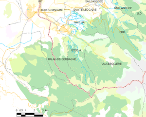
Map of Palau-de-Cerdagne and its surrounding communes
Population
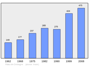
Population 1962-2008
See also
References
| Wikimedia Commons has media related to Palau-de-Cerdagne. |
This article is issued from Wikipedia - version of the 1/11/2016. The text is available under the Creative Commons Attribution/Share Alike but additional terms may apply for the media files.