Bages, Pyrénées-Orientales
| Bages | ||
|---|---|---|
|
The town hall in Bages | ||
| ||
 Bages | ||
|
Location within Occitanie region  Bages | ||
| Coordinates: 42°36′24″N 2°53′51″E / 42.6067°N 2.8975°ECoordinates: 42°36′24″N 2°53′51″E / 42.6067°N 2.8975°E | ||
| Country | France | |
| Region | Occitanie | |
| Department | Pyrénées-Orientales | |
| Arrondissement | Perpignan | |
| Canton | Elne | |
| Intercommunality | Communauté de communes des Albères et de la Côte Vermeille | |
| Government | ||
| • Mayor (2014–2020) | Serge Soubielle | |
| Area1 | 11.95 km2 (4.61 sq mi) | |
| Population (2013)2 | 3,987 | |
| • Density | 330/km2 (860/sq mi) | |
| Time zone | CET (UTC+1) | |
| • Summer (DST) | CEST (UTC+2) | |
| INSEE/Postal code | 66011 / 66670 | |
| Elevation |
14–91 m (46–299 ft) (avg. 17 m or 56 ft) | |
|
1 French Land Register data, which excludes lakes, ponds, glaciers > 1 km² (0.386 sq mi or 247 acres) and river estuaries. 2 Population without double counting: residents of multiple communes (e.g., students and military personnel) only counted once. | ||

.svg.png)
Bages (Catalan: Bages de Rosselló) is a commune in the Pyrénées-Orientales department in southern France.
Geography
Localisation
Bages is located in the canton of Elne and in the arrondissement of Perpignan.
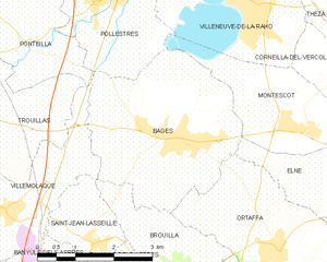
Map of Bages and its surrounding communes
Neighbouring communes
| Ponteilla | Pollestres | Montescot | |
| Villemolaque | |
Elne | |
| |||
| | |||
| Saint-Jean-Lasseille (quadripoint) | Brouilla | Ortaffa |

Government and politics
Mayors
| Mayor | Term start | Term end |
|---|---|---|
| Jean-Pierre Ricard | ? | 1984 |
| Jean-Claude Madrénas | 1984 | 1995 |
| Serge Soubielle | 1995 |
Population
| Historical population | ||
|---|---|---|
| Year | Pop. | ±% |
| 1962 | 1,755 | — |
| 1968 | 1,900 | +8.3% |
| 1975 | 2,145 | +12.9% |
| 1982 | 2,711 | +26.4% |
| 1990 | 3,317 | +22.4% |
| 1999 | 3,328 | +0.3% |
| 2006 | 3,723 | +11.9% |
| 2009 | 3,894 | +4.6% |
See also
References
| Wikimedia Commons has media related to Bages (Pyrénées-Orientales). |
This article is issued from Wikipedia - version of the 8/24/2016. The text is available under the Creative Commons Attribution/Share Alike but additional terms may apply for the media files.