Pettis County, Missouri
| Pettis County, Missouri | |
|---|---|
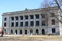 Pettis County Courthouse in Sedalia | |
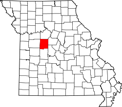 Location in the U.S. state of Missouri | |
 Missouri's location in the U.S. | |
| Founded | January 24, 1833 |
| Named for | Spencer Darwin Pettis |
| Seat | Sedalia |
| Largest city | Sedalia |
| Area | |
| • Total | 686 sq mi (1,777 km2) |
| • Land | 682 sq mi (1,766 km2) |
| • Water | 4.0 sq mi (10 km2), 0.6% |
| Population (est.) | |
| • (2015) | 42,255 |
| • Density | 62/sq mi (24/km²) |
| Congressional district | 4th |
| Time zone | Central: UTC-6/-5 |
| Website |
www |
Pettis County is a county located in the western county portion of the county U.S. state of Missouri. As of the 2010 census, the population was 42,201.[1] Its county seat is Sedalia.[2] The county was organized January 24, 1833, and named after former U.S. Representative Spencer Darwin Pettis.
Pettis County comprises the Sedalia, MO Micropolitan Statistical Area.
The county is home to the site of the Missouri State Fair in Sedalia.
Geography
According to the U.S. Census Bureau, the county has a total area of 686 square miles (1,780 km2), of which 682 square miles (1,770 km2) is land and 4.0 square miles (10 km2) (0.6%) is water.[3]
Adjacent counties
- Saline County (north)
- Cooper County (east)
- Morgan County (southeast)
- Benton County (south)
- Henry County (southwest)
- Johnson County (west)
- Lafayette County (northwest)
Major highways
Demographics
| Historical population | |||
|---|---|---|---|
| Census | Pop. | %± | |
| 1840 | 2,930 | — | |
| 1850 | 5,150 | 75.8% | |
| 1860 | 9,392 | 82.4% | |
| 1870 | 18,706 | 99.2% | |
| 1880 | 27,271 | 45.8% | |
| 1890 | 31,151 | 14.2% | |
| 1900 | 32,438 | 4.1% | |
| 1910 | 33,913 | 4.5% | |
| 1920 | 35,813 | 5.6% | |
| 1930 | 34,664 | −3.2% | |
| 1940 | 33,336 | −3.8% | |
| 1950 | 31,577 | −5.3% | |
| 1960 | 35,120 | 11.2% | |
| 1970 | 34,137 | −2.8% | |
| 1980 | 36,378 | 6.6% | |
| 1990 | 35,437 | −2.6% | |
| 2000 | 39,403 | 11.2% | |
| 2010 | 42,201 | 7.1% | |
| Est. 2015 | 42,255 | [4] | 0.1% |
| U.S. Decennial Census[5] 1790-1960[6] 1900-1990[7] 1990-2000[8] 2010-2015[1] | |||
As of the census[9] of 2000, there were 39,403 people, 15,568 households, and 10,570 families residing in the county. The population density was 58 people per square mile (22/km²). There were 16,963 housing units at an average density of 25 per square mile (10/km²). The racial makeup of the county was 92.06% White, 3.04% Black or African American, 0.38% Native American, 0.39% Asian, 0.05% Pacific Islander, 2.46% from other races, and 1.62% from two or more races. Approximately 3.88% of the population were Hispanic or Latino of any race.
There were 15,568 households out of which 32.50% had children under the age of 18 living with them, 53.30% were married couples living together, 10.50% had a female householder with no husband present, and 32.10% were non-families. 27.00% of all households were made up of individuals and 11.70% had someone living alone who was 65 years of age or older. The average household size was 2.49 and the average family size was 3.01.
In the county the population was spread out with 26.30% under the age of 18, 9.30% from 18 to 24, 27.90% from 25 to 44, 21.10% from 45 to 64, and 15.40% who were 65 years of age or older. The median age was 36 years. For every 100 females there were 94.40 males. For every 100 females age 18 and over, there were 91.70 males.
The median income for a household in the county was $31,822, and the median income for a family was $38,073. Males had a median income of $29,221 versus $19,554 for females. The per capita income for the county was $16,251. About 10.20% of families and 12.80% of the population were below the poverty line, including 16.60% of those under age 18 and 10.50% of those age 65 or over.
Education
Public schools
- Green Ridge R-VIII School District – Green Ridge
- Green Ridge Elementary School (K-06)
- Green Ridge High School (07-12)
- La Monte R-IV School District – La Monte
- La Monte Elementary School (PK-06)
- La Monte High School (07-12)
- Pettis County R-V School District – Hughesville
- Northwest Elementary School (K-06)
- Northwest High School (07-12)
- Pettis County R-XII School District – Sedalia
- Pettis County Elementary School (PK-08)
- Sedalia School District No. 200 – Sedalia
- Sedalia Early Childhood Education Center (PK)
- Heber Hunt Elementary School (K-04)
- Skyline Elementary School (K-04)
- Parkview Elementary School (K-04)
- Horace Mann Elementary School (K-04)
- Washington Elementary School (K-04)
- Sedalia Middle School (05-06)
- Smith-Cotton Junior High School (07-09)
- Smith-Cotton High School (10-12)
- Smithton R-VI School District – Smithton
- Smithton Elementary School (PK-06)
- Smithton High School (07-12)
Private schools
- St. Paul’s Lutheran School – Sedalia (PK-08) – Lutheran
- Sedalia Seventh-day Adventist School – Sedalia (01-08) – Seventh-day Adventist
- Show-Me Christian School – La Monte (K-12) – Nondenominational Christian
- Applewood Christian School – Sedalia (K-12) – Nondenominational Christian
- Sacred Heart Schools – Sedalia (K-12) – Roman Catholic
- Sacred Heart Elementary School (K-06)
- Sacred Heart High School (07-12)
Post-secondary
- State Fair Community College – Sedalia – A public, two-year/community college.
Politics
Local
The Republican Party predominantly controls politics at the local level in Pettis County. Republicans hold all but three of the elected positions in the county.
| Pettis County, Missouri | ||||
|---|---|---|---|---|
| Elected countywide officials | ||||
| Assessor | Karissa A. Logan | Republican | ||
| Circuit Clerk | Susan Sadler | Republican | ||
| County Clerk | Nick Lastrada | Republican | ||
| Collector | Marsha L. Boeschen | Republican | ||
| Commissioner (Presiding) |
John C. Meehan | Republican | ||
| Commissioner (District 1) |
K.R. Lindemann | Republican | ||
| Commissioner (District 2) |
Larry Wilson | Republican | ||
| Coroner | Robert “Skip” Smith, Jr. | Republican | ||
| Prosecuting Attorney | Jeff Mittelhauser | Republican | ||
| Public Administrator | Charli Ackerman | Democratic | ||
| Recorder | Barbara Clevenger | Republican | ||
| Sheriff | Kevin Bond | Republican | ||
| Surveyor | Kerry Turpin | Democratic | ||
| Treasurer | Kim Lyne | Republican | ||
State
| Year | Republican | Democratic | Third Parties |
|---|---|---|---|
| 2008 | 42.55% 7,660 | 54.63% 9,834 | 2.82% 507 |
| 2004 | 57.30% 10,038 | 41.63% 7,293 | 1.06% 186 |
| 2000 | 54.65% 8,536 | 42.85% 6,692 | 2.50% 390 |
| 1996 | 44.63% 6,804 | 51.51% 7,853 | 3.86% 589 |
Pettis County is divided into four legislative districts in the Missouri House of Representatives, all of which are held by Republicans.
- District 116 – Wanda Brown (R-Lincoln). Consists of the communities of Green Ridge, Ionia, and Smithton.
| Party | Candidate | Votes | % | ± | |
|---|---|---|---|---|---|
| Republican | Wanda Brown | 1,666 | 67.94 | ||
| Democratic | Mike Stevenson | 717 | 29.24 | ||
| Constitution | Ray Herron | 69 | 2.81 | ||
- District 117 – Caleb Jones (R-California). Consists of a small portion of the county.
| Party | Candidate | Votes | % | ± | |
|---|---|---|---|---|---|
| Republican | Caleb Jones | 252 | 79.75 | ||
| Constitution | Jacob Luetkemeyer | 64 | 20.25 | ||
- District 118 – Stanley Cox (R-Sedalia). Consists of the communities of Houstonia, Hughesville, La Monte, and Sedalia.
| Party | Candidate | Votes | % | ± | |
|---|---|---|---|---|---|
| Republican | Stanley Cox | 6,506 | 66.80 | ||
| Democratic | Raymond F. Kinney | 2,769 | 28.43 | ||
| Constitution | Curtis Shipman | 464 | 4.76 | ||
- District 120 – Scott N. Largent (R-Clinton). Consists of a very small portion of the county.
| Party | Candidate | Votes | % | ± | |
|---|---|---|---|---|---|
| Republican | Scott N. Largent | 10 | 58.82 | ||
| Democratic | Zac A. Maggi | 6 | 35.29 | ||
| Constitution | Richard Hoxsey | 1 | 5.88 | ||
All of Pettis County is a part of Missouri’s 28th District in the Missouri Senate and is currently represented by Mike Parson (R-Bolivar).
| Party | Candidate | Votes | % | ± | |
|---|---|---|---|---|---|
| Republican | Mike Parson | 9,753 | 85.34 | ||
| Constitution | Bennie B. Hatfield | 1,675 | 14.66 | ||
Federal
All of Pettis County is included in Missouri’s 4th Congressional District and is currently represented by Vicky Hartzler (R-Harrisonville) in the U.S. House of Representatives.
| Party | Candidate | Votes | % | ± | |
|---|---|---|---|---|---|
| Republican | Vicky Hartzler | 6,305 | 49.70 | ||
| Democratic | Ike Skelton* | 5,920 | 46.67 | ||
| Libertarian | Jason Michael Braun | 275 | 2.17 | ||
| Constitution | Greg Cowan | 185 | 1.46 | ||
Political culture
| Year | Republican | Democratic | Third Parties |
|---|---|---|---|
| 2008 | 60.32% 11,018 | 37.95% 6,932 | 1.73% 315 |
| 2004 | 66.32% 11,603 | 33.16% 5,801 | 0.53% 92 |
| 2000 | 60.51% 9,533 | 37.16% 5,855 | 2.33% 367 |
| 1996 | 48.06 7,336 | 39.68% 6,057 | 12.25% 1,870 |
Missouri Presidential Preference Primary (2008)
- Former U.S. Senator Hillary Clinton (D-New York) received more votes, a total of 2,242, than any candidate from either party in Pettis County during the 2008 presidential primary.
| Pettis County, Missouri | ||
|---|---|---|
| 2008 Republican primary in Missouri | ||
| John McCain | 1,372 (36.42%) | |
| Mike Huckabee | 994 (26.39%) | |
| Mitt Romney | 1,226 (32.55%) | |
| Ron Paul | 110 (2.92%) | |
| Pettis County, Missouri | ||
|---|---|---|
| 2008 Democratic primary in Missouri | ||
| Hillary Clinton | 2,242 (54.76%) | |
| Barack Obama | 1,694 (41.38%) | |
| John Edwards (withdrawn) | 123 (3.00%) | |
Communities
- Green Ridge
- Houstonia
- Hughesville
- Ionia
- La Monte
- Sedalia (county seat)
- Smithton
- Windsor
See also
References
- 1 2 "State & County QuickFacts". United States Census Bureau. Retrieved September 12, 2013.
- ↑ "Find a County". National Association of Counties. Retrieved 2011-06-07.
- ↑ "2010 Census Gazetteer Files". United States Census Bureau. August 22, 2012. Retrieved November 18, 2014.
- ↑ "County Totals Dataset: Population, Population Change and Estimated Components of Population Change: April 1, 2010 to July 1, 2015". Retrieved July 2, 2016.
- ↑ "U.S. Decennial Census". United States Census Bureau. Retrieved November 18, 2014.
- ↑ "Historical Census Browser". University of Virginia Library. Retrieved November 18, 2014.
- ↑ "Population of Counties by Decennial Census: 1900 to 1990". United States Census Bureau. Retrieved November 18, 2014.
- ↑ "Census 2000 PHC-T-4. Ranking Tables for Counties: 1990 and 2000" (PDF). United States Census Bureau. Retrieved November 18, 2014.
- ↑ "American FactFinder". United States Census Bureau. Retrieved 2008-01-31.
External links
- Digitized 1930 Plat Book of Pettis County from University of Missouri Division of Special Collections, Archives, and Rare Books
 |
Lafayette County | Saline County | | |
| Johnson County | |
Cooper County | ||
| ||||
| | ||||
| Henry County | Benton County | Morgan County |
Municipalities and communities of Pettis County, Missouri, United States | ||
|---|---|---|
| Cities | | |
| Villages | ||
| Townships |
| |
| Unincorporated communities | ||
| Ghost towns | ||
| Footnotes | ‡This populated place also has portions in an adjacent county or counties | |
Coordinates: 38°44′N 93°17′W / 38.73°N 93.28°W