Pepper Coast
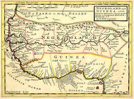
Map by Herman Moll, London, 1729, showing the Grain Coast
Pepper Coast was the name given by European traders to a coastal area of western Africa, between Cape Mesurado and Cape Palmas. It encloses the present republic of Liberia. It got its name from the melegueta pepper. The pepper is also known as the grain of paradise, which gave rise to an alternative name, the Grain Coast. The importance of the spice is shown by the designation of the area from the Saint John River (at present-day Buchanan) to Harper in Liberia as the "Grain Coast" in honor of the availability of grains of paradise.[1] In some cases (as shown on the map) this term covers a wider area incorporating Sierra Leone and the Ivory Coast.
Notes
- ↑ Laurie's Sailing Directory for the Ethiopic or Southern Atlantic Ocean to the Rio de la Plata, Cape Horn, and the Cape of Good Hope etc., including the Islands between the two coasts; 4th Edition 1855
Coordinates: 5°12′N 9°30′W / 5.2°N 9.5°W
This article is issued from Wikipedia - version of the 10/4/2016. The text is available under the Creative Commons Attribution/Share Alike but additional terms may apply for the media files.